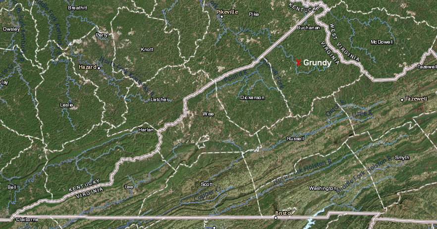
Grundy is the county seat of Buchanan County
Source: ESRI, ArcGIS Online
Grundy is the county seat of Buchanan County
Source: ESRI, ArcGIS Online
The Town of Grundy is located on the floodplain of the Levisa Fork of the Big Sandy River, which flows into the Ohio River just upstream of Ashland, Kentucky. The Levisa Fork floods regularly, causing damage and deaths. A 1977 flood killed three people in Buchanan County, leading to the US Congress specifying in the 1981 Water and Energy Appropriations Act that Grundy was a place for a flood control study.
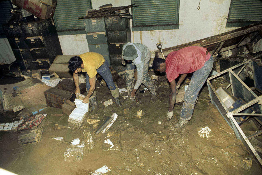
the 1977 Levisa Fork flood damaged courthouse records in Buchanan County
Source: Library of Virginia, The Virginia Public Records Act Marks 35 Years
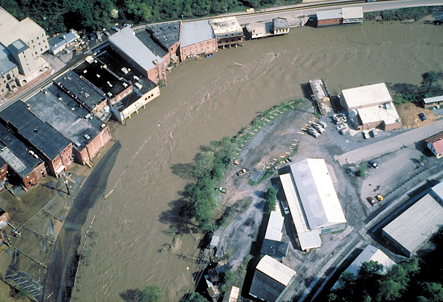
a 1984 flood also damaged Grundy
Source: Wikipedia, Grundy, Virginia
No structural solution was found. Upstream reservoirs, floodwalls, and various possible alterations of the river channel were either insufficient to control another large flood or created too much impact to the central business district. One option was to "floodsafe" the center of town by building a raised platform underneath each building, lifting the structures higher than projected floodwaters.
The best proposal from the Corps of Engineers was to relocate the business district to the site of P. V. Dennis Elementary and the Grundy Jr. High School, and build new schools in a different location. Total cost was estimated at $200 to $300 million. Under the Water Resources Development Act of 1986, the town had to provide 25% of the cost to obtain a 75% Federal match. Grundy did not have the resources to raise the 25% match.1
At the same time, the Virginia Department of Transportation planned to widen US 460 from a 2-lane highway into a 4-lane highway. The strip of one-story, separate commercial structures on the east side of the Levisa Fork would be destroyed as US 460 was expanded, causing more disruption to "downtown" Grundy.
The worst-case scenario was for just an isolated remnant of the commercial district to remain, after the flood wall was built and the highway widened. In an innovative partnership, the Federal and state agencies worked with local officials to create a different solution - move downtown Grundy across the river, to a newly-created flat area made by shaving off the edge of the mountain.
The Virginia Department of Transportation widened US 460, which required tearing down the buildings in the flood zone in order to construct the new road. The highway was built on top of a new levee separating the Levisa Fork of the Big Sandy River and the rest of Grundy. The cost of the land purchased by the state for rebuilding US 460 counted as the local share required to match Federal flood control funding.
The US Army Corps of Engineers completed a new floodwall along the right bank of Levisa Fork in 2008. It protects the remaining portion of the commercial district that was not displaced by the widened highway:2
where flooding could occur due to failure of the levee system or overtopping during a major Levisa Fork flood
Source: US Army Corps of Engineers National Levee Database, Grundy, VA, LPP
In the end, nearly all of Grundy's commercial district on the east side of the Levisa Fork was replaced by a concentrated new development, Grundy Town Center, located on the other (west) side of the river.
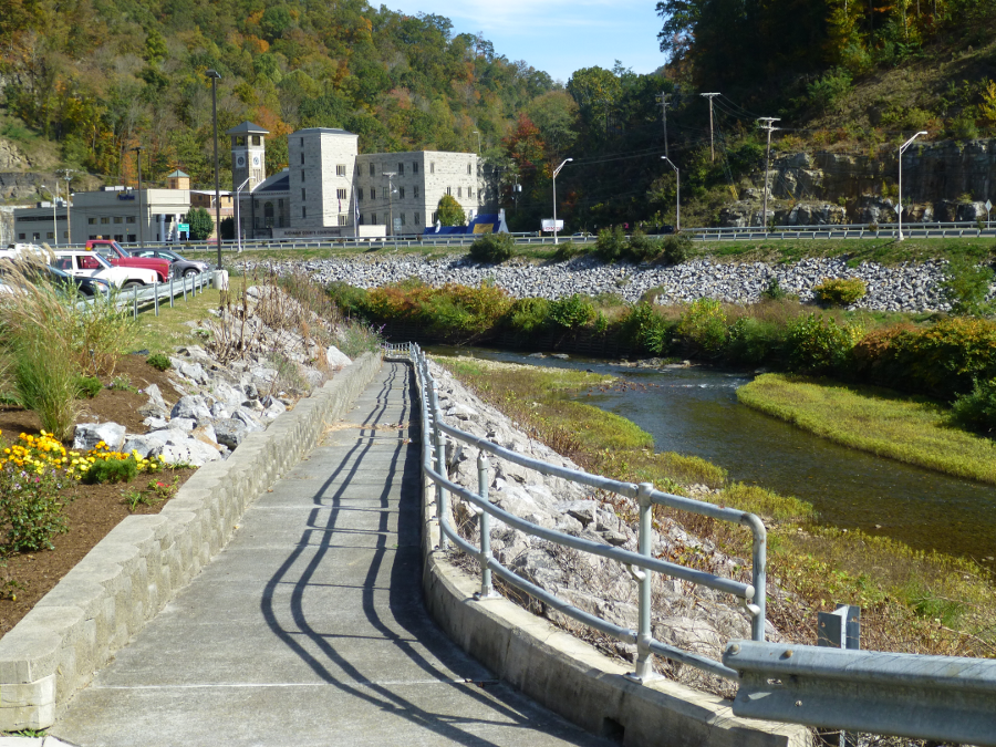
the Buchanan County Courthouse was not moved, and remained on the east side of the Levisa River (as viewed from Grundy Town Center)
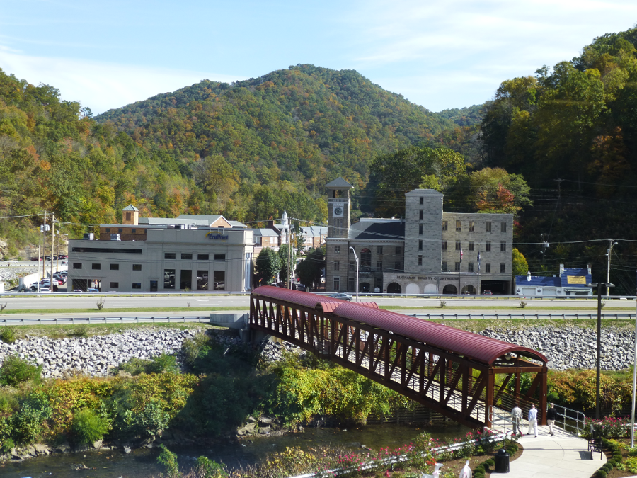
a pedestrian bridge across the Levisa River connected the Grundy Town Center to the Buchanan County Courthouse beyond US 460
For the Grundy Town Center, engineers created a flat plateau on the west side of the Levisa Fork, high enough to be safe from predicted floods. A new three-story structure was built to create a new shopping district on that plateau. The building includes a two-story parking garage faced on three sides by different retail stores. After persistent recruitment efforts, including a personal trip to Bentonville, Arkansas by the Grundy town manager, Wal*Mart built a SuperCenter with a grocery store on the third floor.3
Wal*Mart shoppers use escalators to climb to that top floor. Parallel to the escalators are unusual tracks to move loaded shopping carts filled with goods and groceries down to the second or first floor where customers park their cars.
The Federal government and Virginia Department of Transportation (VDT) jointly financed a large percentage of the $28 million cost of creating a new commercial center above the 1977 flood elevation, and to rebuild/raise US 460 to serve as a levee to provide flood protection.
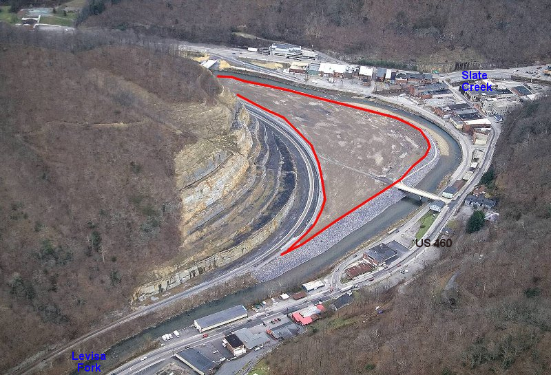
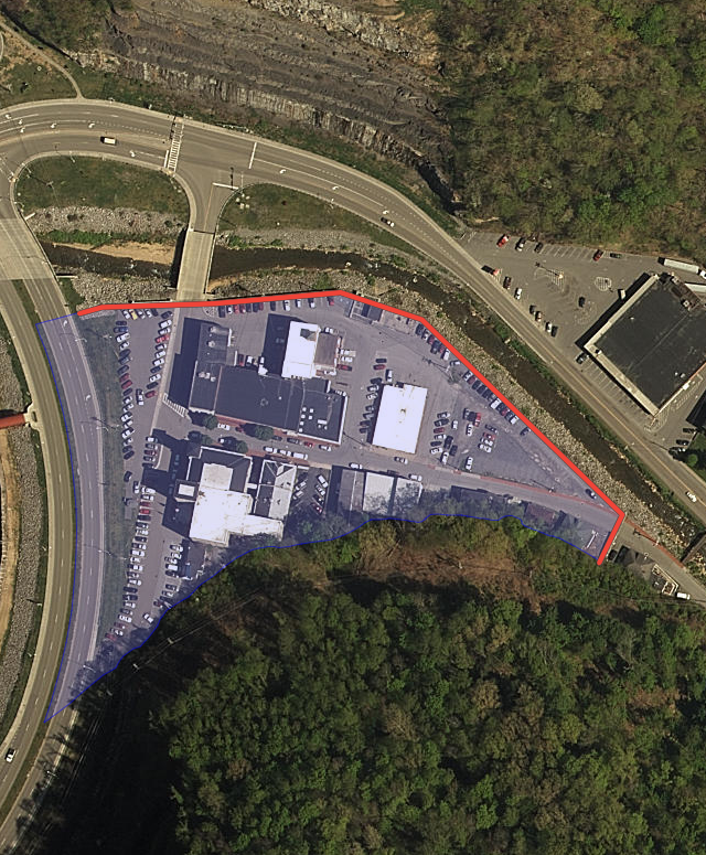
red polygon indicates site for new Grundy Town Center, before commercial strip along US 460 was moved across the Levisa River
Source: US Army Corps of Engineers
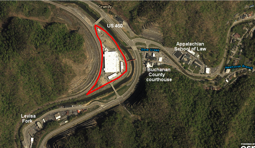
most stores upstream of Slate Creek were eliminated by widening US 460, and retail businesses were concentrated in one building across the Levisa Fork (with the new Wal*Mart in the third story)
Source: ESRI, ArcGIS Online
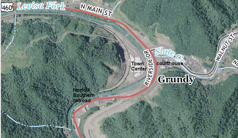
the Buchanan County courthouse remained on the east side of the Levisa Fork, and a small flood control gate was built on Slate Creek to protect the courthouse
Source: US Geological Survey (USGS), 7.5-minute Grundy topographical quadrangle (2016)
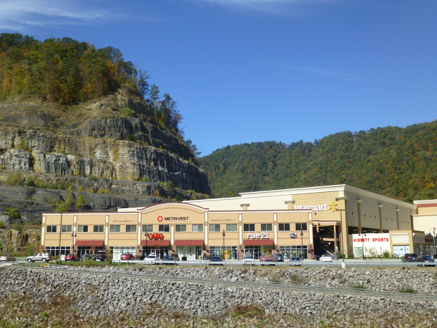 Wal*Mart is on the third floor of Grundy Town Center |
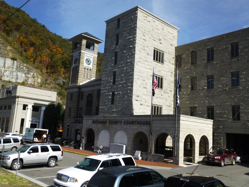 Buchanan County Courthouse was not moved from its site in Grundy |
 the commercial district of Grundy was moved across the Levisa Fork and is now achored by a Wal*Mart |
 the Clinchfield Railroad beat the Chesapeake and Ohio (C&O) and built the line through the Breaks |
 Appalachian School of Law is located in Grundy |
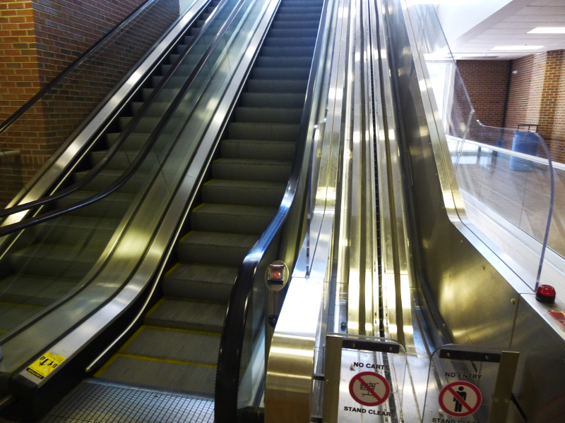 the Grundy Wal*Mart, on the third floor, has escalators for people and special tracks for shopping carts |
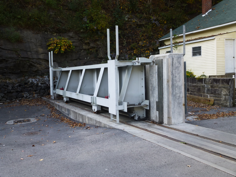 the flood wall gate is closed to protect the courthouse and remains of downtown Grundy, if Slate Creek floods |
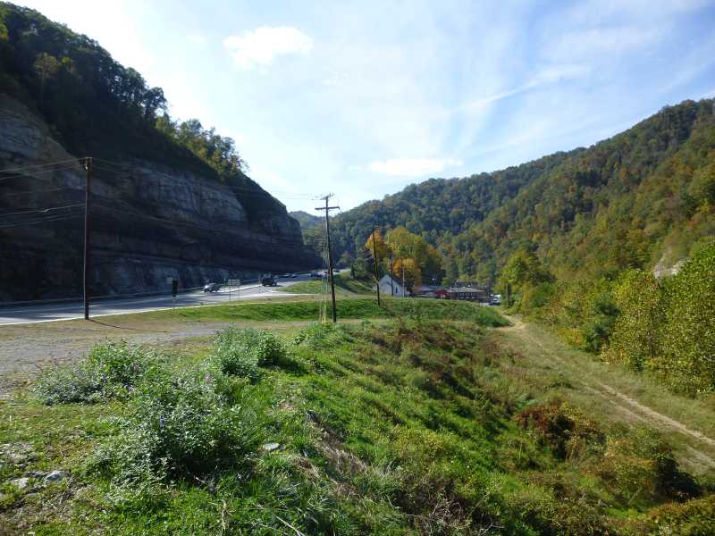 US 460, looking east from new bridge across Levisa Fork leading to new Grundy |
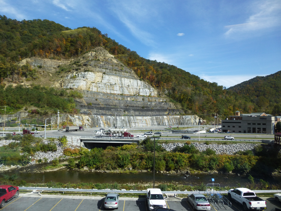
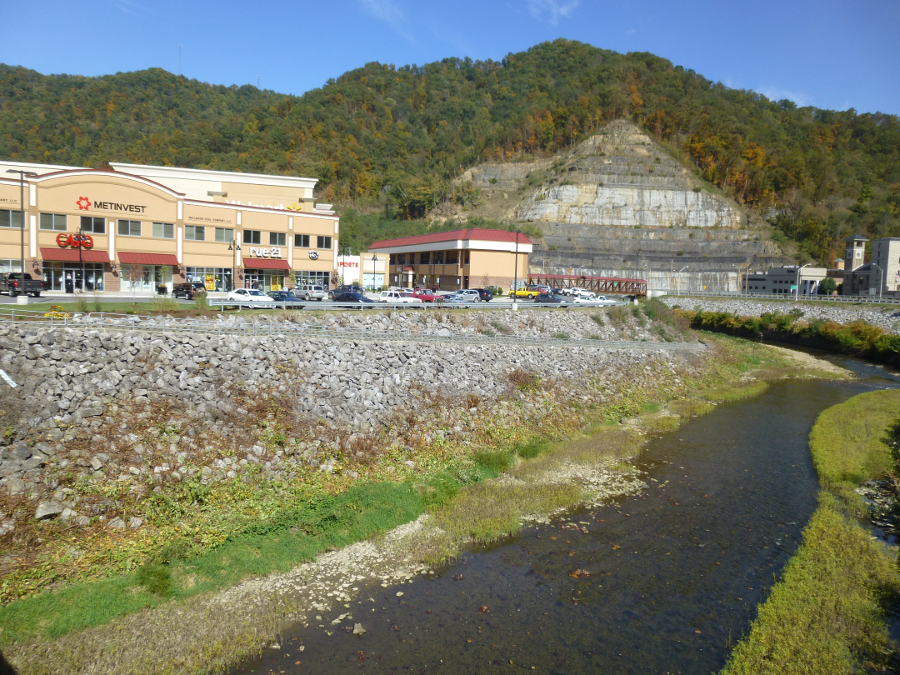
the mountain west of the Levisa Fork was cut back to make room for Grundy Town Center
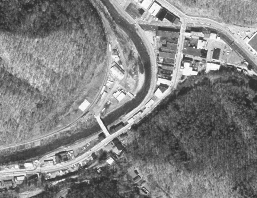
Grundy in 1998, with developed properties along US 460
Source: Google Earth
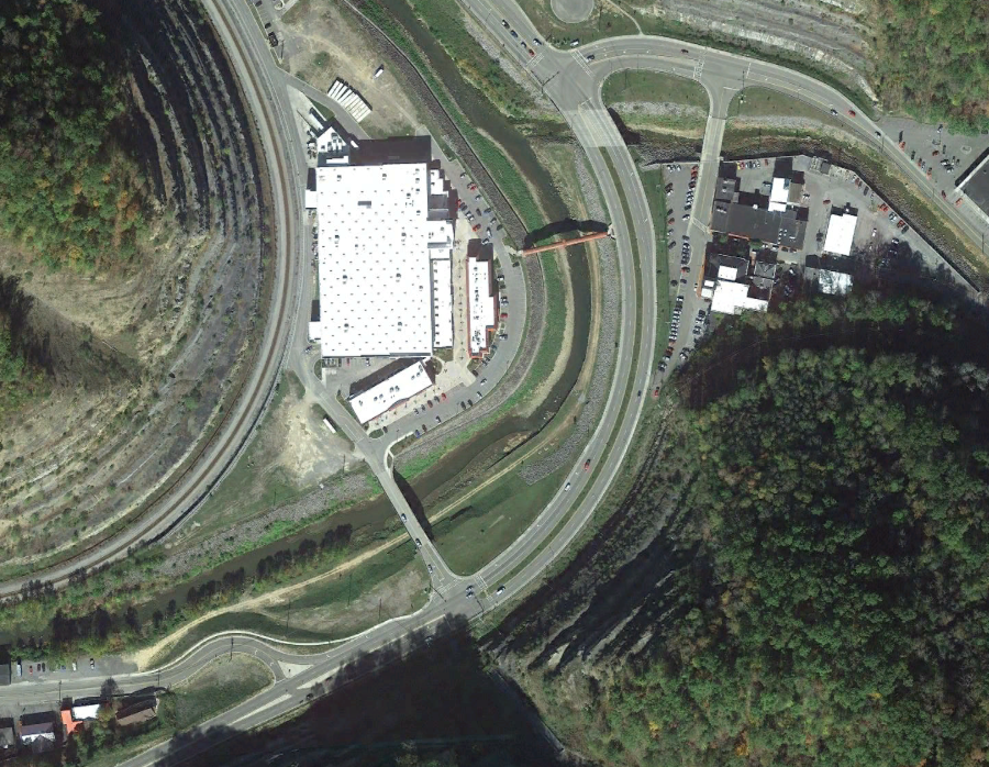
Grundy in 2015
Source: Google Earth
the Levisa Fork is normally a small river at Grundy
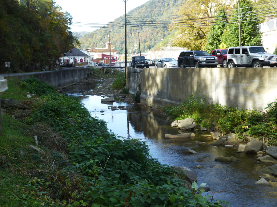
Slate Creek flows past the Appalachian School of Law and into the Levisa River at Grundy