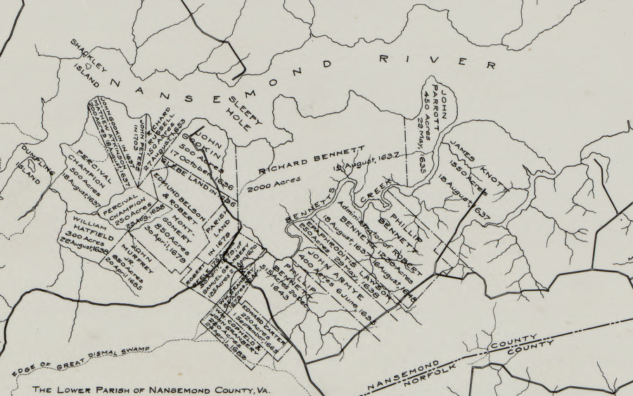
colonists expanded from Jamestown and settled along the Nansemond River, displacing the Native Americans
Source: Library of Congress, The lower parish of Nansemond County, Va. with adjoining portions of Norfolk County
colonists expanded from Jamestown and settled along the Nansemond River, displacing the Native Americans
Source: Library of Congress, The lower parish of Nansemond County, Va. with adjoining portions of Norfolk County
Nansemond apparently meant fishing point, a place of land or peninsula on which the fishing was good, to the Native Americans who lived in the region when the English arrived.
In 1637, the General Assembly divided New Norfolk County into Upper Norfolk County and the separate Lower Norfolk County. The General Assembly renamed Upper Norfolk County as Nansemond County nine years later, in 1646.
It remained Nansemond County until 1972, when the county and the towns of Holland and Whaleyville merged to become the City of Nansemond. Becming a city protected Nansemond from annexation by the City of Suffolk or even Norfolk.
The City of Nansemond merged into the City of Suffolk in 1974. The merger reunited the county and the county seat into one governmental unit for the first time since the City of Suffolk had become an independent political unit in 1910,. The merger also eliminated the name "Nansemond" from the list of political jurisdictions in Virginia for the first time since 1646.1
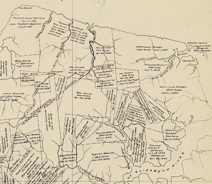
Nansemond County was created primarily to document land ownership and transfers in local court records
Source: Library of Congress, The lower parish of Nansemond County, Va. with adjoining portions of Norfolk County : Elizabeth City Shire 1634, New Norfolk County 1636, Upper Norfolk County 1637, Nansemond County 1642
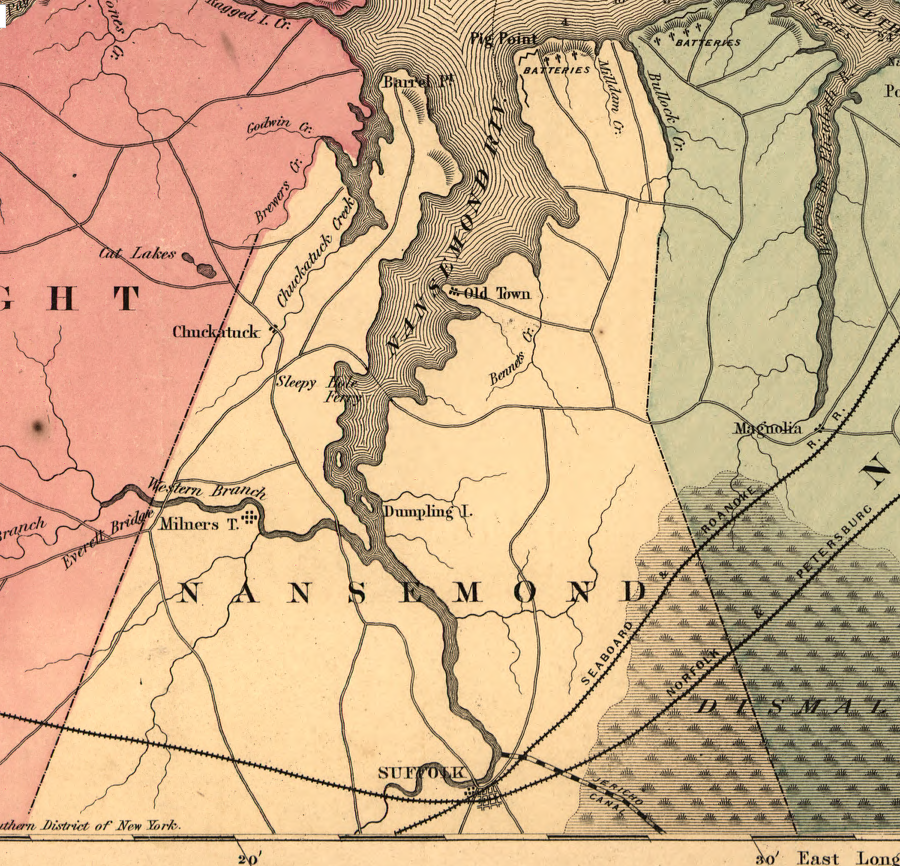
Nansemond County in 1862
Source: Library of Congress, Hare's map of the vicinity of Richmond, and Peninsular campaign in Virginia (by J. Knowles Hare, 1862)
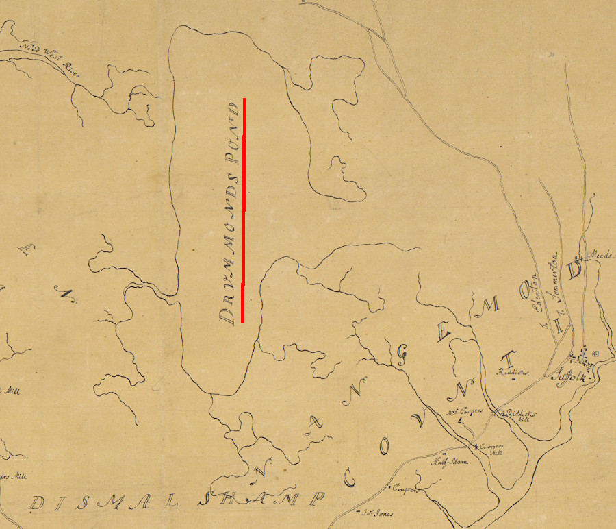
during the Revolutionary War, the British mapped Lake Drummond in Nansemond County as Drummonds Pond
Source: University of Michigan, William L. Clements Library, Plan of Princess Ann and Norfolk counties (c.1781)