
James and Appomattox watersheds
Source: Middle Atlantic River Forecast Center
James and Appomattox watersheds
Source: Middle Atlantic River Forecast Center
The James River is the largest watershed in Virginia. Creeks from as far away as Giles County and Highland County flow down into the tributaries of the river, whose official headwaters is the confluence of the Jackson and Cowpasture rivers near the northern tip of Botetourt County. The James River crosses the Valley and Ridge physiographic province, cuts through the Blue Ridge at Balcony Falls, then crosses the Piedmont before reaching the Fall Line at Richmond.
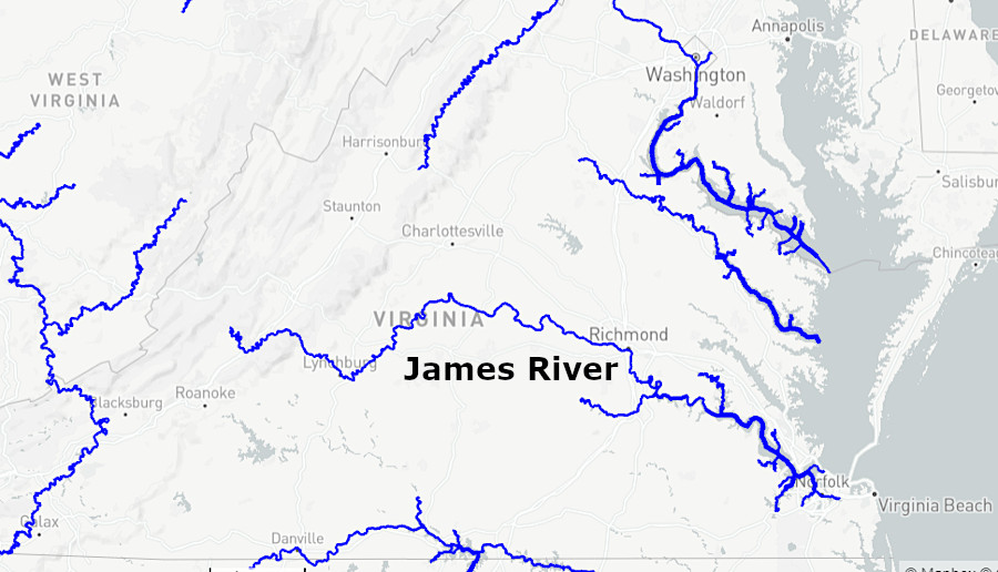
the James River is the largest watershed in Virginia
Source: US Geological Survey (USGS), Water Information from SPace (WISP)
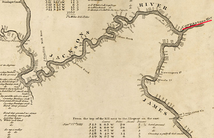
the James River starts at the confluence of the Jackson and Cowpasture rivers
Source: Virginia Memory, A survey of the headwaters of the James River and the Greenbrier, Jackson River and the Great Kenhawa or New River, and the high road between them (Andrew Alexander, 1814)
The first European colonists from Spain in 1570 and from England in 1607 chose to sail up the James River to start their settlements, and only during the Civil War was the state capital (of the Restored Government of Virginia) located away from the James.
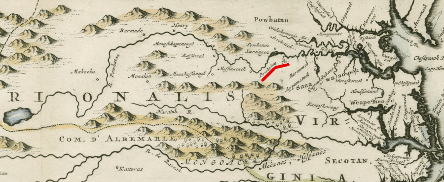
When the English arrived in 1607, the local Native Americans had named the river after Powhatan, the paramount chief in eastern Virginia with control of over 30 tribes. John Smith mapped it as Powhatan's flu ("river"). The English renamed it after their leader in England, King James I on May 24, 1607, after Christopher Newport erected a cross at the Fall Line to mark the English claim to the area. As described by George Percy, who served as President of the Council at Jamestown during 1609-10:1
The local geography and activities of the colonists was communicated back to England when Captain Newport started his trip back across the Atlantic Ocean in June, 1607. When the London Company issued instructions to Sir Thomas Gates before he traveled to Virginia in 1609 to become governor of the colony, the waterway was still called the Kings River.2
John Smith's map does not use "James River"
Source: Middle Atlantic River Forecast Center
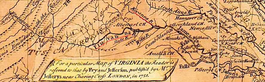
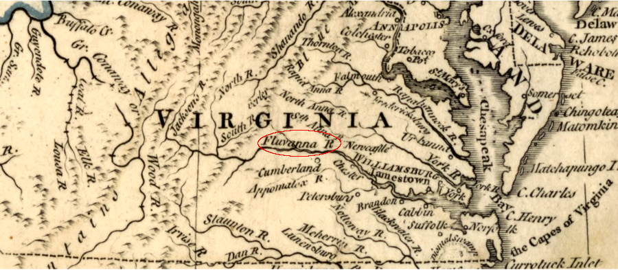
As colonists moved upstream beyond the Fall Line, they reached the confluence of two rivers. They named both after Queen Ann, calling the right fork the Rivanna River and the left fork the Fluvanna River. Had that naming convention been retained, the headwaters of the James River would be at the Point of Fork next to the former town of Columbia. That would be comparable to the headwaters of the York River at West Point, where the Pamunkey and Mattaponi rivers converge.
the headwaters of the James River was once defined to be the confluence of the Rivanna and Fluvanna rivers
Source: University of Michigan Library, A general map of the middle British colonies, in America (by Lewis Evans, 1755)
a French map in 1755 identified the "Fluvanna River"
Source: David Rumsey Historical Map Collection, Composite: Canada, Louisiane, Terres Angloises (by Jean Baptiste Bourguignon d'Anville, 1755)
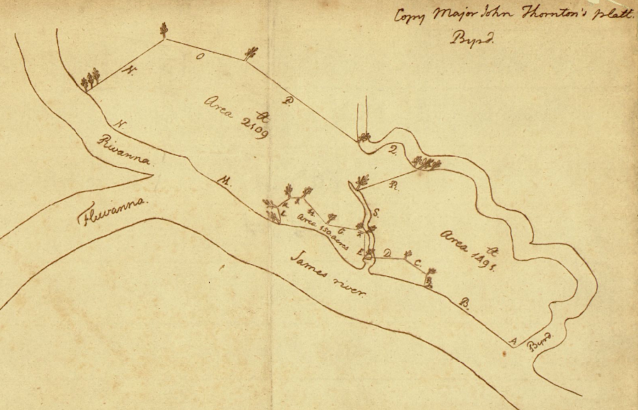
Thomas Jefferson considered the James River to start at the confluence of the Rivanna and Fluvanna rivers
Source: Library of Congress, Copy Major John Thornton's platt (Thomas Jefferson's copy of a 1718 survey by Francis Eppes)
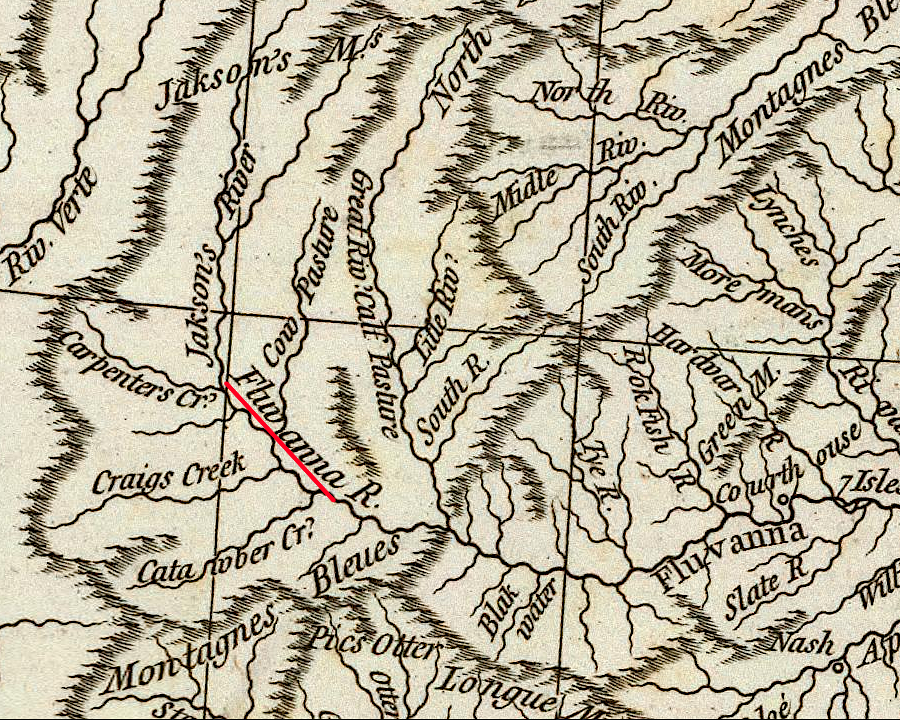
upstream of the Rivanna River, the other fork was called the Fluvanna River
Source: Library of Congress, State of Virginia (Samuel Lewis, 1795)
Later, the left fork was labelled as an extension of the James River. The headwaters of the James River today are at the confluence of the Cowpasture and Jackson rivers, near Clifton Forge.
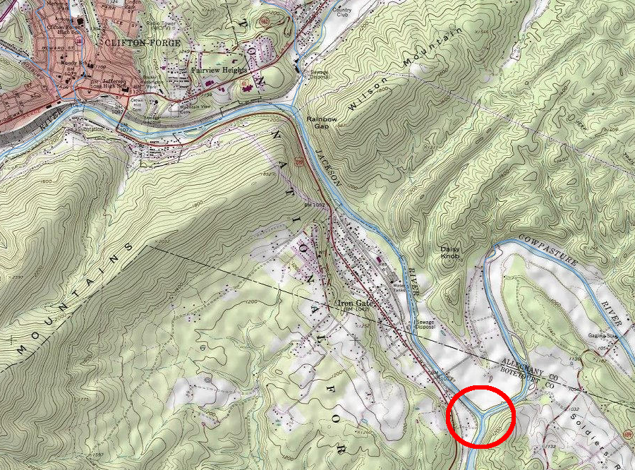
the James River headwaters is at the confluence of the Cowpasture and Jackson rivers
Source: ESRI, ArcGIS Online
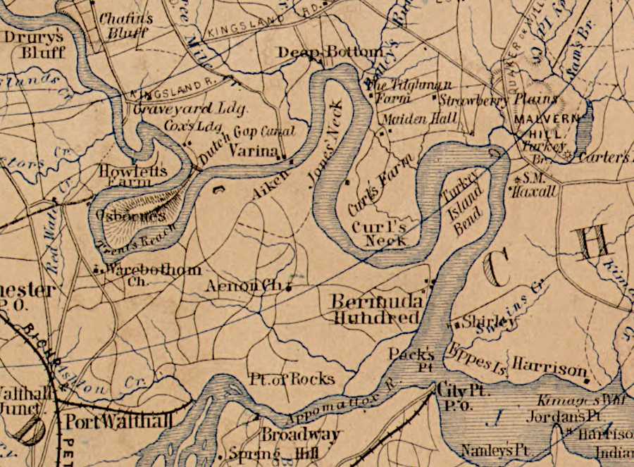
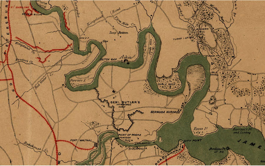
After the Civil War, the Army Corps of Engineers carved artificial channels through several "necks." The new channels shortened the distance traveled by ships going upstream to the port at Richmond. The Dutch Gap Canal, initiated by General Benjamin Butler in 1864, was completed in 1870.3
the James River naturally curled around several bends and necks, until canals were cut after the Civil War
Source: Library of Congress, Thirty five miles around Richmond, Va (by Jedediah Hotchkiss, 1867)
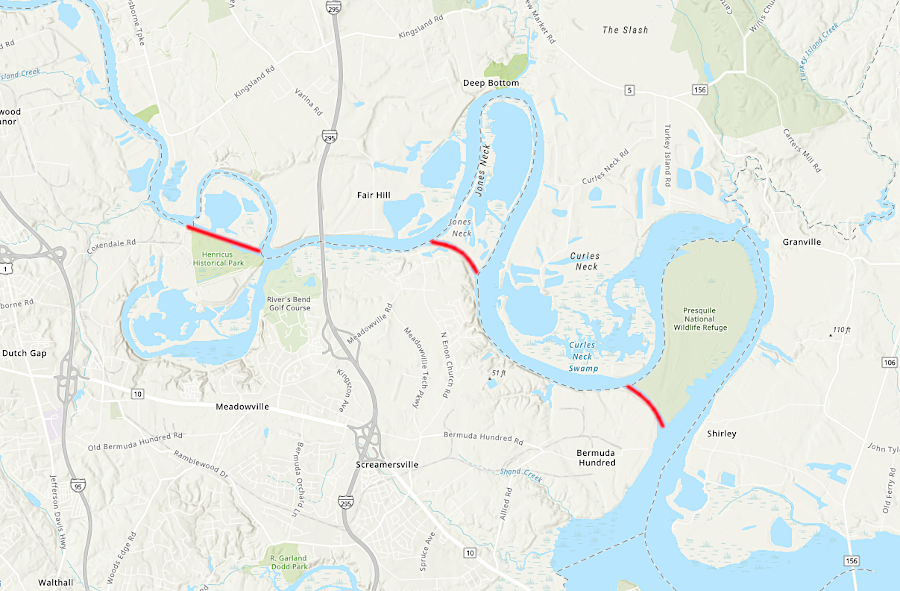
the James River today has three canals upstream of Bermuda Hundred
Source: ESRI, ArcGIS Online
The river channel is too shallow for modern container ships upstream of Newport News, but barge service still connects the Norfolk International Terminals to Deepwater Terminal.
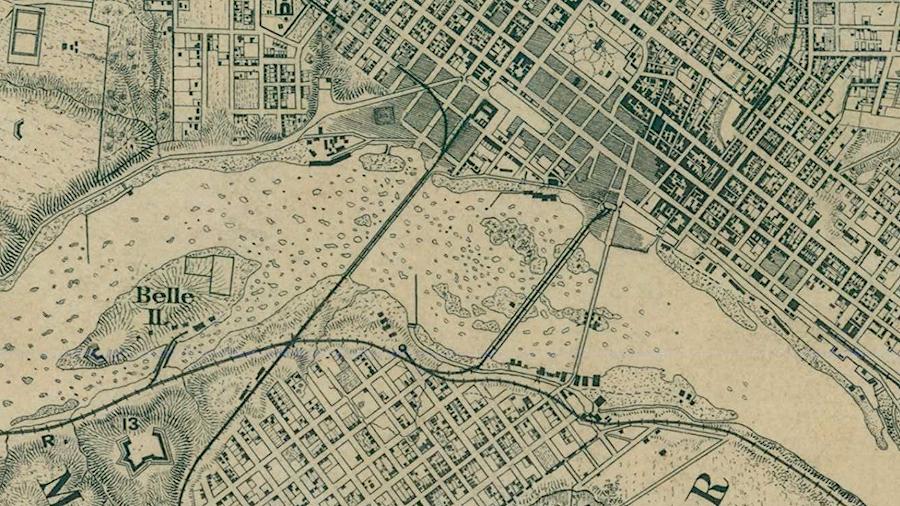
during the Civil War, two railroad bridges and the Mayo Bridge connected Richmond to Manchester at the Fall Line of the James River
Source: National Archives, Virginia and the Chesapeake Bay: Sheet No. 13 Richmond (Civil War era map)

looking downstream on the James River towards Church Hill on the left, below the Fall Line rapids
Source: Picturesque America (by William Cullen Bryant, 1872)
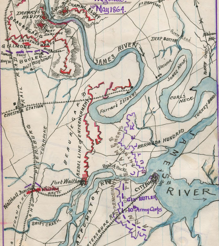
ships no longer had to travel around Turkey Neck and Jones Neck after the Civil War, once the US Army Corps of Engineers completed new channels
Source: Library of Congress, Map of operations at Bermuda Hundred and Drewry's Bluff, Virginia, 10th May 1864
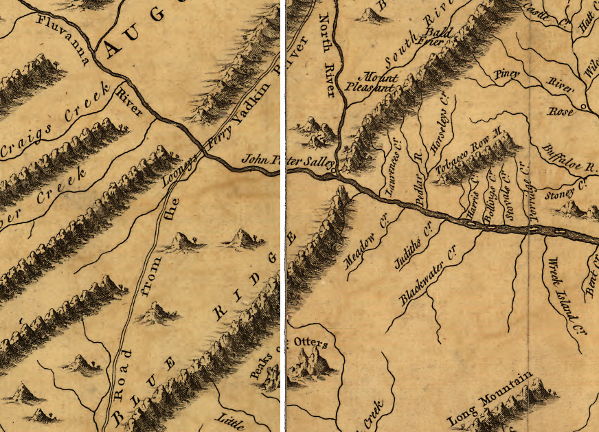
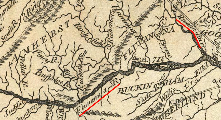
on the 1751 Fry-Jefferson map, the upper James River was called the Fluvanna
Source: Library of Congress, A map of the most inhabited part of Virginia containing the whole province of Maryland with part of Pensilvania, New Jersey and North Carolina (by Joshua Fry/Peter Jefferson, 1751)
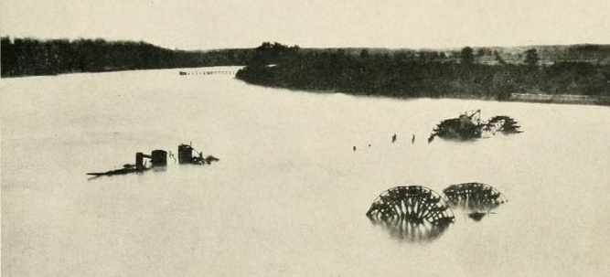
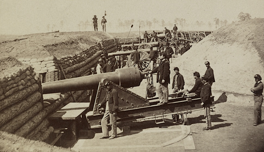
Confederates blocked Union forces from advancing up the James River to Richmond, by building Fort Darling at Drewry's Bluff and sinking ships to form obstructions at that spot
Source: The Photographic History of the Civil War, Digging Under Fire at Dutch Gap - 1863 (p.109)
Union forces did not move upstream of Fort Darling and its river obstructions until Fort Darling was abandoned after the fall of Petersburg in April 1865
Source: The Photographic History of the Civil War, James River, Virginia Near Drewry's Bluff, 1862 (pp.110-111)
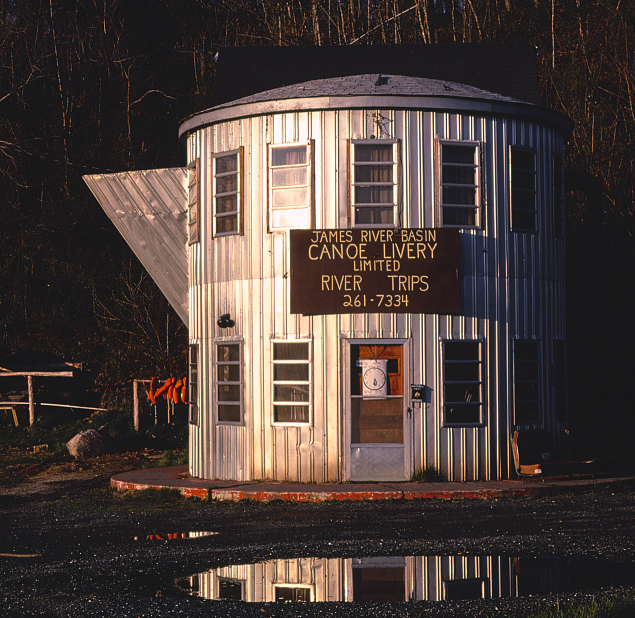
the James River supports recreation-related businesses
Source: Library of Congress, Coffee Pot Restaurant, Lexington, Virginia (by John Margolies, 1982)
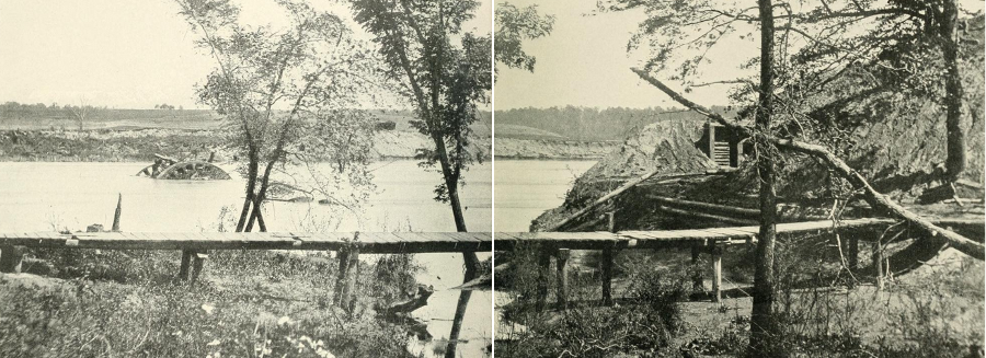
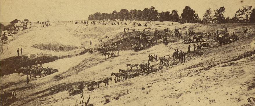
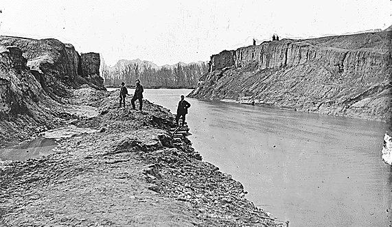
during the Civil War, Federal forces tried to bypass Confederate fortifications by digging an artificial channel at Dutch Gap
Source: Library of Congress, Butler's Dutch Gap Canal, James River, Virginia
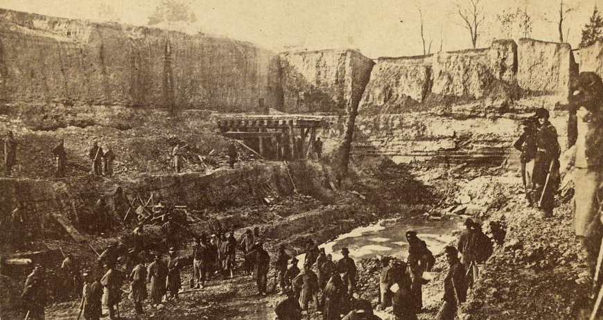
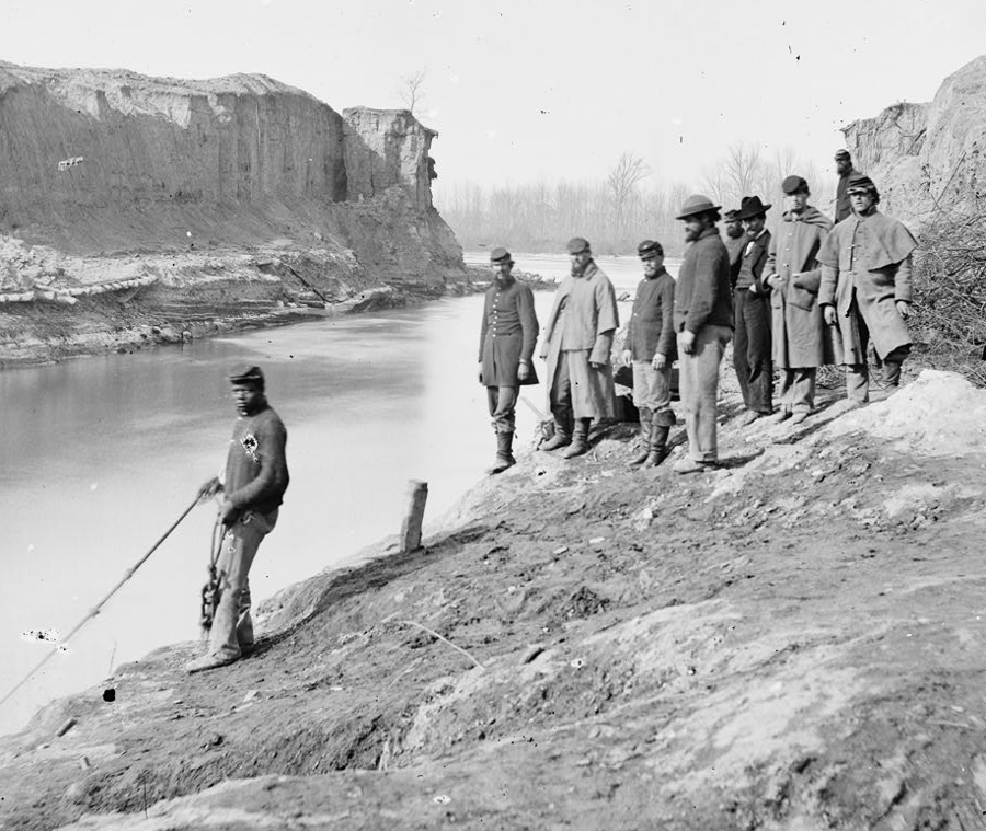
freed slaves as well as Federal soldiers were used to move the dirt during General Benjamin Butler's attempt to dig a canal at Dutch Gap
Source: Library of Congress, Dutch Gap Canal commencement of the work
steam-powered shovels alone were not enough; the Dutch Gap Canal was dug by hand, mule and horsepower as well
Source: Library of Congress, James River, Va. View of the completed Dutch Gap canal
the Union army built Fort Brady in 1864 on the north bank of the James River to trap Confederate ironclads upstream at Richmond
Source: Library of Congress, Interior views of Fort Brady, James River, Va. near Dutch Gap Canal (1771)
Dutch Gap Canal was excavated through the soft sediments of the Coastal Plain
Source: Library of Congress, Dutch Gap Canal
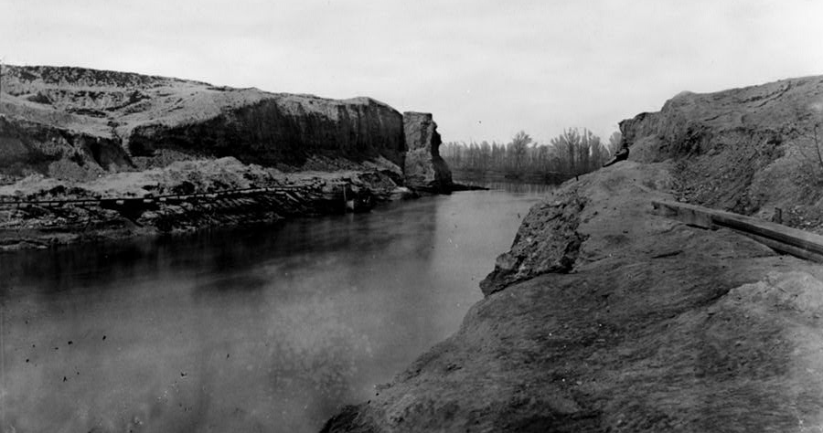
though the Dutch Gap Canal provided no military advantage during the Civil War, it led to a more-direct shipping channel in the 1870's
Source: National Archives, Dutch Gap Canal in 1865
the Dutch Gap canal was completed after the Civil War
Source: Library of Congress, Military topographical map of eastern Virginia
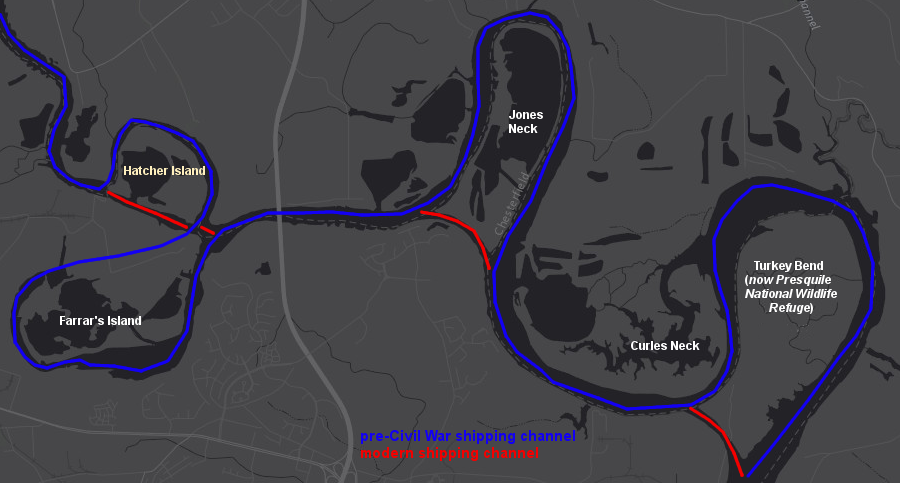
new shipping channels were cut through old meanders downstream of Richmond after the Civil War, and the Dutch Gap Canal created Farrar's Island
Source: ESRI, ArcGIS Online
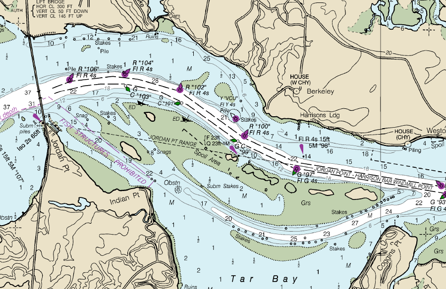
the Corps of Engineers dredges the shipping channel in the James River, keeping it 25' deep up to Richmond
Source: National Oceanic and Atmospheric Administration (NOAA), Office of Coast Survey, Chart: 12251
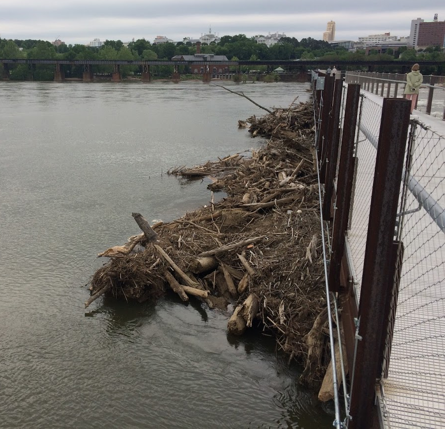
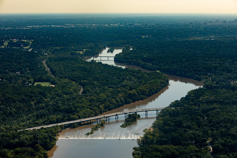
floods bring large woody debris downstream, where it has piled up at the T. Pot Bridge in Richmond
looking at Belle Isle, Lee Bridge, and Dominion Energy facility on north bank from the T. Pot Bridge in Richmond
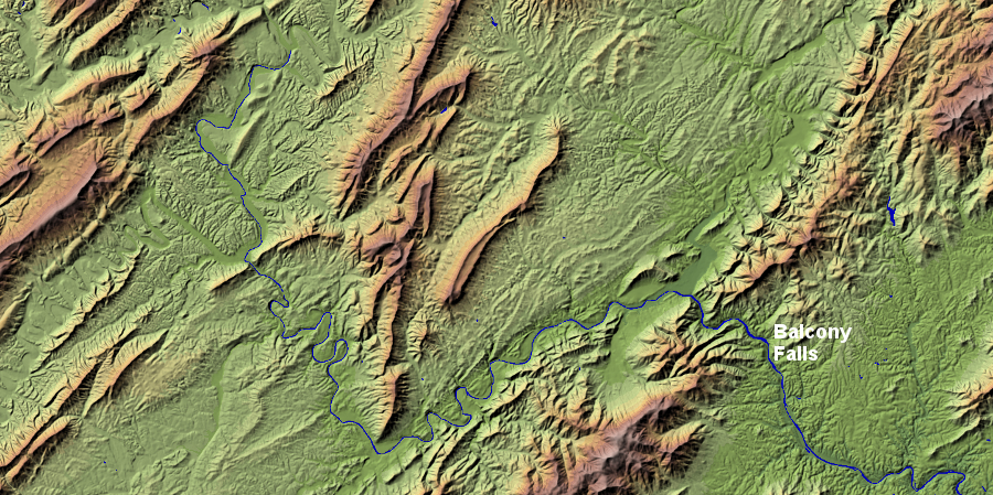
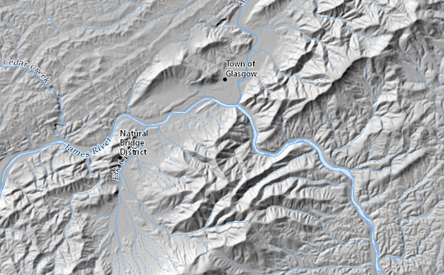
between its headwaters near Iron Gate and its passage through the Blue Ridge at Balcony Falls, the James River crosses the Valley and Ridge physiographic province
Source: USGS National Elevation Dataset, NED Shaded Relief - Virginia
looking downstream towards Richmond, from the Route 288 bridge
looking downstream from Bosher's Dam towards Chippenham Parkway and Huguenot Bridge
Source: Chesapeake Bay Program, James River in Richmond, VA
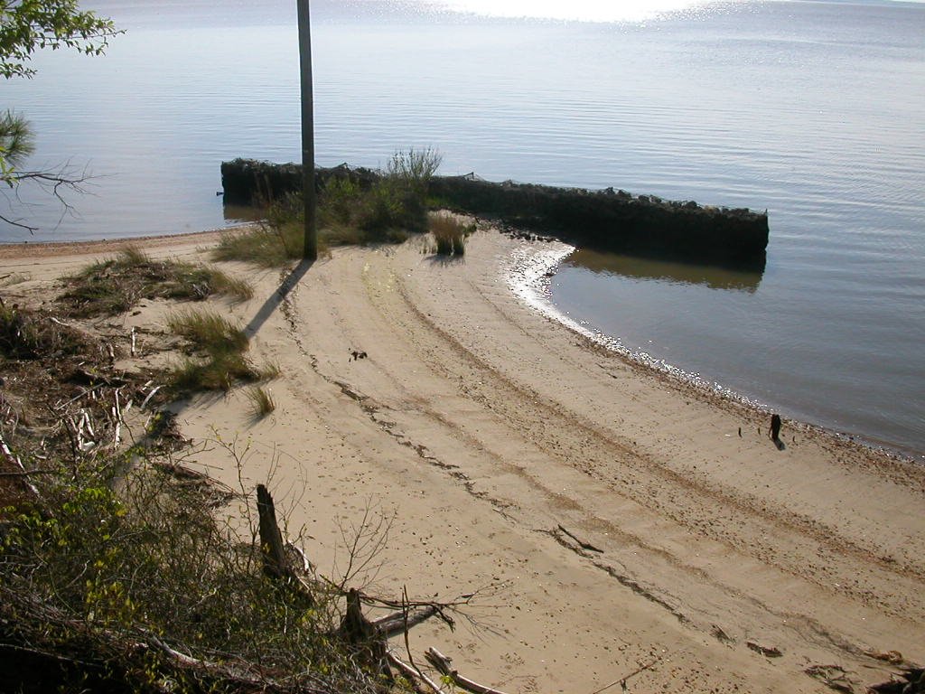 groin at Hog Island |
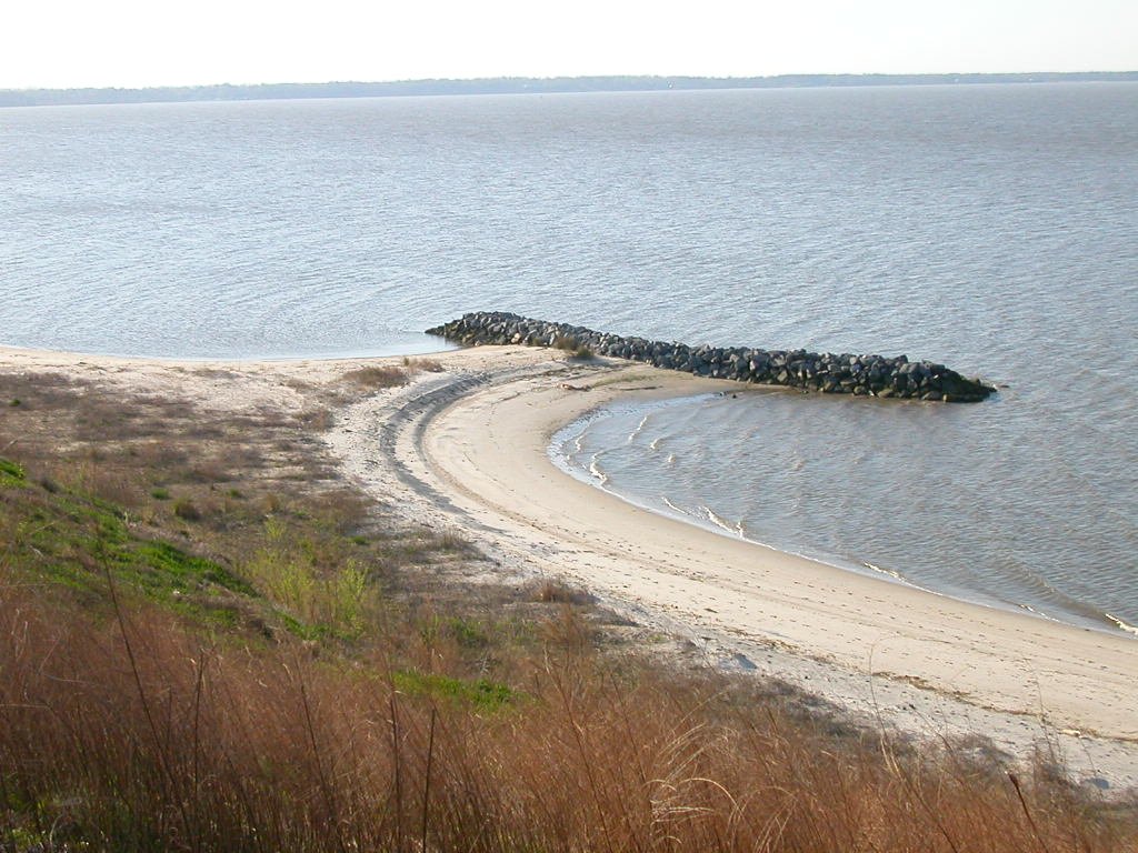 groin near The Rocks |
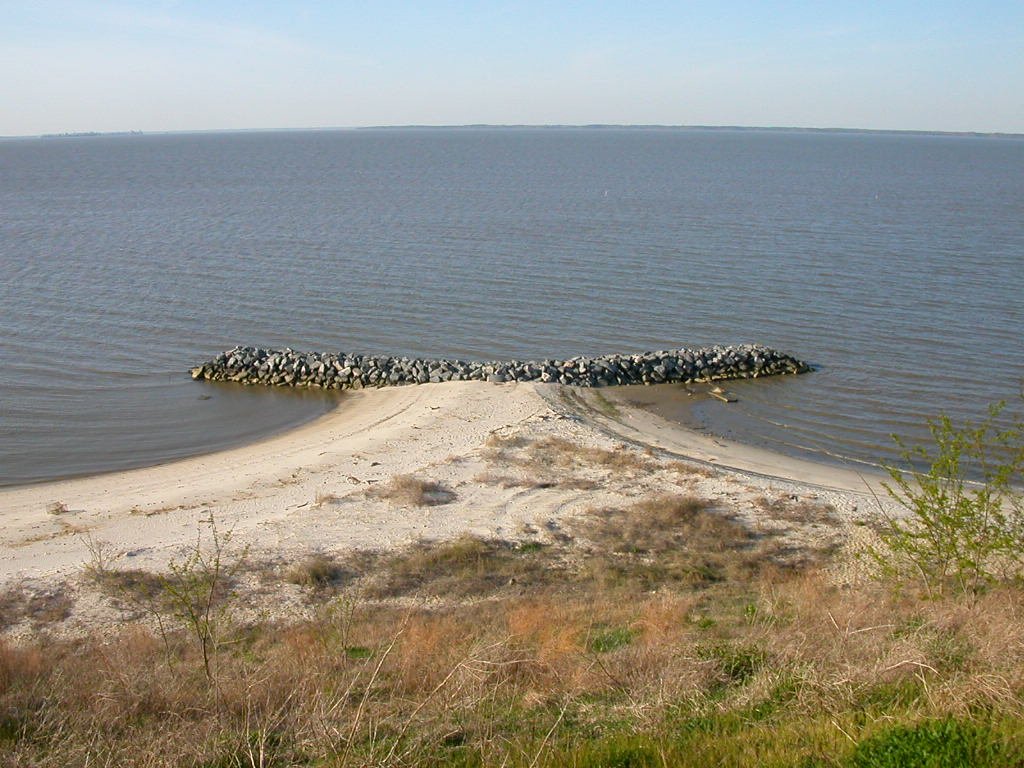 groin at Fort Boykin |
in 1783, the "Fluvanna" River was upstream of Richmond
Source: Library of Congress, The United States of North America, with the British & Spanish territories according to the treaty (by Pieter van der Aa, circa 1729)
even into the 1720's, European mapmakers recycled previous assumptions about a large lake at the headwaters of "Powhatan's flu"
Source: University of North Carolina, Partie meridionale de la Virginie et la partie orientale de la Floride dans l'Amerique Septentrionale (by Gerhard Mercator, 1610)
a wooden roof and sides on bridges helped to protect the rest of the structure from rain and rot
Source: Documenting the American South, The Great South; A Record of Journeys... (1875)
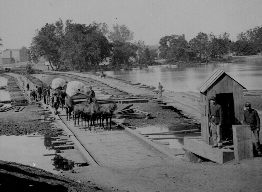
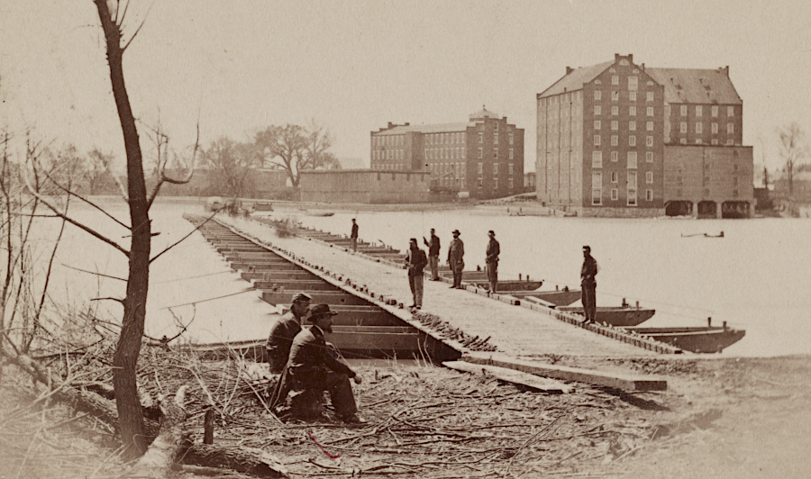
the Union Army used a pontoon bridge to cross the James River in 1865, after retreating Confederates burned bridges at Richmond
Source: National Archives, Pontoon bridge across the James River at Richmond, Va. (by Mathew Brady, 1865)
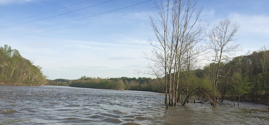
high water on the James River, just below the Reusens hydropower facility near Lynchburg
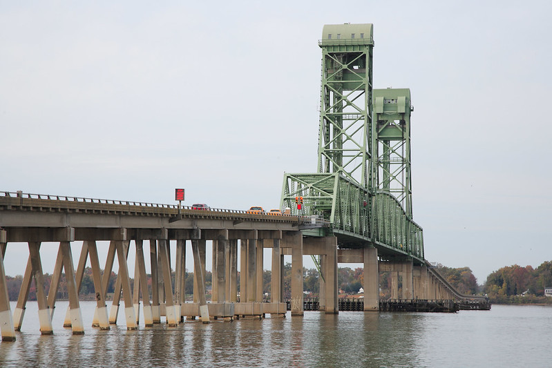
the Benjamin Harrison bridge across the James River connects Prince George and Charles City counties
Source: Virginia Department of Transportation, Benjamin Harrison Bridge Repair Projects
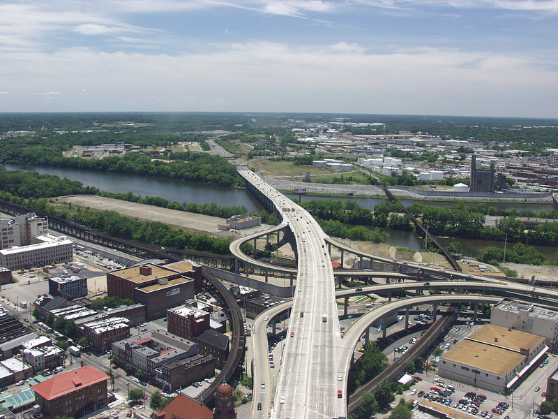
the I-95 bridge across the James River in Richmond, looking south
Source: Virginia Department of Transportation, I-95 Bridge over the James River
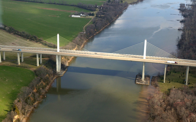
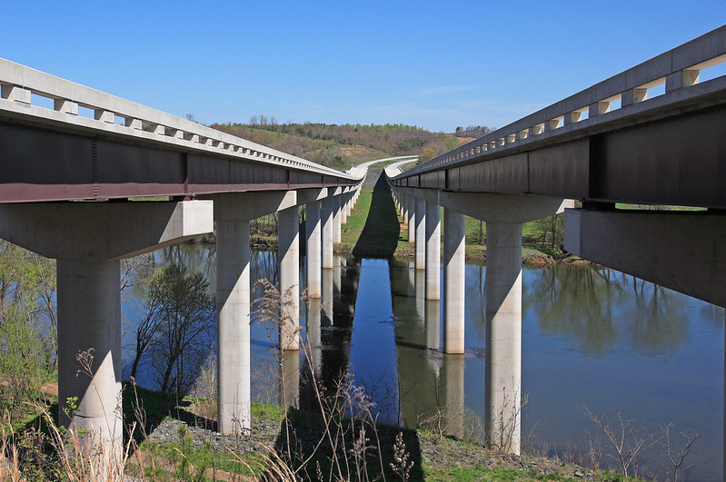
I-295 Varina Enon Bridge across the James River
Source: Virginia Department of Transportation, The Varina Enon Bridge, I-295, over the James River
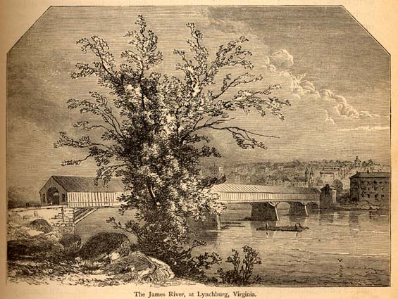
Route 29 bridge across the James River at Lynchburg
Source: Virginia Department of Transportation, The Monacon Bridge over the James River on Rte 29
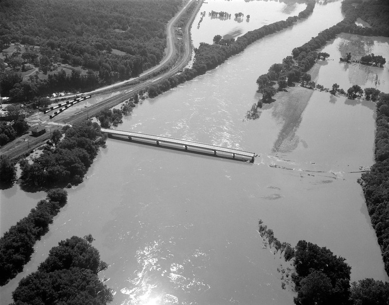
flooding from Hurricane Agnes in 1972 washed out half of the Route 609 bridge at Columbia
Source: Library of Virginia, Bridge Destruction at Columbia
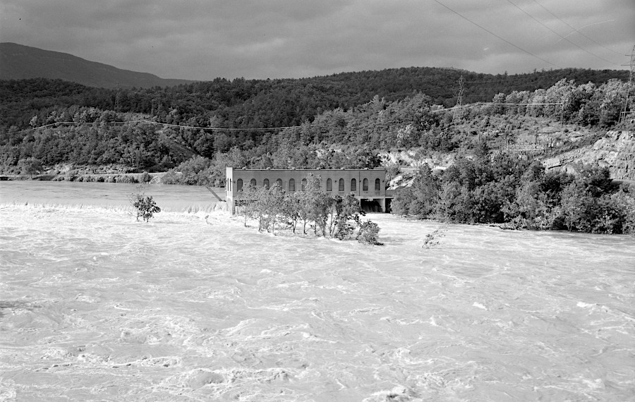
Hurricane Agnes flooded Snowden Dam in 1972
Source: Library of Virginia, Flood Damage on Rt. 501
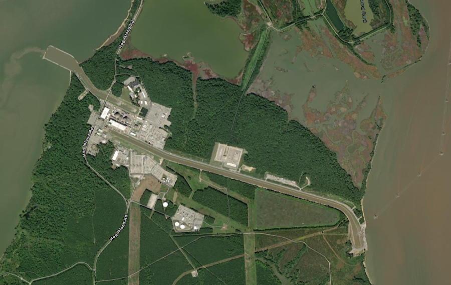
water from the James River cools the nuclear reactors at the Surry Power Station on Hog Island
Source: ESRI, ArcGIS Online
the James River cuts through the Blue Ridge, creating a water level route used by the James River and Kanawha Canal prior to the Civil War
Source: US Geological Survey, National Map
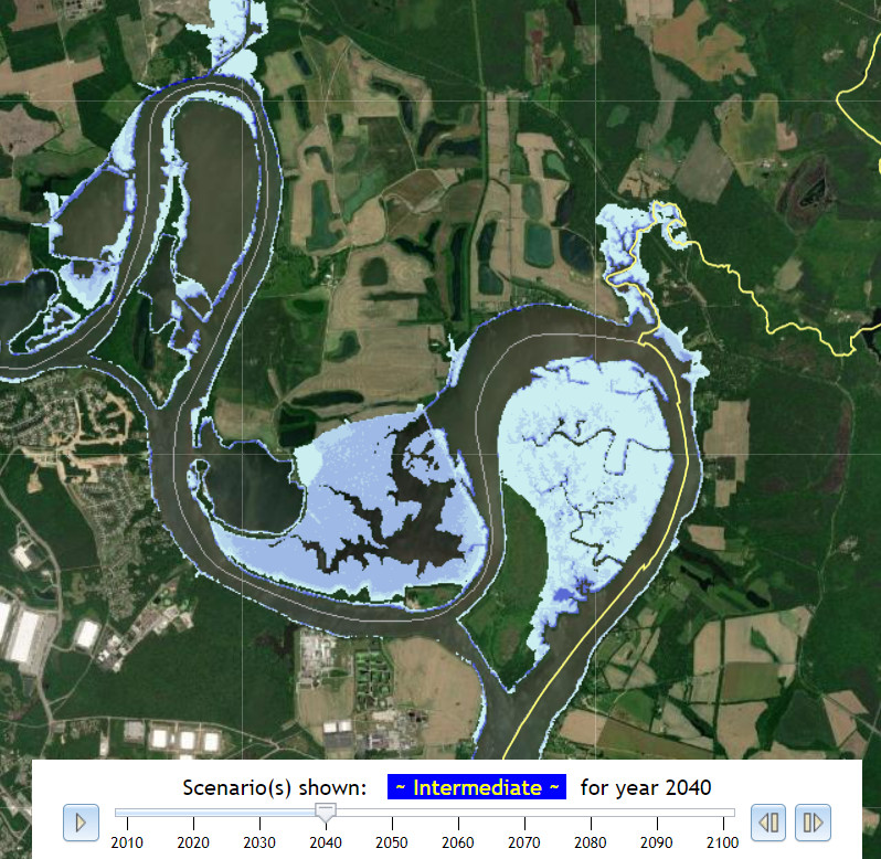
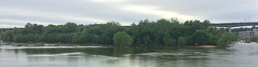
sea level rise could drown Turkey Island (Presque Isle National Wildlife Refuge) and Curles Neck by 2040
Source: Commonwealth Center for Recurrent Flooding Resiliency, Sea Level Rise Projection
after capturing Richmond in 1865, the Union Army built pontoon bridges across the James River
Source: Library of Congress, Pontoon bridges across James River (1865)