Headwaters of the Potomac River, near the Fairfax Stone in West Virginia
Headwaters of the Potomac River, near the Fairfax Stone in West Virginia
The Potomac River, like the Teays River (now the New River), once flowed north towards the St. Lawrence Valley. Perhaps 3.5 million years ago, the Potomac River cut a channel through the Blue Ridge and began to flow east towards the Atlantic Ocean. Rounded gravel now on Tysons and in Prince William Forest Park show where the riverbed was once located, before carving the current channel.1
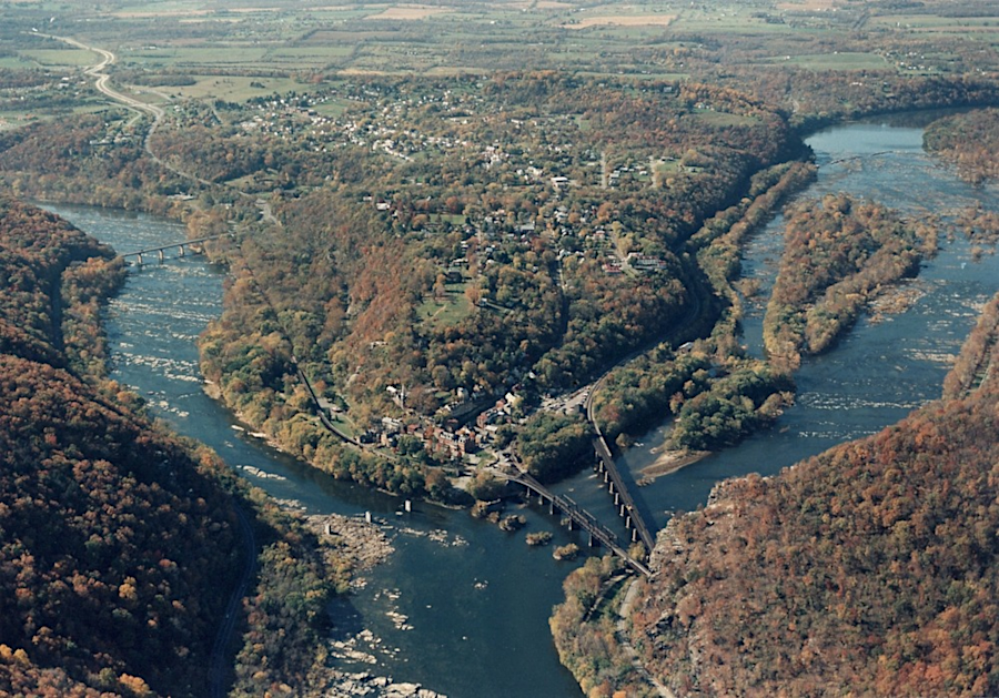
the Potomac River cut through the Blue Ridge within the last 20 million years, forming the gap at modern Harpers Ferry
Source: National Park Service, aerial view of Harpers Ferry
Spanish sailors may have seen at least the mouth of the Potomac River as they explored what they called the Bahia de Santa Maria in the 1500's. When John Smith sailed up the Chesapeake Bay in 1608, he recorded what he saw in person and also what he learned from discussion with Native Americans regarding the length of the river:2

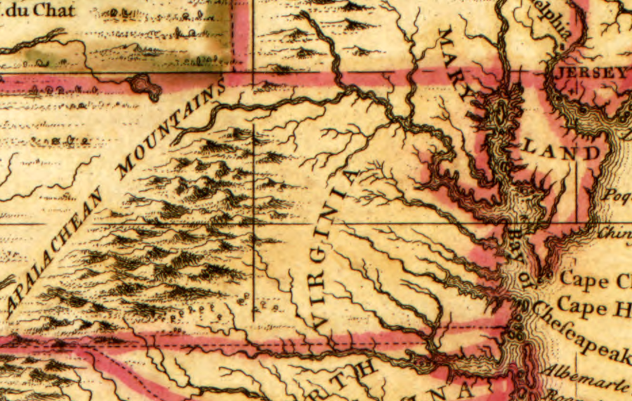
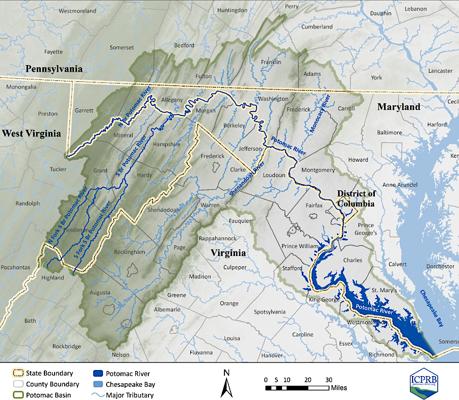
Potomac, Shenandoah, and Rappahannock watersheds
Source: Middle Atlantic River Forecast Center
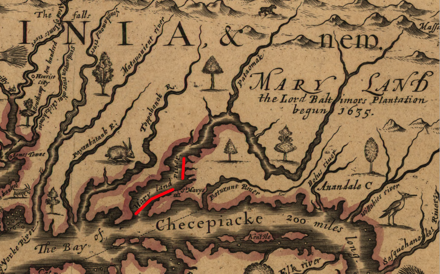
in 1651, John Farrer mapped the Potomac as "Maryland River"
Source: Library of Congress, A mapp of Virginia discovered to ye hills (John Farrer/John Overton, 1667)
The river's name is shared with the Patawomeke, a Native American tribe that John Smith visited at the mouth of Potomac Creek. The US Board on Geographic Names adopted "Potomac" as the official name in 1930, choosing among 95 variant names. It is unknown if Federal agency's decision on the official pronunciation is consistent with the pronunciation in the Algonquian languages back in 1608.
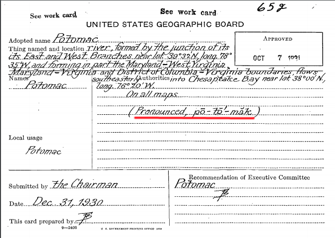
the US Board on Geographic Names adopted the official pronunciation of "Potomac" in 1930
Source: US Geological Survey (USGS), Middle Atlantic River Forecast Center
The meaning of "Potomac" is unknown, but there are various theories:3
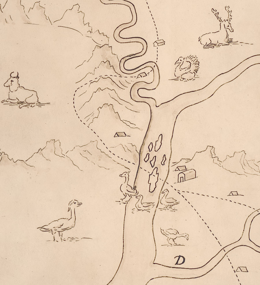
in 1707, Franz Michel sketched geese on the Cohongarooton River when he documented his exploration into the Shenandoah Valley
Source: Library of Congress, Michel's map: 1707
George Washington maximized the view of the Potomac River from Mount Vernon. He actively directed the landscape design and reconstruction of the house he acquired after his half-brother Lawrence Washington died. He used "ha-ha walls," with one side sunken into the turf and not visible from the mansion, to keep domesticated animals out of the lawn stretching down towards the river.
Benjamin Henry Latrobe commented on Washington's development of the vista from his piazza:4
The quality of the water in the Potomac River is affected by runoff upstream. Excessive nutrients (nitrogen/phosphorous) and sediment washes downstream from sources as far away as West Virginia. Massive urbanization in the Washington, DC area may be responsible for the high amount of sediment in the Potomac River. In 2014 a commercial fisherman commented at a meeting of the Potomac River Fisheries Commission that shells on the bottom of the Rappahannock, York, and James rivers were clean, but:5
as late as 1743, maps portraying the upper reaches of the Potomac River were far from accurate
Source: Library of Congress, A map of the British Empire in America with the French and Spanish settlements adjacent thereto (by Henry Popple, 1743)
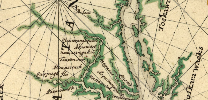
in the mid-1600's, the Dutch were familiar with the Potomac River beyond Great Falls
Source: Library of Congress, Pascaert van Nieuw Nederlandt Virginia (Joan Vinckeboons, 1639?)
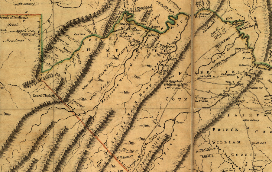
by 1755, Joshua Frye and Peter Jefferson clarified the locations of the north and south branches of the Cohongoranto River
Source: Library of Congress, A map of the most inhabited part of Virginia (by Joshua Frye and Peter Jefferson, 1755)
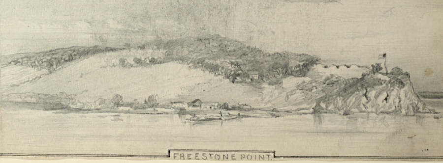
Confederates placed cannon at Freestone Point in 1861 to block Union shipping on the Potomac River
Source: New York Public Library, Flotilla of the Potomac River (by Arthur Lumley)
a multi-state body helps to manage water supplies drawn from the Potomac River basin during drought periods
Source: Interstate Commission for the Potomac River Basin (ICPRB), Potomac Basin Comprehensive Water Resources Plan = 2023 Updates
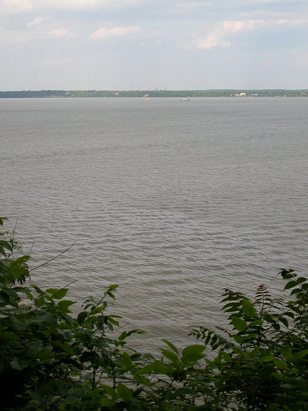
view across Potomac River to Maryland, at Leesylvania State Park
Source: Interstate Commission on the Potomac River, Potomac River and How We Can Help
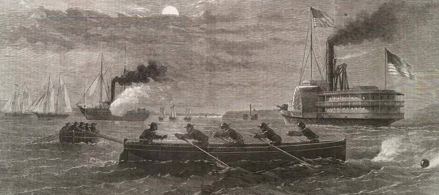
despite the much-larger Union Navy, Confederates were able to smuggle goods and people across the Potomac River to Maryland throughout the Civil War
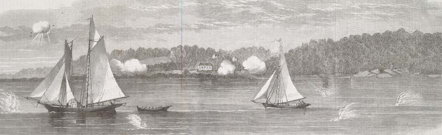
Source: Illustrated London News, The Civil War in America: Cutting off a Confederate Despatch-Galley on the Potomac, Near Freestone Point (November 9, 1861)
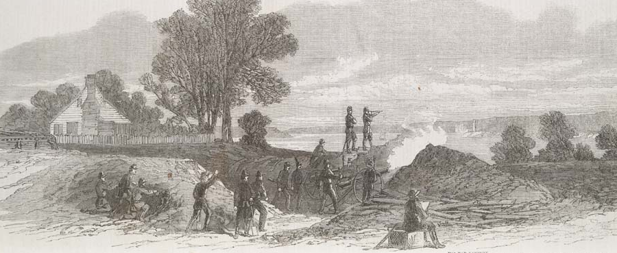
in the winter of 1861-62, Confederate cannon placed on shoreline bluffs blocked most Federal ships from using the Potomac River near Quantico
Source: Illustrated London News, The Civil War in America: The Confederate Batteries on the Lower Potomac, Virginia Shore, Opposite Budd's Ferry-Government Store-Schooners Running the Blockade (December 7, 1861)
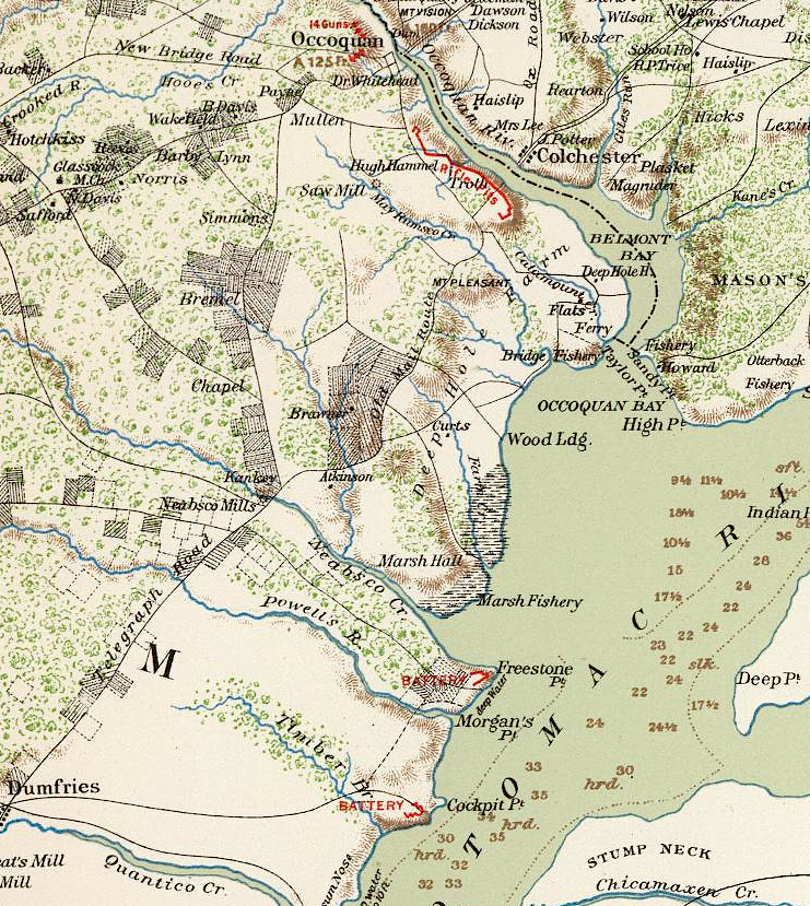
Confederate cannon near Quantico blocked Potomac River traffic, while fortifications near Occoquan were designed to block a land attack
Source: David Rumsey Historical Map Collection, Surveys for military defenses. Map of northeastern Virginia and vicinity of Washington. Sheet 2 (by J.J. Young and W. Hesselbach, August 1, 1862)
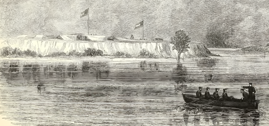
Federal cannon on the Maryland shoreline opposite Quantico could not reach across the river and end the Confederate blockade
Source: Illustrated London News, The Civil War In America: The Ten-Pounder Gun Battery (Federalist) at Budd's Ferry, Lower Potomac, Opposite the Confederate Batteries on the Virginia Shore (December 7, 1861)
\
Confederates installed cannon on bluffs in Prince William County along the Potomac River, and limited the ability of Union ships to reach Washington DC during the winter of 1861-62
Source: Frank Leslie's Illustrated History of the Civil War, North Battery of the Confederates at Shipping Point, On the Virginia Side of the Potomac River Looking Up the River (p.84)
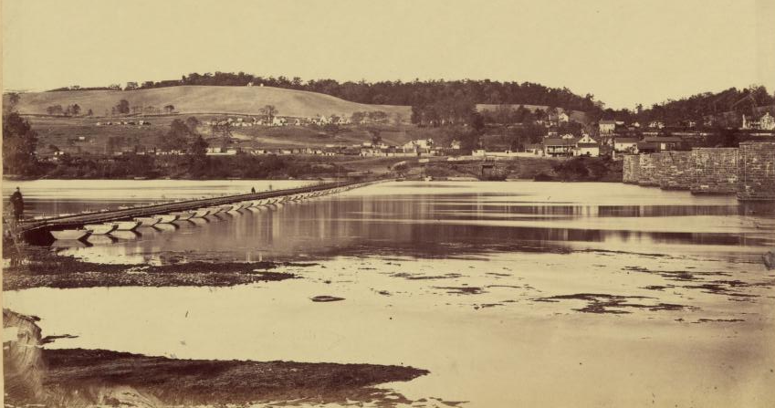
after the Battle of Antietam in September, 1862, Union forces built a pontoon bridge to cross the Potomac into Loudoun County near Lovettsville
Source: Alexander Gardner, Gardner's Photographic Sketch Book of the War
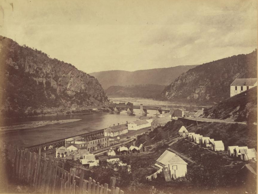
about 5 million years ago, the Potomac River eroded a channel through the Blue Ridge at what today is Harpers Ferry
Source: Alexander Gardner, Gardner's Photographic Sketch Book of the War
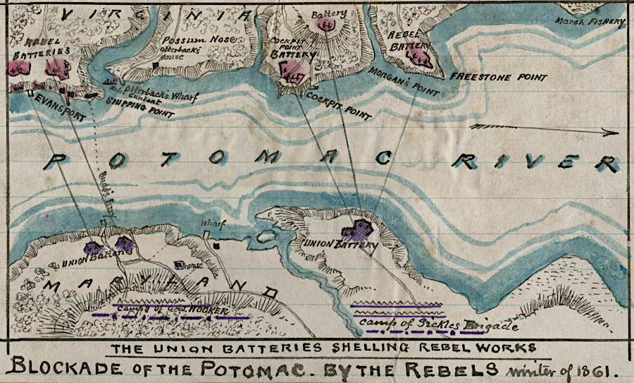
Confederates briefly blocked shipping along the Prince William County waterfront, before the 1862 Penisula Campaign
Source: Library of Congress, Blockade of the Potomac - by Rebels, winter of 1861 (by Robert Knox Sneden)