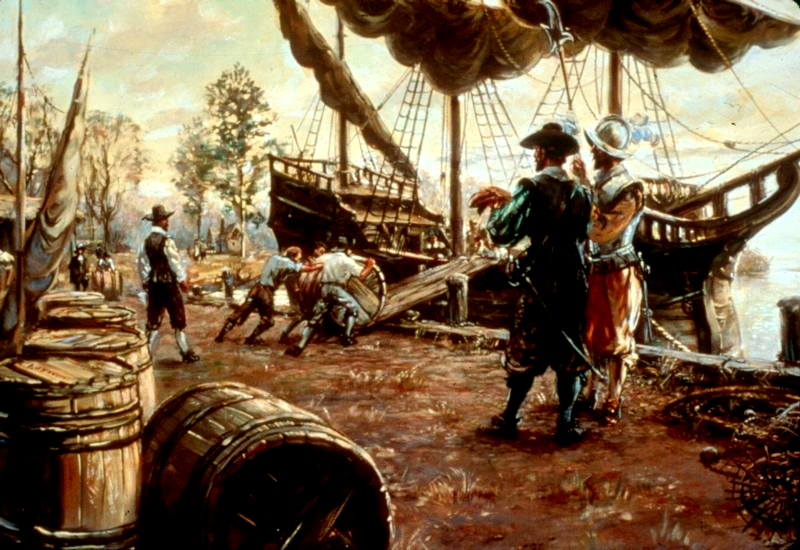
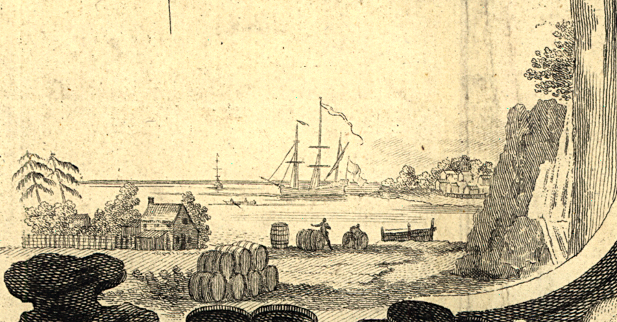
the #1 product exported from Tidewater in colonial times was tobacco, packed ("prized") into wooden barrels called hogsheads
Source: National Park Service - Sidney King Paintings, A Shipping Scene
the #1 product exported from Tidewater in colonial times was tobacco, packed ("prized") into wooden barrels called hogsheads
Source: National Park Service - Sidney King Paintings, A Shipping Scene
Virginia's first colonists nearly starved to death, but soon after the winter of 1609-10 the colony became self-sufficient in food production. The first center of colonial agriculture was on the Peninsula and south of the James River, where various plantations such as Bermuda Hundred were settled.
In the 1600's and 1700's, Virginia farmers earned the most revenue by exporting tobacco to England (plus France and the Netherlands, when permitted). Returning ships brought cloth, glass, guns, and other products from England to Virginia. The colonial trade was based on the mercantile philosophy that the home country should profit as the center of manufacturing, while the colonies provided raw materials.
The early colonists raised wheat and made bread, using windmills to power the grindstones that converted the wheat into flour. They also raised hogs and cattle for sale to ship captains. The livestock yielded fresh meat that could be preserved with salt imported from Bermuda, the Bahamas, or nearby Caribbean islands.
Colonial Virginia also shipped flour and meat to Caribbean islands. Plantation owners there were using their land to grow sugar cane (and thus needed to import food for the slaves and other residents of the islands). In Tidewater Virginia and Back Bay (in Virginia Beach), islands and "necks" - the peninsulas between tidal creeks - were used as pastures.
deep channels in the Chesapeake Bay enabled ocean-going ships to visit plantations scattered on Tidewater peninsulas called necks (due to their shape), reducing the incentive for colonists to establish towns
Source: ESRI, ArcGIS Online
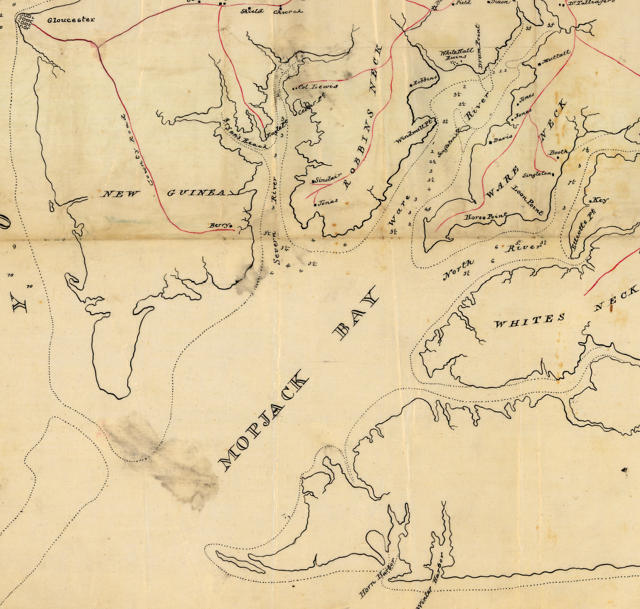
Union mapmakers documented the shoreline of Mobjack Bay during the Civil War, including Robbins Neck, Ware Neck, and Whites Neck
Source: Library of Congress, York River and Mobajack [sic] Bay, Va. (1862)
Because water surrounded three sides of the necks, the labor and materials to build fences to enclose pastures were minimized. Even today, south of the "Green Line" that defines land use patterns, a substantial portion of the City of Virginia Beach is still productive farmland.
The pattern of rivers and "necks" of land throughout Tidewater shaped the settlement of the region by Europeans. The English considered the rivers and Chesapeake Bay to be a transportation bonus, not a barrier to travel. Ships that crossed the Atlantic Ocean from Europe - and later, Africa - could sail far up the bay and its tributaries, using the deep river channels to reach as far west as the Fall Line (modern Interstate 95).
plantations on Tidewater rivers had wharves visited by ships taking tobacco across the Atlantic Ocean
Source: Library of Congress, A map of the British and French dominions in North America (by John Mitchel, 1755)
In the 1730's, laws required Virginia tobacco to be inspected for quality before export were finally implemented, and only then did "tobacco towns" finally develop across Tidewater. Large planters relied upon agents in London to handle sales of their tobacco, then purchase requested items in England and ship them back to Virginia.
Smaller tobacco farmers grew to rely upon Scottish merchants who set up stores in small communities such as Dumfries. Those merchants paid for tobacco before it was shipped across the Atlantic Ocean, and the farmers could purchase cloth, furniture, china, glassware, and other manufactured items in that same store.1
In colonial times, there was a direct connection between ports in Europe and the wharves of individual plantations on various peninsulas or "necks" of land in eastern Virginia. The physical geography affected the cultural pattern - large plantation owners saw no value in establishing towns where European goods could be delivered, stored, and sold, when ocean-going ships could transport manufactured products from England directly to each plantation and then load a return cargo of hogsheads of tobacco.
Development of towns in Virginia was delayed until the population finally moved inland, away from the easy transportation offered by so many peninsulas of land in Tidewater Virginia.
In 1730, over a century after Jamestown was founded, Governor Gooch was able to get the General Assembly to mandate establishment of tobacco inspection warehouses. Scottish merchants started stores near the warehouses, providing small farmers an alternative to dealing with large plantation owners when buying European goods and selling tobacco. The warehouses and stores became the nucleus for many early Tidewater towns, such as Alexandria and Occoquan.
Though Jamestown was the first town created by Europeans in Virginia and Hampton was settled next, Norfolk has been the state's primary port since the 1700's.
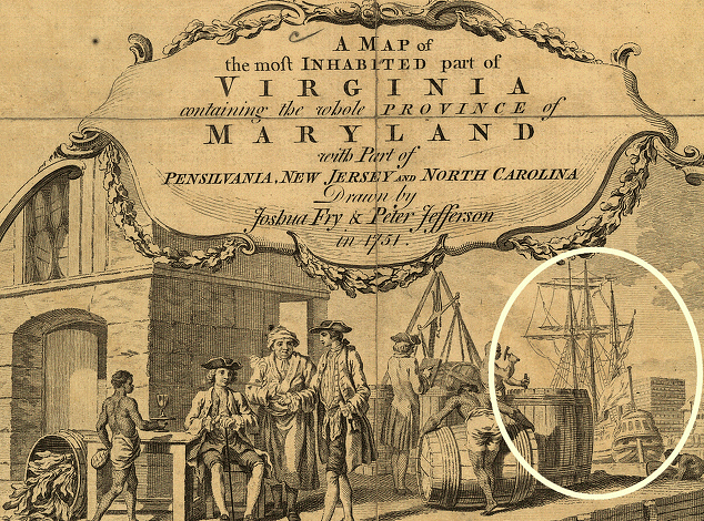
a ship is clearly displayed in the cartouche on the Fry-Jefferson map
Source: Library of Congress
Norfolk's harbor at the mouth of the Elizabeth River was naturally deep, sheltered from storms, and close to the Atlantic Ocean. By doing business at Norfolk, ship captains could avoid a tedious journey of sailing up the James River, tacking back and forth to stay in the narrow channel.
The loyalty of the white residents in Norfolk/Portsmouth to the "mother country" during the American Revolution was affected by the close economic ties to London and Glasgow. In April, 1775, Lord Dunmore (the last colonial governor) fled Williamsburg. He chose Norfolk as his primary base of resistance against the rebels, but was forced to abandon it after the Virginians burnt the town at the start of 1776.
(The British completed the burning of the town, and that was added to the list of "outrages" justifying the American Revolution. It took over 100 years before the true role of the local Virginia rebels in torching their largest city was exposed.2)
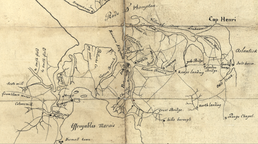
Hampton Roads transportation network in 1781
Source: Library of Congress, Plan des environs de Williamsburg, York, Hampton, et Portsmouth (map produced by French army engineers in Yorktown Campaign)
Today, the Hampton Roads region still depends upon the Chesapeake Bay as its primary economic resource. Now, however, the region is taking advantage of deep river channels and protected harbors for military shipping, as well as export of agricultural goods and coal to Europe and import of manufactured products from Asia.
The US Navy is the main employer in Hampton Roads. The Norfolk Navy Yard has been the primary economic stimulus for expansion in the area, affecting growth north of the James River as well as south. The growth led to Tidewater being the first Virginia region to support commercial broadcasting.3
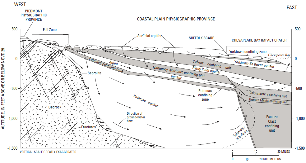
aquifers underneath Coastal Plain
Source: US Geological Survey, The Virginia Coastal Plain Hydrogeologic Framework (USGS Professional Paper 1731, Figure 2)
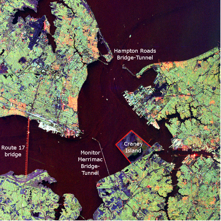
bridges/tunnels in Hampton Roads
Source: NASA Visible Earth, Space Radar Image of Hampton Roads, Virginia