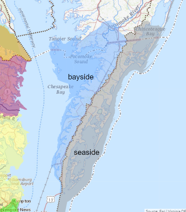
the watershed divide in the middle of the Eastern Shore defines bayside and seaside watersheds
Source: ESRI, ArcGIS Online
the watershed divide in the middle of the Eastern Shore defines bayside and seaside watersheds
Source: ESRI, ArcGIS Online
The Eastern Shore of Virginia is the most-southern 70-80 miles of a peninsula located between the Chesapeake Bay and the Atlantic Ocean. The Delmarva Peninsula is named for Delaware, Maryland, and Virginia.
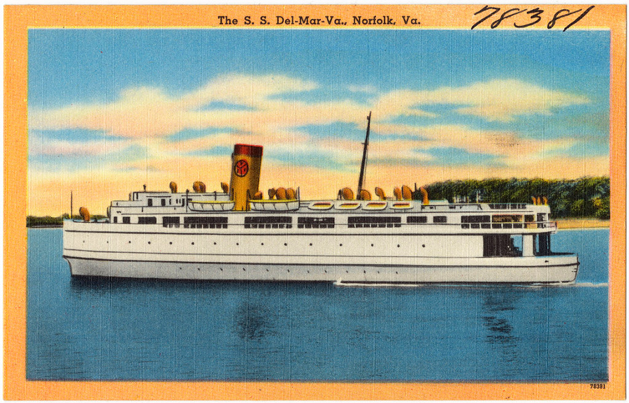
a pre-World War II postcard shows the SS Del-Mar-Va, one of the ferries that linked the Eastern Shore to Princess Anne County (now City of Virginia Beach) until the Chesapeake Bay Bridge-Tunnel opened in 1964
Source: Boston Public Library, The S. S. Del-Mar-Va., Norfolk, VA
Physically, the Eastern Shore Route 13 marks a rough approximation of the watershed divide - land on the "bayside" of the peninsula drains to the Chesapeake, while land on the "seaside" drains to the Atlantic Ocean (and is not part of the Chesapeake Bay watershed).
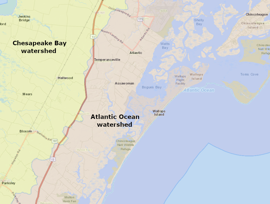
Route 13 in Accomack County approximates the watershed divide between "bayside" and "seaside"
Source: Accomack County, AccoMap
The shape of the peninsula is highly irregular, with extensive indentations filled with bays and marshes, plus many "necks" (extensions of land jutting into the water). Approximately 25% of the state's shoreline mileage, and almost 50% of Virginia's tidal marsh acreage, is located on the Eastern Shore.
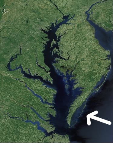
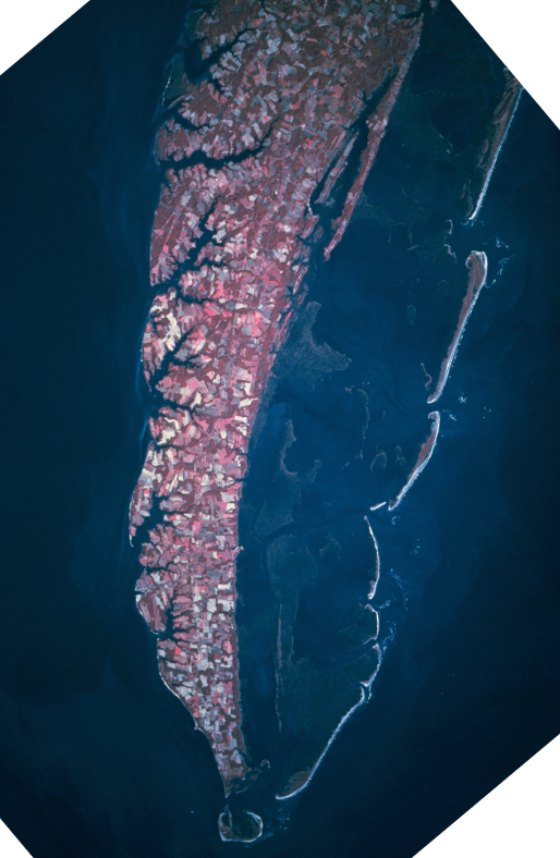
the Eastern Shore of Virginia is part of the Delmarva (DElaware, MAryland, VirginiA) Peninsula, between the Atlantic Ocean and Chesapeake Bay
Source: National Aeronautics and Space Administration (NASA), Landsat Program
The Eastern Shore is often omitted from small maps intended to show the entire state, since it is difficult to portray the isolated two counties on the eastern side of the Chesapeake Bay. Even the State Senate once considered adopting a graphic which omitted Accomack and Northampton County, while including the other 93 counties.
When the minor league baseball team in Salem adopted a new logo with an outline of Virginia, it determined that adding the Eastern Shore as a dot to the embroidered image on hats would look like a sewing error. In response, the editor of the Eastern Shore Post said, presumably with a grin rather than a grimace:1
the two counties that form the Eastern Shore of Virginia are often omitted from state maps
Source: Salem RidgeYaks, Salem Ridge Yaks 5950 Alternate Fitted Hat
35 million years ago, a "bolide" (meteor or comet) hit the Atlantic Ocean off the eastern edge of the continent, when sea levels were higher and the shoreline was close to the Fall Line. Hyper-saline water was trapped as heat evaporated saltwater before debris refilled the crater.
Since then, the Eastern Shore has been below sea level long enough to accumulate over 1,100 feet of marine sediments above the impact crater. Modern water wells drilled within the crater near Cape Charles produce salty water, once they pass through the sediments that accumulated after the impact.2
What today is the Delmarva peninsula evolved as sediments were carried south by the Susquehanna River over hundreds of thousands of years. At times of high sea level, the sediments accumulated as a bar where the Susquehanna River met the Atlantic Ocean. When sea levels dropped, the river carved a new channel south to get past the mound of sand and silt carried south from Pennsylvania and New York. The deposits were reshaped many times by river and wave action during periods when sea levels rose and fell. In addition, ocean currents carried sediments from the Hudson River and Delaware River south, extending the Eastern Shore.3
Since the beginning of the last Ice Age over 100,000 years ago, the landscape of the Eastern Shore has been above sea level. At the peak of glaciation 18,000 years ago, the Eastern Shore was simply part of a continuous Coastal Plain that extended from the Fall Line eastward to the Atlantic Ocean, located about 40 mile east of today's shoreline. The Eastern Shore was not isolated as a peninsula until the Chesapeake Bay formed in the last 10,000 years.4
Sea level rise is recognized as a clear threat to the Eastern Shore, which has few locations higher than 50 feet. Higher sea levels can flood developed areas and farmlands on the shoreline and drown marshes. Higher sea levels can also push a wedge of saltwater into subsurface aquifers, causing them to become too saline for wells to extract water for drinking or irrigation.
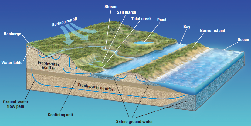
freshwater in the Eastern Shore accumulates from rainfall in shallow aquifers, just as in barrier islands
Source: US Geological Survey (USGS) - Circular 1262, Ground Water in Freshwater-Saltwater Environments of the Atlantic Coast (Figure 3)
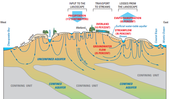
roughly 25% of the rainfall on the Eastern Shore ends up as groundwater
Source: US Geological Survey, Understanding Nutrients in the Chesapeake Bay Watershed and Implications for Management and Restoration - the Eastern Shore (Figure 21) and Virginia Eastern Shore Groundwater Resources
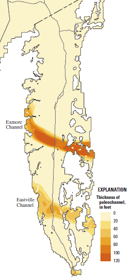
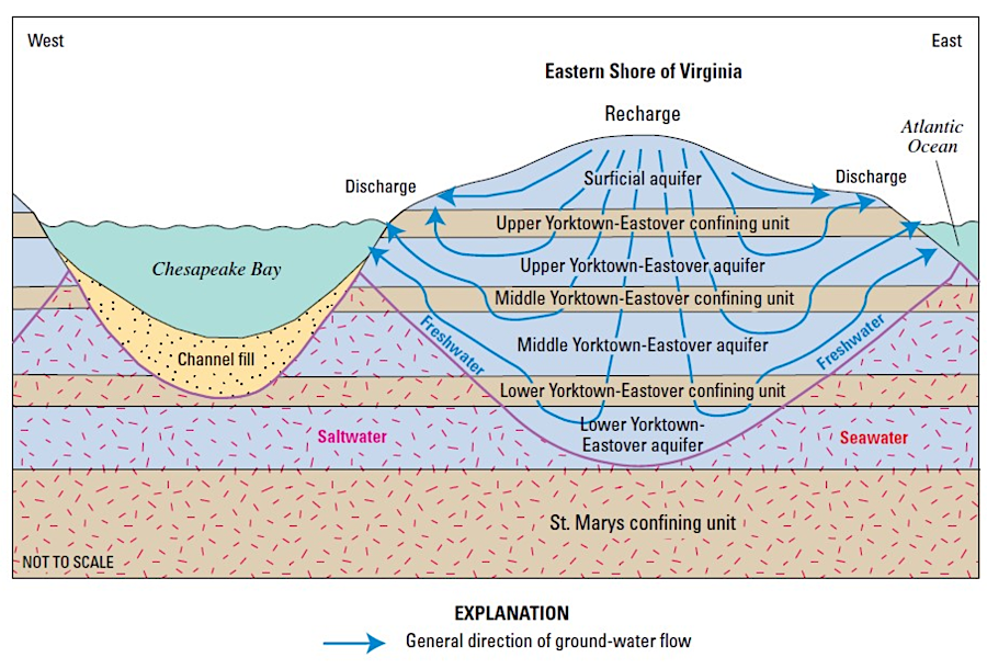
during the Pleistocene Epoch, the original sediments that formed the Yorktown aquifer were eroded by the predecessor to the modern Susquehanna River, creating major paleochannel aquifers that cross the Eastern Shore
Source: US Geological Survey, Simulation of Groundwater-Level and Salinity Changes
in the Eastern Shore, Virginia (Figure 6)
If sea level rises as predicted, the barrier islands and marshes on the eastern edge will migrate westward. However, Tangier Island in Accomack County and other islands in the Chesapeake Bay could disappear entirely underwater.5
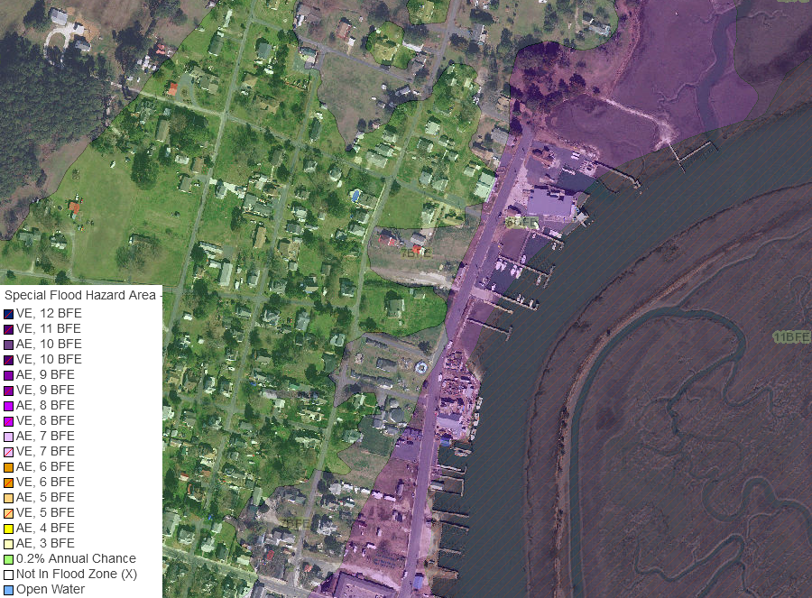
most structures in Wachapreague are in the 500-year flood plain (green shows 0.2% annual chance)
Source: Accomack County, AccoMap

multiple census tracts on the Eastern Shore were designated as Community Disaster Resilience Zones in 2023
Source: Federal Emergency Management Agency (FEMA), Community Disaster Resilience Zones Viewer
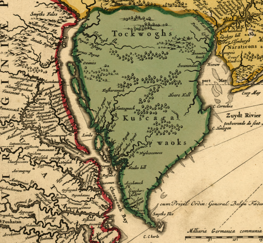
The Dutch established a colony on the Delaware River in the 1600's and desired ownership of the entire Delmarva Peninsula. Their influence reached far south. The distinctive yellow bricks and smoking pipes used by the Dutch have been excavated at Eyreville, not far from Eastville in Northampton County.
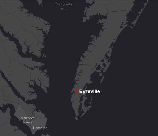
Dutch traders, if not Dutch settlers, were active at Eyreville on the Eastern Shore in the 1600's
Source: ESRI, ArcGIS Online
by 1670, colonists had built farms along the shorelines but left the interior of the Eastern Shore lightly settled
Source: John Carter Brown Library, Virginia and Maryland As it is planted and Inhabited this present Year 1670 (by Augustine Herrman, 1670)
Maryland also disputed Virginia's claim to the Eastern Shore. Lord Calvert's initial charter from King Charles I granted him all of the peninsula, south to Cape Charles. Virginians had already settled the southern portion, so the final boundary was moved north to a line starting at Watkin's Point on the western side of the peninsula.6
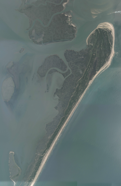
The Virginians and Marylanders disputed the exact location of that boundary. Edmund Scarborough, the Surveyor General of Virginia, had land claims in the area and sought to move the line to the north. A 1668 survey resolved the dispute, and Chincoteague Island ended up within Virginia.
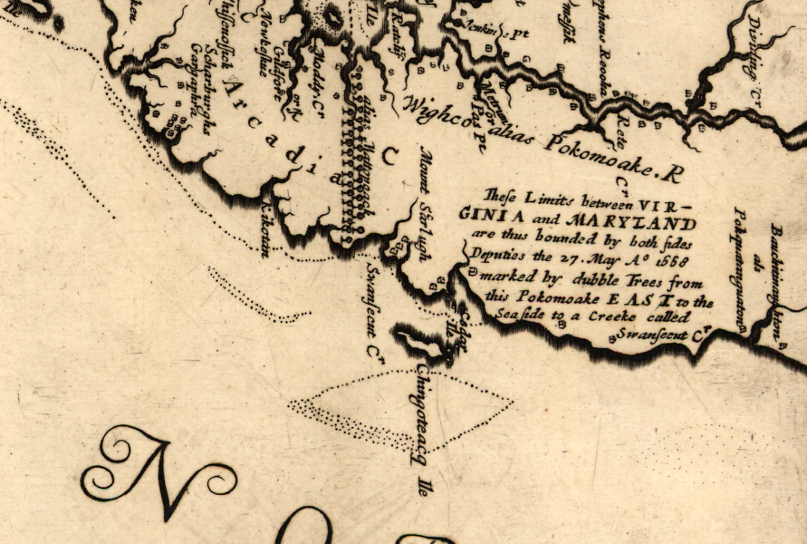
Augustine Herrman's map, prepared for Lord Calvert in the 1660's, placed Chincoteague within Maryland
Source: Library of Congress, Virginia and Maryland as it is planted and inhabited this present year 1670 (by Augustine Herrman)
Dutch maps in the early colonial era indicated that the Dutch settlements on the Delaware River established a claim to the Eastern Shore
Source: Library of Congress, Novi Belgii Novaeque Angliae (by Nicolaes Visscher, 1685)
Politically, the modern Delmarva Peninsula is divided between three separate states. Within Virginia, the Eastern Shore region consists of two counties - Accomack and Northampton, both created by 1643. Both counties are rural and relatively poor today, despite having been settled continuously by Europeans longer than nearly any other area in North America. The division of the region among three states diminished political support for investment and public services on the Eastern Shore. Among various visions for creating a single political entity is one from a Methodist minister in 1886 who proposed uniting the Delmarva Peninsula:7
at the end of the American Revolution, mapmakers were careless about identifying Virginia's portion of the Delmarva Peninsula
Source: National Archives, An Accurate Map of the United States of America, with Part of the Surrounding Provinces agreeable to the Treaty of Peace of 1783
After 400 years of potential economic growth, Accomack and Northampton counties have some of the lowest median household incomes in the state. According to the Bureau of Census, between 2006-2010 16% of individuals in Accomack County and 19% of individuals in Northampton County fell below the poverty line, higher than the average of 10% for the entire state of Virginia.
To encourage companies to locate on the Eastern Shore, the region was designated by Virginia as an Enterprise Zone in the 1990's, authorizing incentive grants for job creation and construction of business facilities.8
Accomack and Northampton counties relied upon fishing, oystering/clamming, and agriculture until recently. The Hog Island sheep breed developed in isolation over 200 years, as sheep struggled to survive on the barrier island. Today, the heritage breed survives in exhibits at sites such as Mount Vernon, because all sheep were removed from the island in the 1970's by The Nature Conservancy in order to restore/preserve natural habitat.9

Hog Island was home of the Hog Island sheep (photographed at Ingles Farm in Radford)
Image Source: US Geological Survey Map Store, Quinby Inlet topographic map
The future for economic growth on the Eastern Shore includes tourism and second home development. The economic situation was described by the Virginia Economic Development Partnership in 2001:10
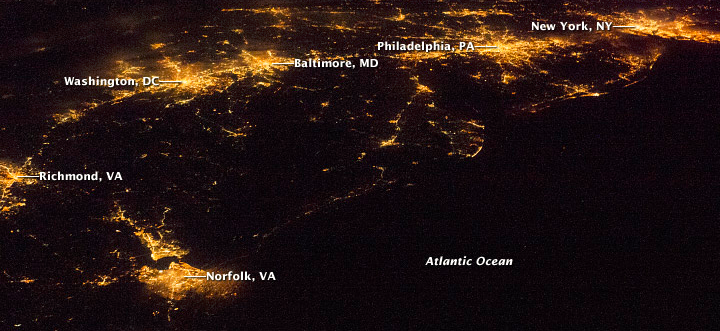
Eastern Shore at night - dark, compared to Hampton Roads and other urbanized areas
Source: National Aeronautics and Space Administration (NASA), Earth Observatory - U.S. Atlantic Seaboard at Night
Despite the economic stress, Northampton County rejected proposals in the 1990's for a new state prison and for a facility to treat contaminated soil shipped in from northern states. Instead, the Eastern Shore identified six economic priorities: agriculture, seafood/aquaculture, heritage tourism, arts/crafts/local products, research/education and new industry. "New industry" has a unique focus. The Cape Charles Sustainable Technologies Industrial Park, an ambitious plan for an eco-industrial park, was launched in the mid-1990's. However, so far the sustainable development industrial park has failed to attract and retain tenants.11
Modern industries are reluctant to build manufacturing facilities on the Eastern Shore, because transportation to market is slow and costly. Access to markets via road and rail transportation matters; manufacturing is limited, and the Eastern Shore ships mostly seafood and farm products. Recreational and small commercial fishing boats dominate the marinas. There is no deep water port, though reconstructions of tall ships from the colonial era can sail into Cape Charles harbor for tourism festivals.
Chesapeake Bay, with Eastern Shore on the east and Northern Neck/Middle Peninsula on the west
Source: US Geological Survey
Accomack County is twice the size of Northampton County, and physically closer to the customers who by agricultural and seafood products in Baltimore, Philadelphia, and New York. The 2010 Census recorded 33,164 residents in Accomack County, compared to only 12,389 for Northampton County. In the 1900 Census, Accomack County had 32,570 residents and Northampton County had 13,770 people. A century earlier in 1800, Accomack County had 15,693 residents and Northampton County had 6,763.12
In 2011, the health commissioner of Virginia approved relocating the only hospital on the Eastern Shore from Northampton to Accomack, to be closer to the center of population.13
As the song goes, "the times they are a-changing." Wallops Island, in the northeast corner of Accomack County next to Chincoteague, has expanded beyond research flights and is the site of the Mid-Atlantic Regional Spaceport. NASA has funded eight re-supply missions from Wallops to the International Space Station between 2012 and 2021, and Orbital Sciences Corp. is competing for additional space launch business at Wallops. Other companies are considering Wallops as a site for space tourism launches, though sending humans into space might require building a third launch pad at the site.14
In addition, the two runways at Wallops Island exceeding 8,000 feet in length will be used for more military operations. The Navy built the first airbase there in 1942, when airplane patrols were increased to stop German submarines from sinking ships along the Atlantic Ocean coastline.
Seven decades later, the Navy needed an additional outlying landing field (OLF) for pilots to practice carrier landings before landing on a real ship. The existing Naval Auxiliary Landing Field (NALF) Fentress near Oceana Naval Air Station in Virginia Beach lacked capacity to satisfy all training requirements, forcing expensive deployments to Jacksonville, Florida. Wallops was selected as an alternative to Fentress, and will serve as a site for up to 20,000 practice landings/takeoffs per year.
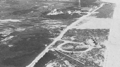
Pilotless Aircraft Research Station, Wallops Island, Virginia, in 1947 (note launch ramp in the foreground)
Source: National Aeronautics and Space Administration (NASA), SP-4103 Model Research - Volume 1
Wallops is one on many sites suitable for training military personnel to fly drones. The first two successful drone airplane landings on an aircraft carrier occurred in July 2013 off the Virginia coast - but the third attempt was foiled by a software glitch, so the drone diverted instead to land at Wallops.
The US Navy considered the Wallops Flight Facility when selecting bases in the United States for the new MQ-4C Triton drone fleet. Those drones are 48 feet long and have a wingspan of 131 feet, adding new capabilities to the Navy's Maritime Patrol and Reconnaissance Force. Florida won the competition for the East Coast. Naval Air Station (NAS) Jacksonville was chosen to serve as the Main Operating Base (MOB) where pilots will be based. Naval Station Mayport was chosen for the East Coast Forward Operating Base (FOB), the site where drones will take off and land after patrols.15
Wallops Research Park had competition for becoming a center of employment for companies integrating drones into civilian airspace. In 2013, 24 states bid for one of the six test sites to be established by the Federal Aviation Administration (FAA), before the FAA certified drones to perform commercial operations.16
Virginia ended up as one of the six winners when the Mid-Atlantic Aviation Partnership (Virginia Tech, the University of Maryland and Rutgers University) was chosen. That consortium was tasked with testing the software that ensures safe responses by drones after they lose their radio connections with operators.17

Wallops Island Research Range
Source: National Aeronautics and Space Administration (NASA), Wallops Range and Mission Management Office
Virginia Tech's Kentland Experimental Aerial Systems Laboratory, located at its experimental farm near Blacksburg, expanded to include testing at Dahlgren Naval Surface Warfare Center (King George County), Fort Pickett (primarily in Nottoway County near Blackstone), and Wallops Island (Accomack County). In 2017, the state completed a 3,000-foot long, 75-foot wide runway at Wallops designed for drone flights. Governor Terry McAuliffe dedicated the Mid-Atlantic Regional Spaceport's Unmanned Aircraft Systems (MARS UAS) Airfield by riding in a drone controlled from a laptop, giving him bragging rights as the first governor to take such a flight.18
There was no opportunity for a drone test site in Charlottesville - in 2013, that city became the first city in the US to block the use of unmanned surveillance drones. However, the first authorized use of a drone for law enforcement occurred near Charlottesville in September, 2014, when the Mid-Atlantic Aviation Partnership was given special permission by FAA to search for a missing University of Virginia student.19
One long-range possibility that could transform the Eastern Shore: energy development. Wind energy could be developed first in the Chesapeake Bay, where the costs for building towers and transmission lines would be far less than hypothetical sites in the Atlantic Ocean. Any large-scale wind farms along the Atlantic Flyway will face environmental restrictions, to protect migrating birds and bats.
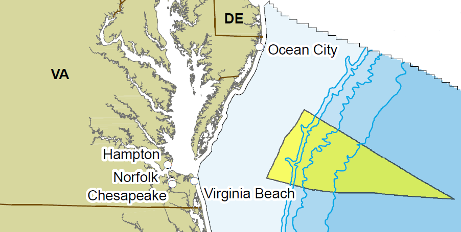
The oil and gas potential of the Outer Continental Shelf is unknown, but Jurassic-age rocks in the Baltimore Canyon Trough are a particular target for future development. In 2008, the Obama Administration planned Mid-Atlantic Oil and Gas Lease Sale 220 - but cancelled the sale after the Deepwater Horizon spill in the Gulf of Mexico. While Governor McDonnell continued to propose making Virginia the "Energy Capital of the East Coast," no state leases were proposed for oil and gas drilling within state waters. Instead, the focus was on drilling offshore in Federal waters, 50 miles or more east of the Atlantic shoreline of Virginia.
Offshore areas along the Atlantic Coast could turn out to be as rich in hydrocarbons as the Gulf Coast. If so, then an oil/gas port with development comparable to Morgan City, Louisiana would be required to support hydrocarbon extraction and processing. One candidate in Virginia is the Town of Cape Charles at the southern tip of Northampton County, though Portsmouth and even Craney Island could be major competitors.
The industrial potential of the Town of Cape Charles to support offshore oil, gas, or wind energy projects is constrained by the depth of the shipping channel. A precast concrete plant was built in 1964 at Cape Charles to supply the 3,000 piers supporting the Chesapeake Bay Bridge-Tunnel, and is the logical site for constructing platforms for offshore wind farms. However, the ability of that concrete fabrication plant to compete for major contracts today is limited by the narrow 18-foot deep channel.
The Sparrows Point Shipyard in Baltimore supplied the concrete tubes installed in 2013 for the parallel Midtown Tunnel, connecting Portsmouth and Norfolk underneath the Elizabeth River. The Bayshore Concrete plant at Cape Charles needed a 35-foot channel to float the tubes out into the Chesapeake Bay, but the projected cost was $35 million - at a time when the US Congress had reduced Federal funding for small port dredging projects. By 2011, the effort to obtain Federal funds was reduced to requests for a 22-foot deep channel.20
The land use planner for Cape Charles, Tom Bonadeo, explained in 2012 why a deeper channel was needed to trigger new economic development, beyond the transport of Bay Coast Railroad barges south to Little Creek:21
note contrast between Atlantic Ocean/Chesapeake Bay sides of Eastern Shore
Source: NASA Earth from Space, Southern Delmarva Peninsula (October 1995)
Hopes for an economic boom from offshore oil drill rig construction and operations were postponed in March 2016. The Northampton Board of Supervisors passed a resolution opposing inclusion of waters off Virginia's coast in the Federal government's 2017-2022 Outer Continental Shelf leasing program. Accomack County had done the same in January, choosing to focus on building its tourism-based businesses rather than risk an oil spill.
The Bureau of Ocean Energy Management released its 2017-2022 leasing plans shortly after the Northampton County vote. All proposals for leases off the coasts of the southeastern states were dropped, eliminating at least for the moment that potential for new industrial development at Cape Charles.22
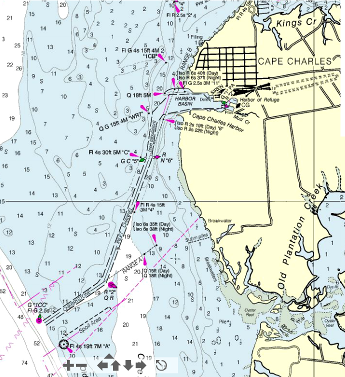
nautical chart showing Cape Charles harbor
Source: National Oceanic and Atmospheric Administration (NOAA), Nautical Chart On-Line Viewer
Chart #12224 - Chesapeake Bay, Cape Charles to Wolf Trap
OCS Lease Sale 220 - as originally planned by Obama Administration
Source: Bureau of Ocean Energy Management, Regulation and Enforcement, Virginia Lease Sale 220 Information
electricity is brought to the Eastern Shore by one 69-kilovolt and two 138-kilovolt transmission lines linking to the grid in Maryland
Source: Homeland Infrastructure Foundation Level Database - Department of Homeland Security, Electric Power Transmission Lines

northeastern tip of Accomack County
Source: US Fish and Wildlife Service, Chincoteague NWR Alternative Transportation Study
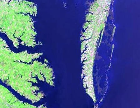
defining the eastern edge of the Eastern Shore requires deciding if the boundary is the mainland or the barrier islands...
Source: National Aeronautics and Space Administration (NASA), Gateway to Astronaut Photography of Earth
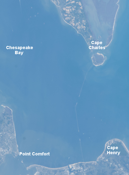
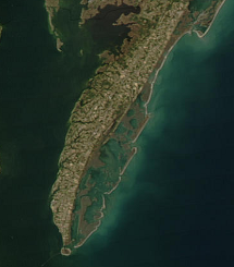
Cape Charles is at the southern edge of the Eastern Shore
Source: National Aeronautics and Space Administration (NASA), Gateway to Astronaut Photography of Earth

wetlands separate barrier islands from the Eastern Shore peninsula
Source: NASA Scientific Visualization Studio, Wetlands of the Eastern shore and Fishermans Island
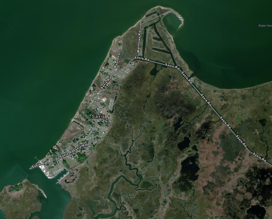
Saxis was built on the edge of the Chesapeake Bay, with three miles of wetlands to the east
Source: ESRI, ArcGIS Online
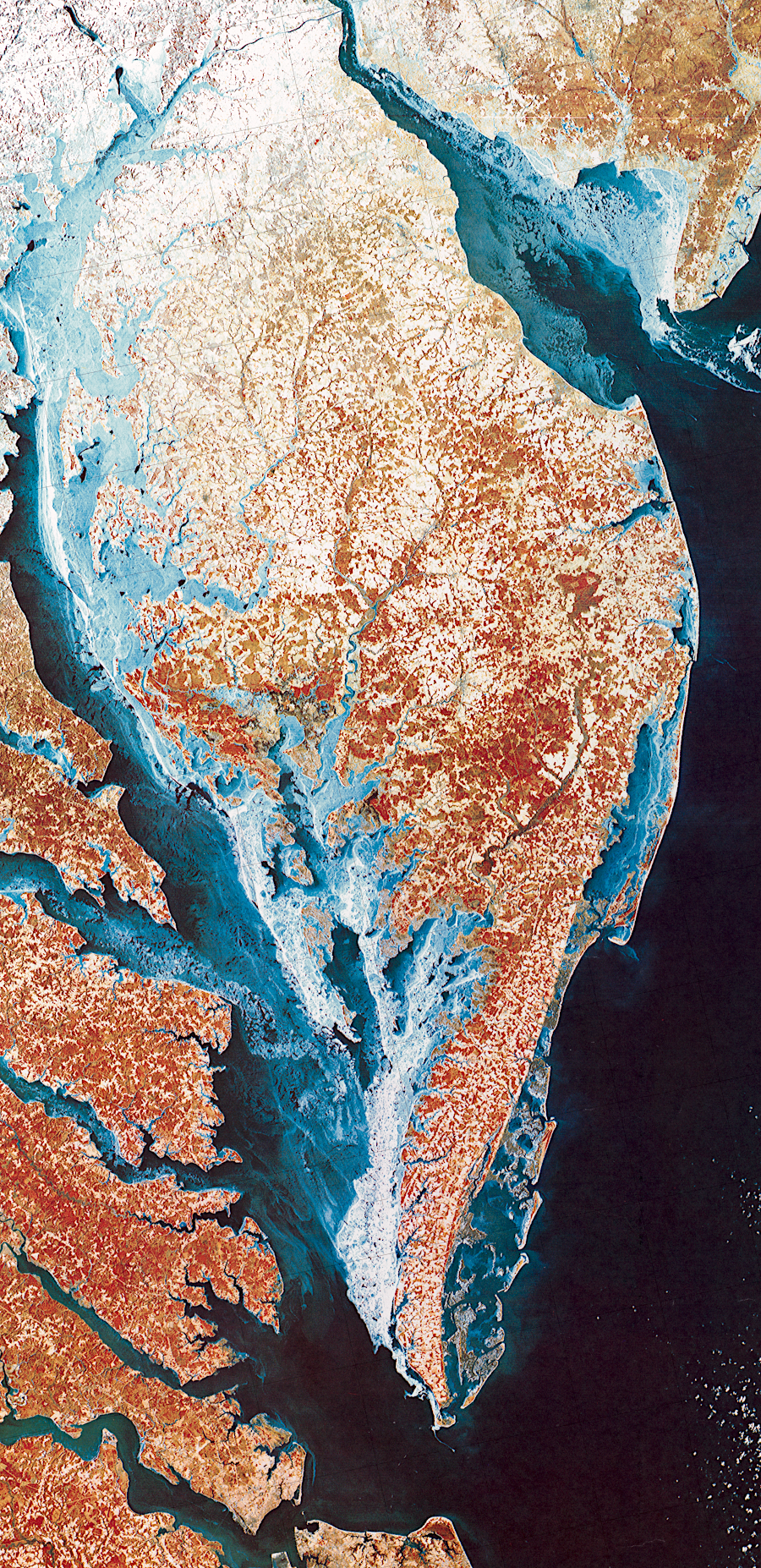
LANDSAT image of Delmarva peninsula
Source: Library of Congress, Chesapeake Bay and vicinity, winter 1976-77