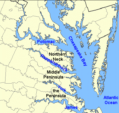
"The Northern Neck" Is Not "The Peninsula"
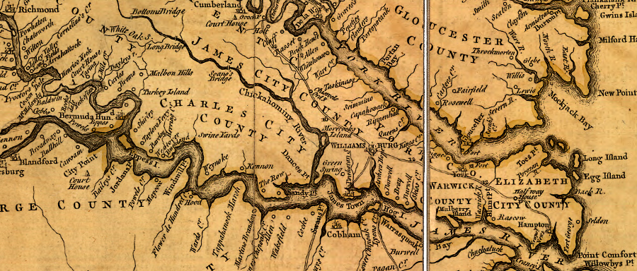
the 1755 Fry-Jefferson map of Virginia shows the Peninsula, between the James and York Rivers
Source: Library of Congress, A map of the most inhabited part of Virginia containing the whole province of Maryland with part of Pensilvania, New Jersey and North Carolina (by Joshua Fry and Peter Jefferson, 1755)
Four rivers define three peninsulas east of the Fall Line. South of the James River, the area was known as "Southside," with the exception that the far southeastern corner of the state was called Hampton Roads.
The land between the Potomac and Rappahannock rivers is the Northern Neck. The "neck" refers to the shape of the peninsula.
The Northern Neck peninsula is "Northern" in reference to Jamestown and the mouth of the Chesapeake Bay. If Marylanders had created the place names of Virginia, the peninsula would have been called something different - the peninsula is south of the colony of Maryland and its first capital, Saint Mary's.
However, Virginians settled their colony 25 years before the Marylanders. Normally the place names assigned by the first people to explore a place are adopted by later settlers - but the English ignored many of the place names that had been created by the Native Americans.
Between the James and York Rivers is The Peninsula. The Peninsula was the center of English settlement during the first 325 years after Jamestown was established.
The Middle Peninsula is the land between the York and the Rappahannock. It was settled after "The Peninsula," and was not as far north as the "Northern Neck," so it was in the middle.
In what passes for high society in Richmond, key places and institutions are sometimes referred to as "the ____" without further elaboration, as if everyone who is not socially inept knows what place is being described. The Beach is Virginia Beach, The University is the University of Virginia, The High School is Episcopal High School in Alexandria, and The Club is the Country Club of Virginia in Richmond.
The River may be more than the James River, however. Wealthy Richmonders living in one of the West End suburbs stretching into Goochland may say they are going to "the Riv'ah" if they own a summer cottage on the Rappahannock, York, Mobjack, Coan, or other Tidewater rivers.
Note that the county boundaries in Tidewater reflect primarily rivers and watershed divides. There are some straight lines south of the James, and in other county boundaries in Virginia, but in Tidewater straight-line boundaries for a county are the exception rather than the rule.
The shape of Delaware on the Delmarva Peninsula (the land east of Chesapeake Bay - Del for Delaware, mar for Maryland, and va for the two counties of Virginia located east of the bay) also shows that natural boundaries do not shape all of the political boundaries near the bay.
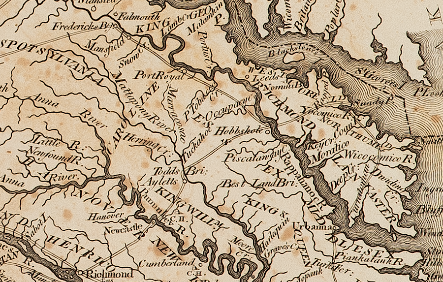
in 1794, travelers crossed the Rappahannnock River to use the roads to Fredericksburg as well as Richmond
Source: American Philosophical Society, State of Virginia from the best Authorities by Samuel Lewis, 1794
Links
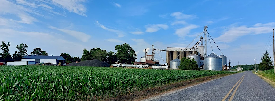
grain storage facilites are a common sight on the Northern Neck, where winter wheat is rotated with corn and soybeans
northernneckgrain.png
Regions of Virginia
Chesapeake Bay
Rivers and Watersheds of Virginia
Virginia Places