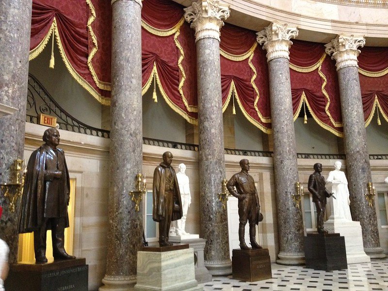
Potomac Marble was used for columns in the US House of Representatives when Benjamin Latrobe rebuilt the Capitol after it was burned in 1814
Source: Sue Waters, National Statuary Hall Collection in United States Capitol
Potomac Marble was used for columns in the US House of Representatives when Benjamin Latrobe rebuilt the Capitol after it was burned in 1814
Source: Sue Waters, National Statuary Hall Collection in United States Capitol
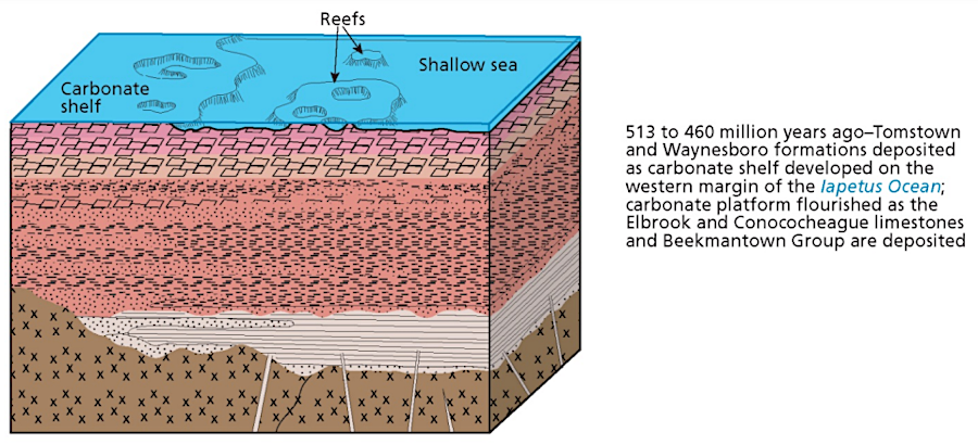
the limestone formations in Loudoun County consist of plant skeletons that fell to the bottom of the Iapetus Ocean half a billion years ago
Source: National Park Service, Geologic Resources Inventory Report (p.41)
The magnesium-rich dolostone in far western Loudoun County is the Tomstown Formation, exposed on the surface east of Furnace Mountain. Crystal Grottoes, the only commercial cave in Maryland, is located in the Tomstown Formation.1
The Tomstown Formation was deposited on top of the Antietam Quartzite as sea level rose higher. Below the Antietam Quartzite was the billion year old Grenville basement, formed when tectonic plates had crashed together to create the supercontinent Rodinia.
The Tomstown Formation dates to the early Cambrian Period. What is now bedrock in Loudoun County was created as tiny skeletons descended to the bottom of the Iapetus Ocean around 513 million years ago. The formation is less than 200' thick in Loudoun County, but is 1,000 feet or more in thickness in the Shenandoah Valley.
The Frederick Limestone in eastern Loudoun County was deposited under different conditions in the Iapetus Ocean. It is similar to the Tomstown Formation, but younger and has less magnesium. Frederick Limestone sediments were deposited roughly 485 million years ago, in a later part of the Cambrian Period than the Tomstown Dolomite. Frederick Limestone fills the Frederick Valley in Maryland, across the Potomac River from Loudoun County.
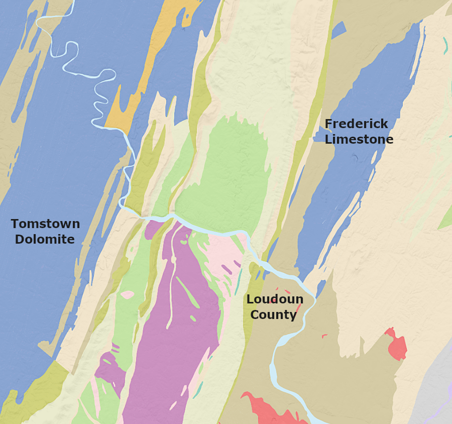
the Frederick Limestone is younger than the Tomstown Dolomite, and has less magnesium
Source: US Geological Survey, Geologic maps of US states
During the Taconic Orogeny, one or more island arc terranes collided with the continental shelf. The sedimentary deposits were cracked and shoved inland, in some cases with broken slices stacked on top of each other like plates stored in a cabinet. The same process may have affected what is now Northern Virginia during the neo-Acadian Orogeny. During the Alleghenian Orogeny, the collision with the tectonic plate which included Africa cracked the edge of the Grenville basement.
About 250 million years ago, a slice of that basement rock was shoved roughly 40 miles westward. That slice, broken off from the edge of the Grenville basement, is known today as the Blue Ridge. The old Grenville slice was pushed up through the old Iapetus Ocean seafloor deposits. Erosion has removed the material that was once directly above the Blue Ridge slice.
The Blue Ridge was thrust through the sedimentary layer known today as the Tomstown Formation. Later erosion has exposed some of the Tomstown Formation on either side of the Blue Ridge. Some is on the eastern side of the Blue Ridge north of Leesburg. Some is on the western side, including Bolivar Heights in Harpers Ferry.2
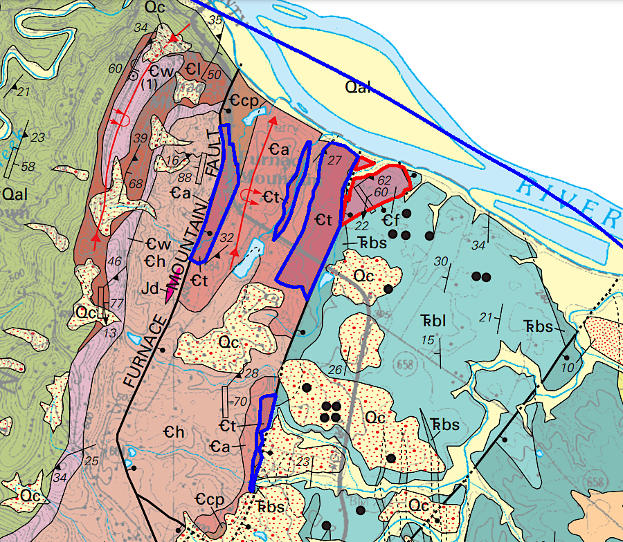
Tomstown Formation dolostone (red polygons) and Frederick Limestone (red polygons) from the Cambrian era are exposed east of Furnace Mountain in the northern edge of Loudoun County
Source: US Geological Survey (USGS), Geologic Map of Loudoun County, Virginia (Revised March 2007)
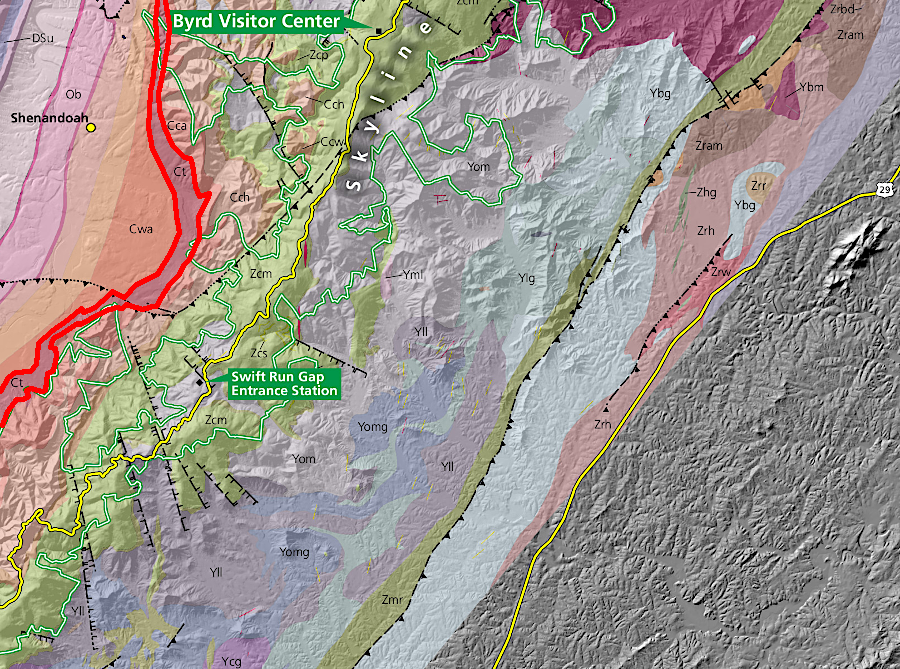
the Tomstown Formation (red polygon) is thicker on the western side of the Blue Ridge
Source: National Park Service, Bedrock Geologic Map of Shenandoah National Park
The local geology is reflected in the name of the stream "Limestone Branch."
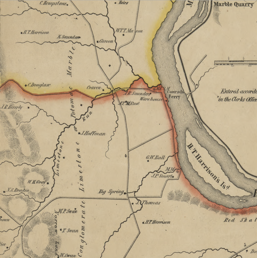
Limestone Run in Loudoun County is now called Limestone Branch
Source: Library of Congress, Map of Loudoun County, Virginia (by Yardley Taylor, 1854)
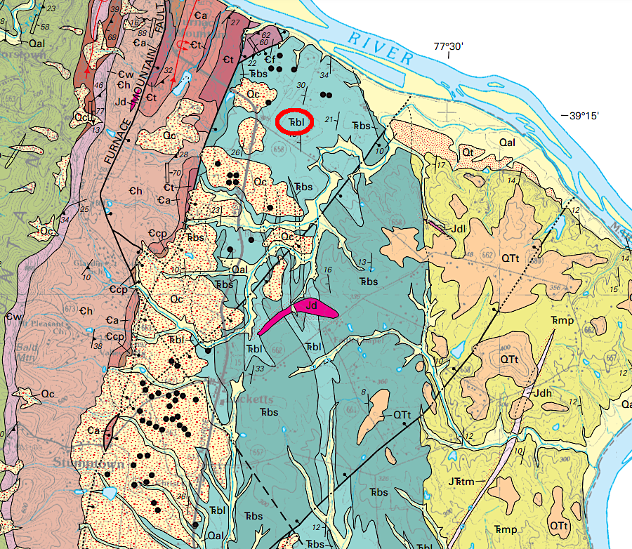
There is actual marble in western Loudoun County. It is in the Swift Run Formation, which was heated by the Catoctin basalt 550-570 million years ago and then deeply buried. Dolomite and limestone minerals metamorphosed into a tighter crystalline structure from heat and pressure. The marble appears in discontinuous layers up to three feet thick.3
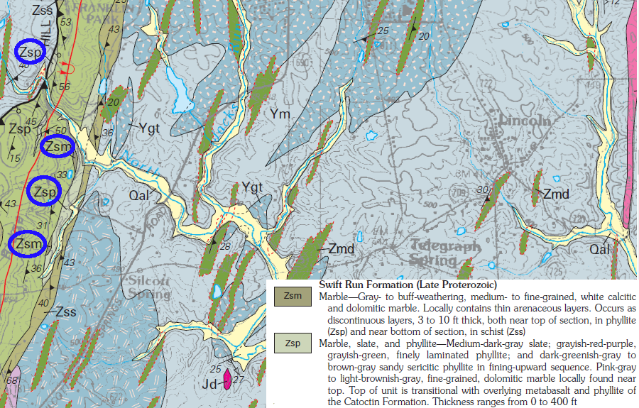
Precambrian deposits of limestone in the Swift Run Formation have been metamorphosed into marble (circled in blue)
Source: US Geological Survey (USGS), Geologic Map of Loudoun County, Virginia
During the late Jurassic Period and early Triassic Period, Pangea split up and a rift valley (Culpeper Basin) began to form east of the Blue Ridge. A valley gradually sank east of a fault line at the base of the Blue Ridge. About 25,000 feet of sediments eroded from the mountains.
Limestone and dolostone bedrock from the Cambrian Period (Tomstown Formation and Frederick Limestone) were eroded from the bedrock. Floods and other high-energy erosion events, such as major storms, broke off fragments and carried those carbonates a short distance downstream. As Pangea split up, stone cobbles and smaller pebbles were deposited in alluvial fans at the mouths of rivers. Those rivers flowed east into freshwater lakes that formed in the rift valley. Eventually, 25,000 feet of sediments accumulated in what is known today as the Culpeper Basin.
Some cobbles traveled enough distance to develop rounded edges. Most chunks of limestone/dolostone still retained their sharp edges when the fragments accumulated in the alluvial fans.
Over time, the Triassic Period sediments were compacted and cemented together to create a solid breccia. The heat and pressure was high enough to create solid rock formations such as the Leesburg Member of the Balls Bluff Siltstone, but not high enough to metamorphose the carbonate cobbles into marble. The Leesburg Member is 3,500 feet thick, indicating that erosion and redeposition of older (Cambrian Period) dolostone/limestone continued for a significant period of time.
In weak spots of the thinning crust, lava flowed up towards the surface. The dikes and sheets of molten rock altered the sandstone, mudstone, and limestone/dolostone cobbles into hornfels and marble. In some places, the heat of the lava was sufficient to metamorphose sediments one mile wide and 700 feet thick.4
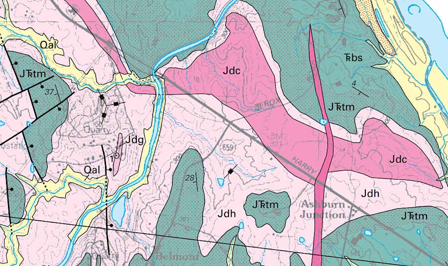
Jurassic/Triassic dikes and sills (red and pink) metamorphosed calcium-rich cobbles into marble, in places coded as "JTrm" with reddish spots on the geologic map
Source: US Geological Survey (USGS), Geologic Map of Loudoun County, Virginia
Layers of limestone and dolomite originally deposited on a flat ocean bottom have been uplifted, broken, transported, redeposited, and in some cases metamorphosed. Starting in the 1700's, the calcium-rich deposits were recognized as a valuable resource for agricultural fertilizer.
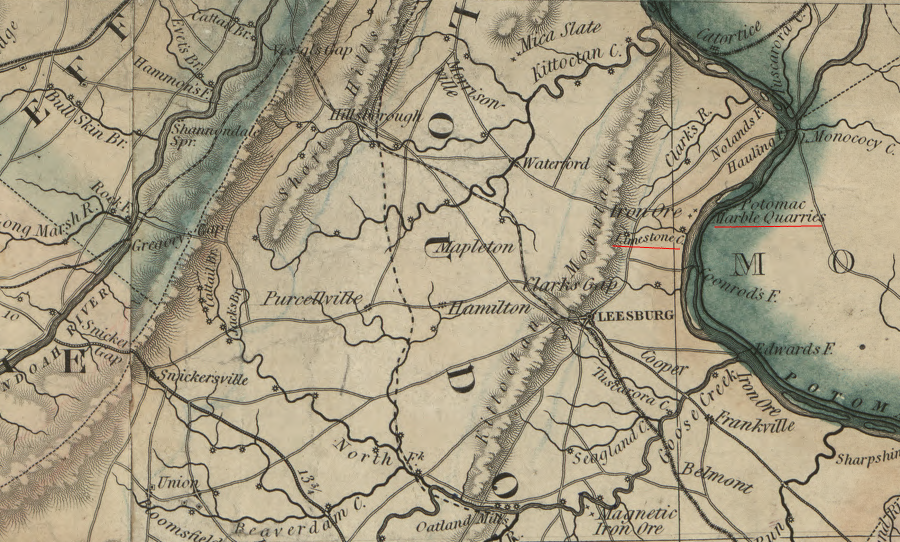
the limestone deposits in Loudoun County were mined primarily for agricultural lime prior to the Civil War
Source: Library of Congress, A map of the state of Virginia, constructed in conformity to law from the late surveys authorized by the legislature and other original and authentic documents (1859)
A 50' thick layer of breccia known as "Potomac Marble" was mined near Goose Creek between 1798-1949. By the time Thomas Jefferson was elected president, it was being excavated for agricultural fertilizer and for building stone. Primary quarries were near Goose Creek in Loudoun County and next to the Chesapeake and Ohio Canal in Montgomery County, Maryland.
Despite the name, the Potomac Marble was not a limestone formation which had been metamorphosed by heat and pressure into marble. Instead, cobbles and smaller pebbles of broken rock had been deposited and then encased like marbles in a matrix of limestone.
The cobbles had come from old limestone sediments that were uplifted by tectonic forces to become exposed on land. That land was then eroded in major storms, sending cobbles and pebbles downstream via rushing rivers into the Iapetus Ocean. The large sizes of the cobbles reveal the intensity and power of the storms. The sharp edges of the cobbles reveal they were not washed downstream very far. Otherwise, the cobbles would have banged into each other and developed smooth, rounded edges.
the older dolostone/limestone was redeposited in the Triassic Period to form the limestone-rich Leesburg Member ("Trbl")
Source: US Geological Survey (USGS), Geologic Map of Loudoun County, Virginia
Colonists used the Potomac Marble to increase the pH of the soil and enhance crop growth. The stone was crushed, burned to produce lime, and spread on the fields of Oatlands and other plantations to enhance productivity of farmland. The Virginia Marble Company operated the quarries after the Civil War. It became one of the largest employers of African-American men in the county.
That Loudoun County marble was used to produce the Confederate memorial erected in Little Washington, Rappahannock County and the 1898 Confederate Heroes Monument in Page County. (A second marble monument installed later in downtown Luray, and two other Confederate soldier memorials in Lunenburg and Spotsylvania counties, were sculpted in Georgia.) The Virginia Marble Company produced terrazzo (marble chips) until 1949 at Goose Creek.5
By the time Thomas Jefferson was elected president, the 50' thick layer of breccia known as "Potomac Marble" was being quarried near Goose Creek in Loudoun County. The rock was actually a sedimentary layer deposited in the Triassic Period. "Marbles" or pebbles of broken rock were encased in a matrix of limestone. The rock was crushed, burned to produce agricultural lime, and spread on the fields of Oatlands and other plantations to enhance productivity of the soil. The Virginia Marble Company operated the quarries after the Civil War, and it became one of the largest employers of African-American men in the county.
tectonic pressures metamorphosed Precambrian deposits of limestone into marble (circled in blue) which was mined near Goose Creek between 1798-1949
Source: US Geological Survey (USGS), Geologic Map of Loudoun County, Virginia
That Loudoun County marble was used to produce the Confederate memorial erected in Little Washington, Rappahannock County and the 1898 Confederate Heroes Monument in Page County. A second marble monument installed later in downtown Luray, and two other Confederate soldier memorials in Lunenburg and Spotsylvania counties, were sculpted in Georgia. The Virginia Marble Company produced terrazzo (marble chips) until 1949 at Goose Creek.6
One major deposit of limestone is exposed on the surface near Leesburg, east of the Blue Ridge in Loudoun County. Limestone conglomerate at Raspberry Falls/Leesburg ("Calico marble" or "Potomac marble") is the Leesburg Member of the Balls Bluff Siltstone. The limestone cobbles in the conglomerate were deposited originally in the Sauk Sea, in sediments now exposed in Frederick County Maryland as the Frederick Limestone and Tomstown Formation. During the Triassic Period, carbonate clasts were eroded in storms, carried downstream in flooded river channels, and deposited in debris-flow deposits on alluvial fans in the Culpeper Basin.7
The "Potomac marble" is actually a conglomerate, not metamorphosed limestone. When the Capitol in Washington, DC was rebuilt after being burned by British troops in 1814, the "marble" was quarried in Maryland and used by Benjamin Latrobe for the columns in the Senate Chamber. Those columns are sill visible in what is now Statuary Hall.
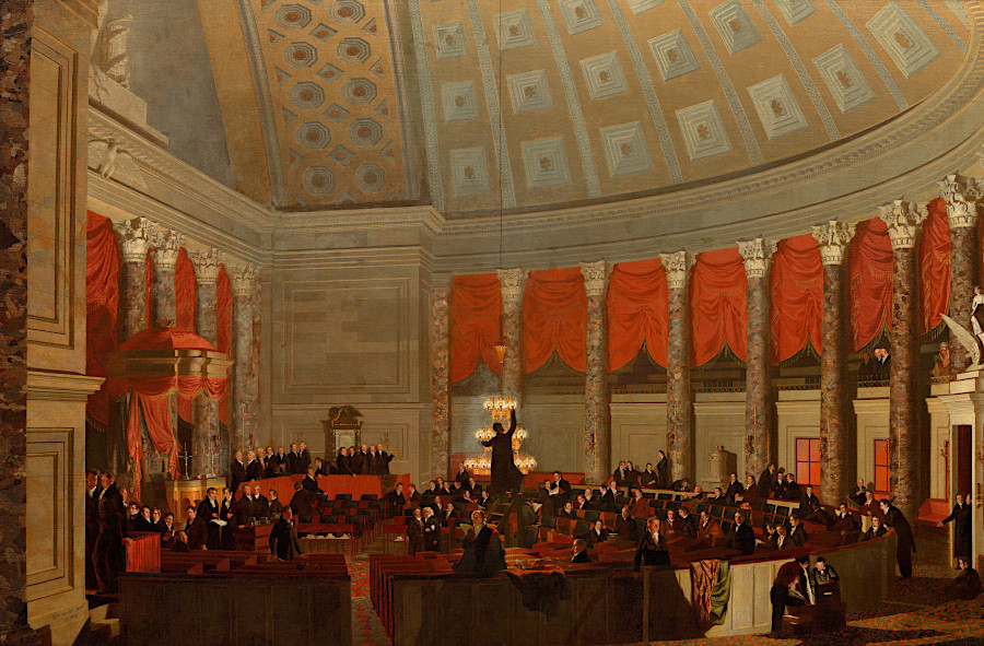
when the US Capitol was rebuilt after 1814, Potomac Marble was used for the columns in the Senate Chamber
Source: National Gallery of Art, The House of Representatives (by Samuel F. B. Morse, 1822)
Conglomerate mined near Leesburg was processed into agricultural lime. One historic quarry is located near the modern pond in Olde Isaak Walton Park. Others are located on Lime Kiln Road, between US 15 and Snickersville Turnpike.
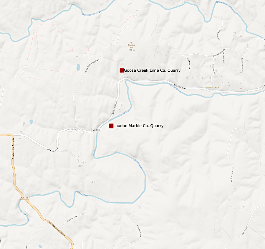
Lime Kiln Road in Loudoun County reveals the geologically-based industry there
Source: US Geological Survey (USGS), Mineral Resources Data System
The only known natural caves in Virginia located east of the Blue Ridge are in the Leesburg Member north of Leesburg. There are also sinkholes in Loudoun County east of Route 15.
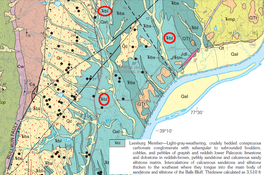
the only natural caves in Virginia east of the Blue Ridge are in the conglomerate known as the Leesburg Member (circled in red) of the of the Balls Bluff Siltstone, which also produced sinkholes at Temple Hall Regional Park
Source: US Geological Survey (USGS), Geologic Map of Loudoun County, Virginia
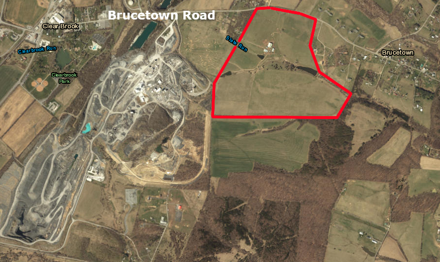
the Clorox cat litter plant would have been located on 146 acres (red polygon) near the Carmeuse quarry in Frederick County
Source: ESRI, ArcGIS Online

in the Cambrian Period, the limestones of the Valley and Ridge physiographic province were deposited in a shallow Iapetus Ocean
Source: Dr. Ron Blakey, Paleogeography and Geologic History of North America
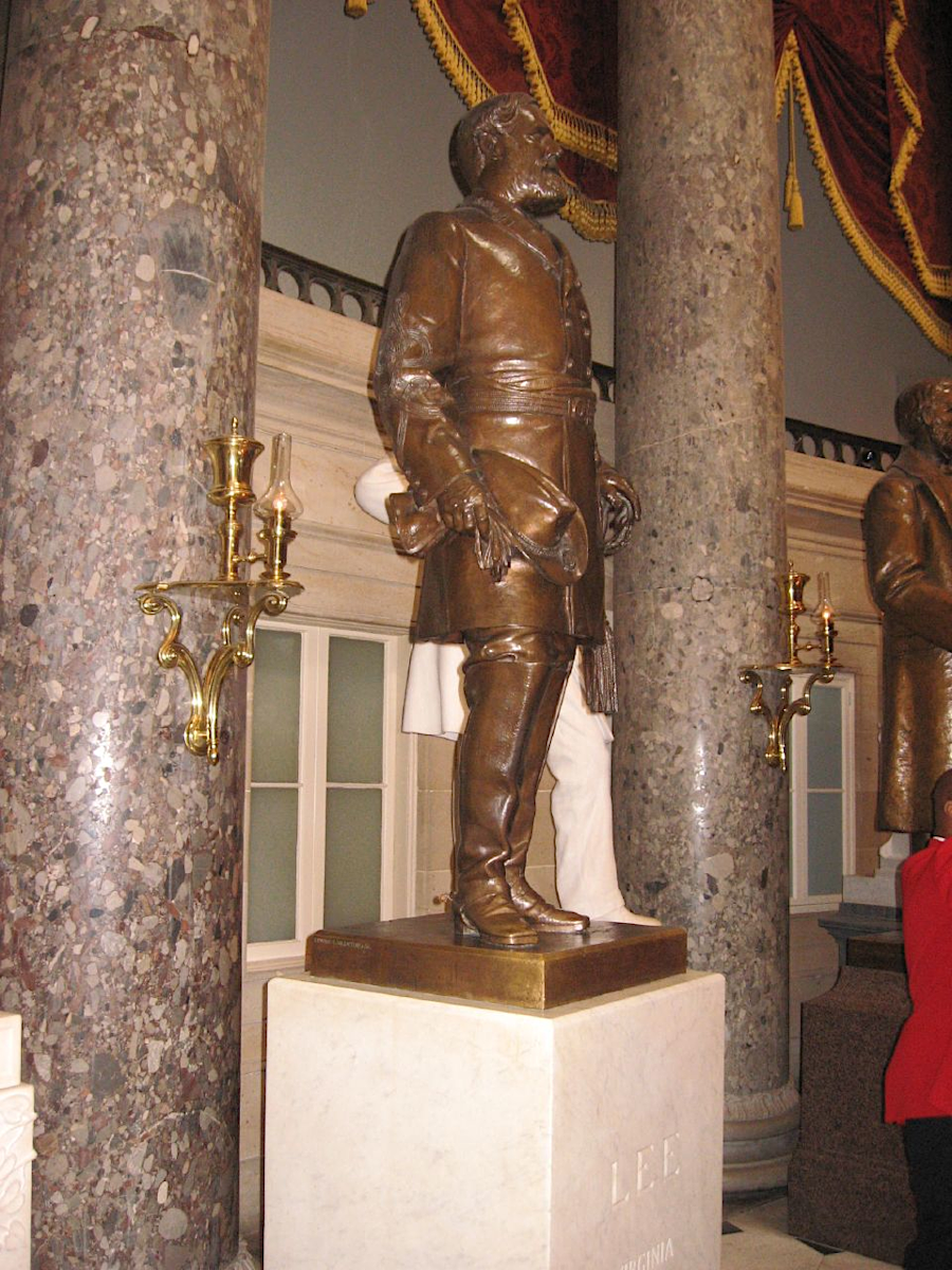
columns of Potomac Marble flank the old statue of Robert E. Lee in Statuary Hall
Source: Ken Lund, Robert E. Lee, National Statuary Hall (2008)