Virginia has an unlimited amount of salt on its eastern edge, in solution with seawater of the Atlantic Ocean. The state also has buried deposits of salt on its western edge, remnants of the Sauk sea that filled the Central Appalachian Basin 350 million years ago.
Humans evolved on a low-sodium diet of just of 200-600 milligrams/day. Our bodies retain sodium while discarding potassium, which was more available in the environment. Consuming too much sodium increases the risk of hypertension, kidney disease, heart attacks, and other health problems. Today the American Heart Association recommends consuming no more than 2,300 milligrams/day, but Americans on average consume 1/3 more than that amount.
Europeans were manufacturing salt 7,000 years ago. The oldest salt production site, the Hallstatt mine in Austria, is about 2,000 years older than Stonehenge. Between 300-900 Common Era, the Mayan in what is modern Belize were boiling seawater in pots and scraping out the salt which crystallized from the evaporated brine. They produced salt cakes and salted animal meat at the Paynes Creek Salt Work, trading with Mayans living further inland.
Human use of salt in North America preceded the arrival of European colonists. In Mexico, salt was a common trade item, with archeological evidence of production as early as 1,000 BCE. Salt was obtained by two basic techniques, by evaporation and by boiling brines. Demand may have increased as agriculture reduced the percentage of meat in local diets, creating the need for supplemental salt.
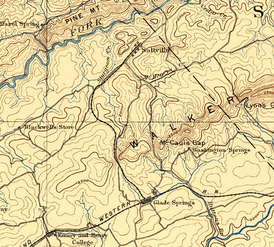
Salt and shell traders associated with the Mississippian Culture migrated from Tennessee and built the Carter Robinson mound in Lee County, sometime between 1250 to 1400CE (Common Era). They picked that location, near places later named Saltville and Cumberland Gap, apparently in order to exchange salt for other goods with Native Americans who lived in what is now Southwestern Virginia.
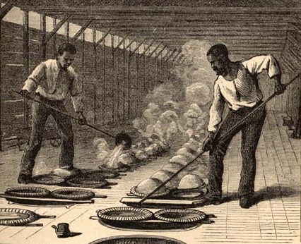
Archeologists have excavated the pottery remains of two salt pans at the Carter Robinson mound. Elsewhere in the Tennessee River watershed, pans were sized to boil 12-15 gallons up to 110 gallons. The pottery was not placed directly in the fire. Instead, it was placed above a small fire and supported by clay pedestals, or the pan was buried in dirt and:1
Brine water was carried from the springs and poured into the embedded pans. Stones (often sandstone) were heated in nearby fires and dropped into the pans to speed up the natural evaporation process. At some sites stones have even been found within the pans. The crystallized salt was then scraped off the interior base and walls of the pan and the process began anew.
Hernando DeSoto's expedition between 1538-1543 recorded Native Americans using salt to flavor food, and manufacturing salt as an item for trade:2
The Indians of Eastern North America apparently used salt as a condiment. There is no evidence for salt ever having been used historically for preserving meat or fish, as drying game over a low fire was the standard Southeastern method of preservation. The DeSoto expedition observed four ways in which salt was produced. It was made from the ashes of plants, from brine water at salines, and from salt-impregnated sand; and it was also gathered in a free state (rock salt)...
...Salt pans are believed to have been used as follows. First they were set within depressions in the ground. Brine was carried from the spring and poured into the pans, followed by heated stones from nearby fires. After evaporation of the water, crystallized salt would then be scraped from the bottom of the containers.
Native Americans in Virginia smoked their fish and deer/bear/elk meat, rather than used salt to preserve food. The Algonquians who controlled the Tidewater region may have used salt, but there is no evidence that they boiled seawater and exchanged salt with Siouan-speaking and Iroquoian-speaking tribes west of the Fall Line. Those western tribes obtained whatever salt they used from natural saline springs, which carry some of the buried deposits of salt to the surface.
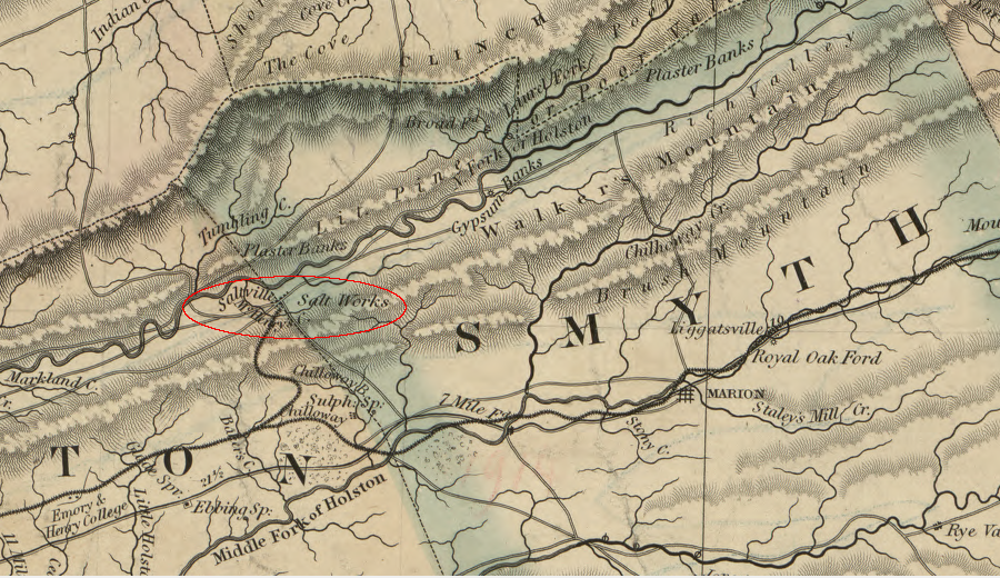
The first Spanish to explore Virginia away from the Atlantic Ocean coastline were members of Juan Pardo's expedition, which built a fort near modern Morganton, North Carolina in 1566. Sergeant Hernando Moyano was left in charge of about 20 Spanish soldiers for the winter of 1566-67. During that time, Moyano assisted the local tribe when they marched to attack the rival Chisca tribe on the Holston River, perhaps at the modern town of Saltville in Smyth County. The Chiscas produced salt from natural brine springs there. How the Chiscas used that salt in the 16th Century, or traded it with others, is unclear.
Outside of Virginia, there was large-scale salt production by Native American tribes. The Caddoes lived at the "place of salt" on the Red River in Texas, had been producing salt for perhaps over a century before the remnants of Hernando de Soto's expedition arrived in 1542.
In Eastern North America, Native American production of salt increased after colonial settlement created a demand for salt. In the 1600's, the Tunica in Louisiana and the Onondaga tribe in New York boiled brine from salt springs to make enough salt for exchange with Europeans.
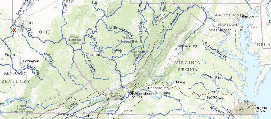
In 1755, after the Shawnee captured Mary Draper Ingles from a site on or near the modern campus of Virginia Tech, the raiding party stopped on the way home to make salt from a brine spring on the Kanawha River. Mary Draper Ingles was later taken to Big Bone Lick in Kentucky to make salt, 500 miles away from Blacksburg.
Her long journey home to safety from that site, walking upstream perhaps 400 miles in about 6 weeks, is a dramatic tale of personal endurance. Her trip was so lengthy because she had been carried to a site where salt attracted animals that could be hunted, and where salt could be manufactured for trading with frontier settlers.3
Mary Draper Ingles was captured in 1755 on the New River (black X) and carried to Big Bone Lick on the Ohio River (red X)
Source: ESRI, ArcGIS Online
For the colonists in Virginia, salt was more than a condiment. It was essential for preserving food in the days before refrigeration. After the Sea Venture was shipwrecked on Bermuda during its voyage to Jamestown in 1609, the castaways built two replacement ships and completed the journey in 1610. They made salt on Bermuda and used it to preserve meat from the wild hogs caught on the island. The "powdered" (salted) pork helped sustain nearly 150 travelers for what ended up being a two-week trip between Bermuda and Jamestown.4
Colonists used indentured servants (and later slaves) to boil kettles of brackish water to drive off the water as steam, precipitating a crust of mineralized salt. The technology dates back to the days of Romans; the word "salary" is derived from paying soldiers enough to purchase salt. Lewis and Clark made salt by boiling Pacific Ocean water in kettles in the winter of 1805-1806, after they crossed the continent and reached the Oregon coast.5
Lewis and Clark used the same technique in 1805-1806 as the English colonists in Virginia - boil seawater to precipitate salt
Source: National Park Service - Lewis and Clark National Historic Park, Frequently Asked Questions
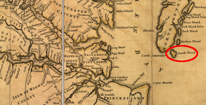
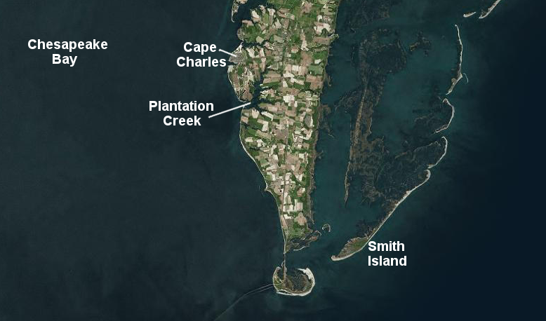
The Spanish manufactured salt in the Caribbean for a century before the English arrived at Jamestown. The first major colonial salt-making operation in Virginia was started by Sir Thomas Dale in 1614. Dale, the marshal of the colony responsible for military defense and discipline, sent colonists to Smith's Island on the southern tip of the Eastern Shore to make salt.
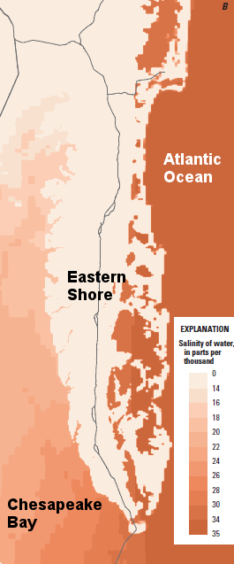
Sir Thomas Dale directed indentured servants to go to the eastern side of the Eastern Shore ("seaside") to boil Atlantic Ocean water and precipitate salt. On the western side of the Eastern Shore ("bayside"), fresh water runoff from the Susquehanna, Potomac, and other rivers dilutes the salinity of the seawater that enters the Chesapeake Bay between Cape Charles and Cape Henry. Within the estuary, the concentration of salt drops as you travel upstream, away from the mouth of the bay where the salty Atlantic Ocean water enters. Water on the surface is "fresh" (with less than 0.5ppt) on the James River near Jamestown, on the Potomac River near Mason Neck, and at the mouth of the Susquehanna River.
When the colonists chose to settle at Jamestown in May, 1607, the water in the river may have been fresh. As runoff declined during the summer, saltier water may have intruded upstream from the Chesapeake Bay. An excess of salt, imbibed because of the subtle change in water quality that summer, could have damaged the health of the colonists and been one reason for the high number of deaths at Jamestown starting in August.6
English colonists desired salt to improve the taste of food. In 1611, salt was essential for preserving pork when the castaways from the Sea Venture shipwreck sailed from Virginia to Bermuda. In 1614, Dale's colonists set up a salt-production base on the Eastern Shore on Smith's Island. That salt was needed to preserve the fish that colonial officials expected to be caught off Smith's Island.
One traditional story about the Eastern Shore salt camp is that their 1614 base camp became known as the "plantation." The name is still applied to the creek next to the Town of Cape Charles.
tradition says Sir Thomas Dale's saltmakers lived on Plantation Creek, where a trip across the Chesapeake Bay to Jamestown was easier
Source: ESRI, ArcGIS Online
Walking back and forth from a bayside location to Smith's Island on the seaside of the Eastern Shore would have required much of a day. The workers had to add wood constantly to the fires boiling salt water, so some workers must have stayed on Smith's Island throughout the salt-making process while others may have stayed at the "plantation."
Locating the "plantation" on the Chesapeake Bay side of the Eastern Shore made it harder for the saltmakers to get to work on Smith's Island, but easier for ships to bring supplies to the workers. A trip from Jamestown to Plantation Creek involved a routine journey across the relatively-protected waters of the Chesapeake Bay. Sending supplies directly to Smith Island would have required traveling into the more-hazardous currents and winds of the Atlantic Ocean.
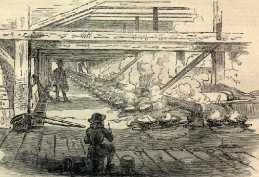
Saltmakers boiled 250-300 gallons of seawater in large kettles, evaporating the water to produce salt. The salt manufacturing operation required collection of driftwood and perhaps cutting some nearby trees for fuel, and steady winds increased the rate of evaporation. The 20 saltmakers were not entrepreneurs working for themselves. They were indentured servants working for the Virginia Company, which owned the colony until 1624.
Making salt at Smith Island was not a fun camping expedition. The workers may have named the isolated salt-making site "Dale's Gift" satirically, because it was so far from the protection and social connections of Jamestown itself. Colonial leaders had idealistic visions of manufacturing enough salt to preserve fish for shipment to Caribbean islands and back to England, but salt production at Dale's Gift lasted less than four years. It never produced enough salt to meet all the needs of the colonists in Virginia, and may have ben abandoned because fuel for the heating of the kettles was so difficult to obtain on the barrier island.
In 1620, a new set of saltmakers were sent to the Eastern Shore. Before abandoning that effort they tried to make salt through solar evaporation in shallow ponds lined with clay - a technique identified in 1613, when Samuel Argall first explored the area and reported:7
Salt might easily be made there, if there were any ponds digged, for that I found Salt Kerned where the water had overflowne in certain places.
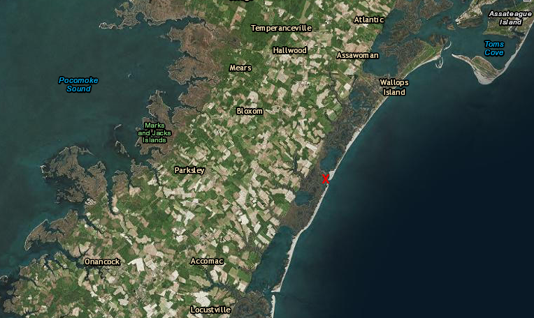
Later efforts in the 17th Century to make salt from seawater also were based on the Atlantic Ocean side of the Eastern Shore ("sea side" in local jargon), where salinity was higher than on the "bay side." In 1660, the General Assembly promised Edmund Scarborough (Scarborough) a monopoly on salt production, with a ban on competition from imports, if he could produce 800 bushels of salt. The bar was set too high and Scarborough's arrogant behavior cost him political support from other members of the Virginia gentry, so he lost his monopoly after failing to produce enough salt.8
Col. Edmund Scarborough made salt at Gargaphia Plantation (red X) in the 1660's
(today, the place name has been modified to Gargathy Bay and Gargathy Creek)
Source: ESRI, ArcGIS Online
It required substantial labor to collect the firewood, feed the fire, and boil water in kettles, then scrape the salt out. Importing salt produced by slaves on Caribbean islands was less expensive than making salt on the Eastern Shore. Sea water was evaporated in ponds on salt islands, particularly on what is today the Turks and Caicos Islands, then scaped into barrels and shipped to North America and other markets.
In 1668, after Edmund Scarborough lost his monopoly, John Custis contracted with Peter Reverdley to construct 312 salt-evaporation ponds ("salters") on Mockhorn Island. That operation relied upon the heat of the sun to evaporate seawater; no driftwood needed to be collected or wood shipped to Mockhorn Island to maintain fires. The process would have been inefficient, since any rain or spray would delay evaporation. Conditions on Caribbean islands were better for salt production; most salt in Virginia was imported and only a small amount was produced locally from seawater.
Virginians needed large amounts of salt to preserve enough beef and pork to feed their families, especially on Piedmont plantations with large numbers of slaves. On the Potomac River, George Washington operated a large herring fishery. His enslaved workers cut off the heads and removed the guts before packing 800 fish in a barrel. Alternating layers of fish and salt preserved the fish for as long as a year, facilitating shipment to markets in the Caribbean and South America. Enslaved workers in the Caribbean produced the salt which was used to preserve the fish which was used to feed the enslaved workers.9
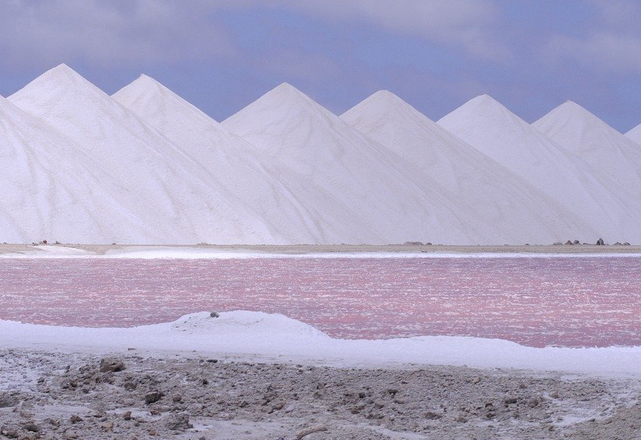
salt is still produced on Caribbean islands, using solar energy to evaporate seawater in ponds
Source: Pixabay, Salt Caribben Pastel, (by Alex Bennett)
During the Revolutionary War, British warships blocked most of the trade with the Caribbean and interrupted the supply of salt that the Virginia militia needed to preserve fish and meat. By the time Governor Dunmore abandoned Hampton Roads in May 1776, the British had captured merchant ships with 45,000 barrels of salt. The British dumped that salt into the Elizabeth River before sailing away from Portsmouth and Norfolk.
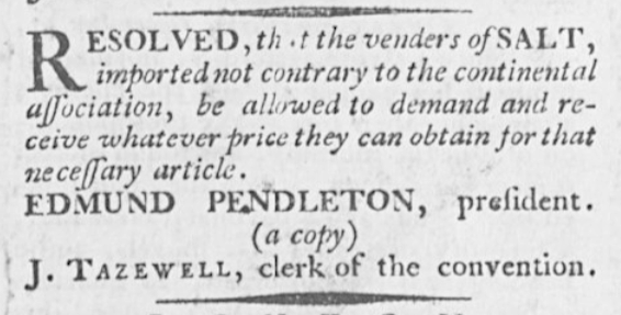
Merchants hoarded salt and prices climbed until the Virginia General Assembly established a state monopoly and imposed price controls in 1776. The Virginia Convention (which governed the colony after until the state declared independence) proposed creating 10 state-owned saltworks, with shallow ponds to be constructed for evaporating the brine and precipitating salt.
in 1775 the Virginia Committee of Safety sought to increase the availability of salt by allowing a free market, but price controls were imposed in 1776
Source: Virginia Chronicle, Virginia Gazette (December 15, 1775, p.1)
Either out of ignorance regarding salinity differences or fear of British attack, most of the saltworks were located within the Chesapeake Bay rather than on the sea side of the Eastern Shore. Evaporation efforts failed to generate more than a token amount of salt, and plans to purchase metal pans and boil brackish water floundered over the difficulty of acquiring the pans. The most effective solution turned out to be importing salt from Bermuda and the Caribbean islands via fast ships that could avoid the British blockade.10
Inland from Tidewater, there are no salt lakes in Virginia equivalent to the Great Salt Lake in Utah because there are no depressions in Virginia without an outlet. Just as in Utah, rainfall leaches minerals out of the soil in Virginia, but annual rainfall is sufficient for streams to carry the dissolved ions downstream all the way to the Atlantic Ocean or Gulf of Mexico.
No salt beds or salt domes are close enough to the surface in Virginia to be mined as "rock salt."
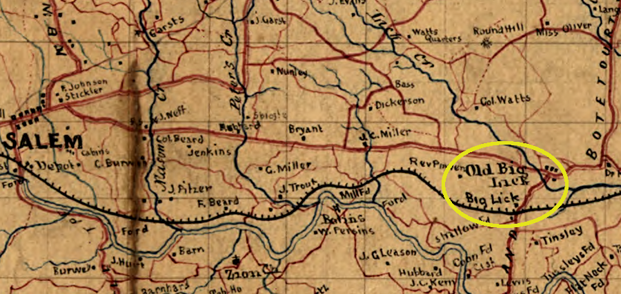
There are a few places where salt springs from underground salt beds create "salt licks" on the surface of the ground. Animals seek out the minerals at those locations, and for perhaps 15,000 years hunters have been well aware of the locations where salt from underground formations is carried by groundwater to the surface. Mastodons and other large mammals utilized salty marshes that later were the site of the Chiscas and then today's Saltville. "Big Lick" was an animal concentration point long before it became the modern city of Roanoke.
the Big Lick station on the Virginia and Tennessee Railroad (which developed into the city of Roanoke) was named for mineral-rich springs
Source: Library of Congress, Roanoke County, Virginia (1865?)
The few natural salt licks in the western part of the state were identified early by colonial explorers. Thomas Batts and Robert Fallam (or Fellows) explored across the Blue Ridge in 1671, discovering the New River before turning back. Native Americans told them that if they had traveled further beyond the mountains, they would have reached where others "lived on a plain level, from whence came abundance of salt." The Chiscas may have been replaced by Cherokees a century after Hernando Moyano's attack, but the salt springs on the North Fork of Holston at modern Saltville were still being utilized.11
In 1750, Dr. Thomas Walker traveled past "the great Lick on A Branch of the Staunton" River. That site, later called Big Lick, is now in downtown Roanoke. Dr. Walker noted how the mineralized soil attracted game, and how the early settlers had wasted that asset:12
This Lick has been one of the best places for Game in these parts and would have been of much greater advantage to the Inhabitants than it has been if the Hunters had not killed the Buffaloes for diversion, and the Elks and Deer for their skins.
Before the buffaloes, there were mastodons seeking out the mineral springs. Thomas Jefferson acquired mastodon bones dug up at Big Bone Lick in Kentucky. He was not aware of the salt springs further west on the Kanawha River, but in Notes on Virginia he recorded the existence of three salt springs in Kentucky as well as the one at Saltville on the Holston River:13
The country westward of the Alleghaney abounds with springs of common salt. The most remarkable we have heard of are at Bullet's lick, the Big bones, the Blue licks, and on the North fork of Holston.
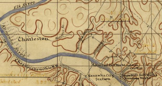
Virginia first major commercial production west of the Alleghenies was on the Kanawha River near modern-day Charleston, before the creation of West Virginia. The same springs where Mary Draper Ingles was forced to make salt in 1755 were converted into an industrial production site starting in 1797.
The westward expansion of population created a strong demand for salt used to preserve meat and butter, in the days before refrigeration. Salt was essential in making it profitable to raise livestock west of the Appalachians; without salt, more people had to immigrate into the region because more labor was required to raise crops compared to cattle. Without salt, the meat and other products could not be transported via rivers and later railroads to distant markets; only the hides could be tanned and shipped.
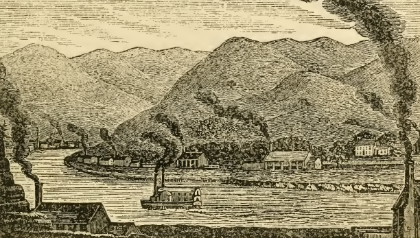
Development of the salt deposits on a 15-mile stretch of the Kanawha River created an industrial complex in western Virginia. The manufactured product (salt) was shipped west to customers all the way to New Orleans, not eastward to the traditional Tidewater port cities of Alexandria, Fredericksburg, Richmond, or Petersburg.
Within 14 years, wells were drilled over 400 feet deep to tap into the saline aquifers. Saltmakers soon switched from wood to coal to fuel the fires that kept the kettles boiling, and organized the Kanawha Salt Company to monopolize production and control prices. The Kanawha salt industry boomed until a major flood in 1861, followed by the Civil War, disrupted production and altered state boundaries so the site was no longer in Virginia. Kanawha brines are still extracted from wells 350 feet deep, crystallized by solar drying in hothouses, and sold to food connoisseurs who seek an artisan salt.14
the salt licks and salt springs on the Kanawha River were developed into a industrial complex, using wood and then coal to fuel the fires that extracted the mineral resource
Source: Historical collections of Virginia, View of the Salt-Works on the Kanawha (p.345)
The salt resources on the North Fork of the Holston River formed over 300 million years ago when seawater evaporated in a basin with tidal flats, in an area similar to today's Persian Gulf or the Gulf of California. Salt water was intermittently trapped in the basin, now the location of the town of Saltville. As water evaporated, minerals in the seawater were concentrated until they were precipitated in layers of salt as "evaporite deposits." The largest deposits were of sodium chloride (NaCl) and gypsum/calcium carbonate (CaSO4.2H2O).
New inflows created a repeating cycle that produced thick beds later named the Little Valley and the Maccrady Shale formations, formed during what geologists label the Mississippian subperiod of the Carboniferous Period. The ocean later covered the evaporite deposits, sealing them underground. Various layers of limestone, shale, and other rocks ended up on top.
Folding and fracturing during initial deposition was followed by intense deformation during the later Alleghenian orogeny. Tectonic pressures caused the rock layers to break and created the Saltville fault. That scrambled the underground layers of evaporite deposits until the once-horizontal beds of salt ended up in fragmented pods and stringers. Thrust faults also moved the bedrock around 20 miles. Roughly 280 million years ago, the deposits underneath Saltville would have been located in what is now North Carolina, and the continental plate was located near the equator.
Today, the tops of the beds of evaporated salt are 200 feet below the surface. The bottom of the bed is a mile deep, so the reservoir of salt is massive. The percentage of sodium chloride in the brine exceeds 98%.
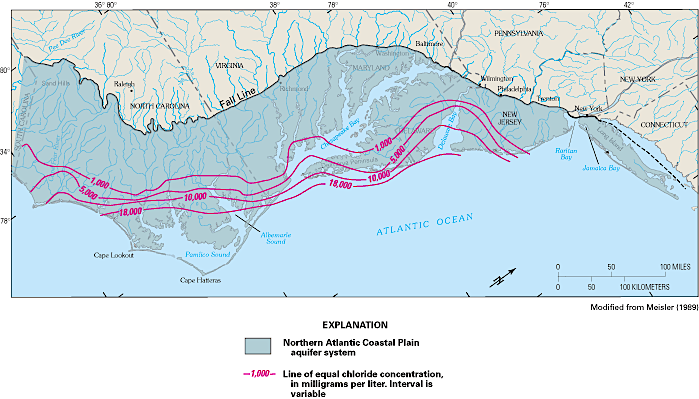
Similar evaporite deposits created during the Jurassic Period are located on the Coastal Plain and Continental Shelf. A well drilled near Norfolk had saltwater with a maximum chloride concentration of nearly 27,000 mg/L, almost 8,000 mg/L greater than that of seawater. The level of salt in the seawater was increased by mixture with brines leached from underground evaporite deposits.15
Since at least the Ice Age, groundwater circulating through those deposits has emerged at the surface in springs. The groundwater reaching the surface was enriched in salt, and the naturally-occurring brine has attracted animals to salt licks. Paleontology excavations have exposed remains of mastodons, woolly mammoths, and other Pleistocene Epoch animals. The collection and display of fossils from Saltville dates back to the time of Thomas Jefferson.
Colonists began to settle in the area in the 1730's. They needed salt to preserve beef, pork, and venison, and to pickle vegetables for long-term storage. Hauling salt upstream from Chesapeake Bay port cities, across the mountains on roads barely fit for wagons, was always very expensive.
During the American Revolution, Virginia's salt imports from overseas and the Caribbean were cut off by naval blockades. Coastal plain residents could cope with this hardship, especially by using slave labor to make salt from seawater. Across the Blue Ridge and away from the Kanawha River saline springs, salt was expensive and occasionally hard to acquire at any price.
In the 1780's, the Campbells, Kings, and other early industrialists started digging shallow wells into the Maccrady Shale to extract the brine. It was evaporated in kettles to produce salt for preserving meat and other food. During the Civil War, Union forces raided Saltville to destroy the furnaces and salt-boiling kettles. Blocking salt production would limit the Confederacy's ability to transport salted beef in barrels, constraining the ability of large groups of Confederate soldiers to march away from supply bases in order to fight Union armies.
In the 1890's, Mathieson Alkali Works started operations and the town of Saltville was chartered in Smyth County. Deeper wells pumped more brine to the surface, where it was processed to create chlorine, bicarbonate of soda, and caustic soda chemicals for various industrial uses (instead of boiled down to produce "table salt" for use as a preservative). Gypsum, used for plaster and modern drywall, was mined at Plasterco in Washington County.
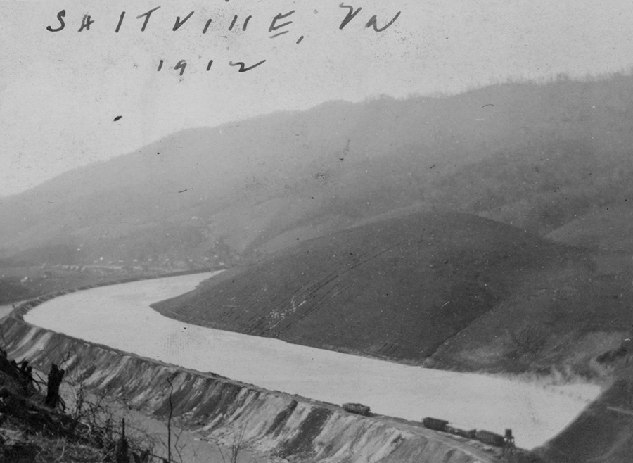
Waste residue from the saltmaking was collected behind a "muck dam" constructed in 1908 on the North Fork of the Holston River. That dam broke in 1924, and accumulated alkali waste flooded the community of Palmerton just downstream. The river was so polluted by the waste that residents of Kingsport Tennessee, more than 50 miles downstream, found it easy to collect fish that were unable to breathe in the water.
At least 19 people died at Saltville, including 12 children. Two were rescued from the ruins of a house where the parents had been killed by the mud that filled the lower story, but left a small space beneath the roof. After hearing the cries of the children for help, rescuers cut through the roof:16
The children were unaware of what had happened. They had been put to bed upstairs with some of their Christmas toys. When found, they were still in bed, and the bed was resting on the muck and pressing up against the roof rafter.
the Mathieson Alkali Works/Olin dominated Saltville's economy until 1972
Source: Appalachian State University Libraries Digital Collections, River with Railroad Grade and Railroad Cars (1912)
In 1917, the land around Well 69 collapsed due to removal of brine. That exposed bones, and a scientist from the Carnegie Museum documented fossils of giant ground sloth, mastodon, and other species dating back to the Ice Age. Since 2008, primary research has been done by Museum of the Middle Appalachians and East Tennessee State University paleontologists with experience at the Gray Fossil Site. The excavations each summer attract visitors, and special tours are offered.
For several years scientists focused on with giant short-faced bear fossils, but the most-desired find would be evidence of the earliest humans in the area. The salty clay has kelp the fossils wet with unusually-good preservation. Mastodon fossils are providing evidence of climate change during the last 20,000 years, and there is potential of finding a Paleo-Indian fossil with intact human DNA at Saltville.17
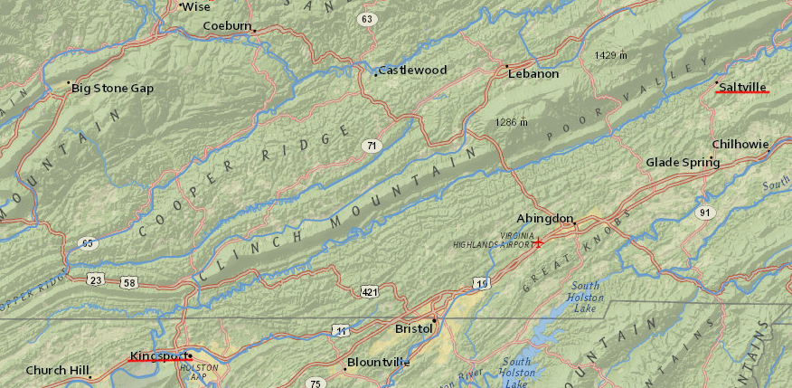
Communities downstream of Saltville that used the North Fork of the Holston River as a water supply source has to spend extra money in the treatment of drinking water to remove chlorides dumped by the chemical plant, to "soften" the hard water. At the start of the 1970's, Olin (the successor to Mathieson Alkali Works) was discharging wastewater into the river with 4,000ppm salt, far exceeding the Commonwealth of Virginia's water quality standard of 500ppm.18
alkali pollution from the plant at Saltville contaminated water downstream into Tennessee and triggered complaints from Kingsport until Olin closed the facility in 1972
Source: ESRI, ArcGIS Online
Saltville developed as a company town. Much of the housing was owned by Olin, and it funded many of the community services that in other towns were the responsibility of taxpayers, churches, or charitable organizations.
In 1972, the Olin shut down its operations at Saltville rather than rehabilitate the outdated equipment and comply with water quality standards established by the Virginia Water Control Board and the new Environmental Protection Agency. Olin's closure had a dramatic effect on local employment in Smyth County, which had a population below 32,000 people:19
It was one of the first big industrial shutdowns attributed to growing concern about the environment. It threw 900 people out of work and shredded the social fabric of a company town, where four generations of fathers and sons and a few mothers and daughters worked at "the plant" and rarely looked beyond company-supported schools, grocery stores and churches.
The chemical plant became a Superfund site requiring extensive cleanup, due to pollution caused by mercury used in the chlorine production process. The mercury trapped in the sediments will continue to contaminate the water and accumulate in fish tissue for many decades to come.
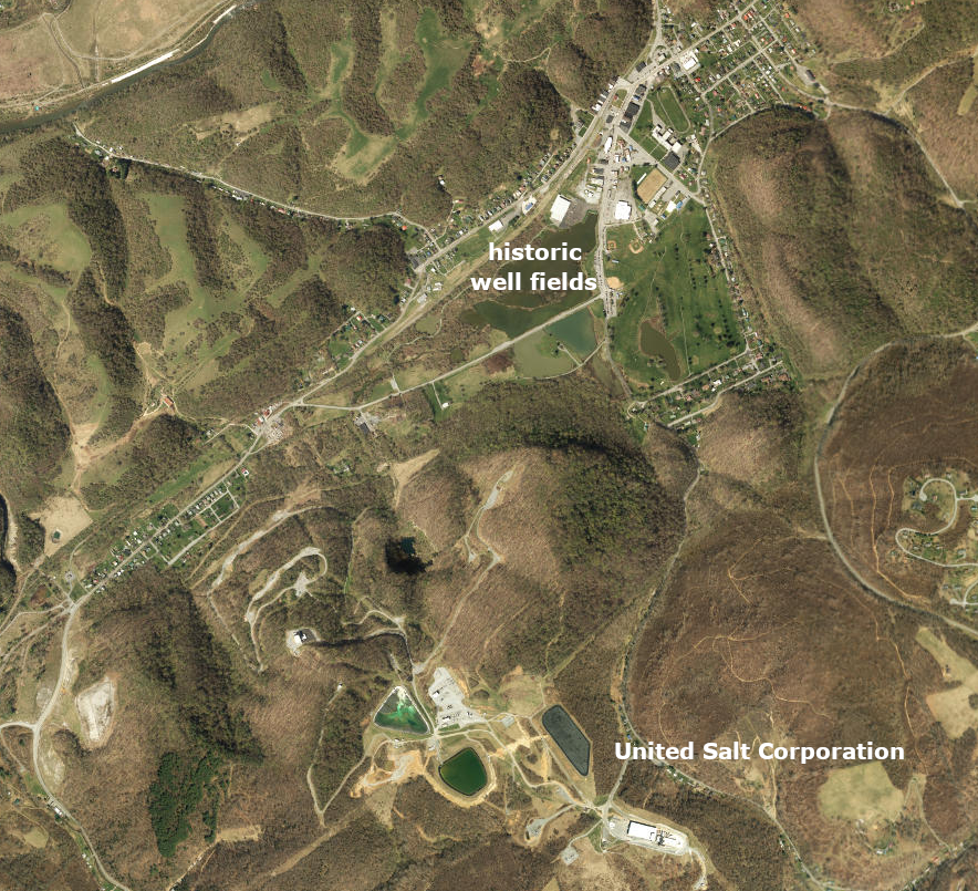
Today, salt production in Virginia is a byproduct. The old mining operations in Saltville created voids in the underground salt beds as brine was pumped to the surface. Starting in the 1990's, more water was pumped underground to create ever greater "empty space" between the remaining grains of salt to create a natural gas storage cavern.
During the summer when demand for natural gas is low, a surplus of gas is transported to Saltville by pipeline from the Gulf of Mexico, nearby coalbed methane wells, and new "fracked" wells drilled horizontally into shale formations. That gas is injected into the ground at Saltville, where it displaces brine and 5 billion cubic feet (Bcf) can be stored until the cold winter months. When demand increases and the pipeline bringing more gas from the Gulf Coast to Saltville is at capacity, gas is pumped out of the artificial reservoir and sold to customers in the region and further north.
Developing and maintaining the reservoir, with its valuable empty space, requires pumping brine to the surface. The brine was a waste product, and expensive to treat in order to comply with water quality standards. Starting in 2000, the gas storage company began to process the saline water and sell the salt products for agricultural operations in the region.
United Salt Corporation acquired the production facilities in 2007. It uses heat and vacuum (technically, the "mechanical vapor recompression process") to manufacture food grade and swimming pool salt.
In 2023-2024, the company invested in a 25% increase of production capacity t Saltville. The company was already contributing 20% of the revenue for the Town of Saltville budget.20
United Salt Corporation produces salt near the historic brine-producing well fields, which are now a public park
Source: ESRI ArcGIS Online
Salt production on the Eastern Shore lasted from 1614 at the southern tip to 1852 at Chincoteague. Recently, recreational salt-making gained a few adherents. Two commented in 2019:21
The first time we made salt, we thought it didn't work. We boiled all weekend, and by Sunday night, we had about five gallons of water left from the original 30 gallons, but no salt. We split the water and took it home. The next day, independently, we boiled what we had and suddenly, salt started precipitating out. It's a pretty cool natural phenomenon. The water finally becomes over-saturated and salt starts to fall to the bottom. We each collected about a half-gallon of Eastern Shore salt, and we were hooked. Since then, we have experimented and refined the process by heating and cooling the water and skimming the large crystals (fleur de sel) off the top of the pot...
... Boiling sometimes goes on for two days with periodic middle-of-the-night wake-up calls to add wood and stoke the fire. We split the brine and take our shares home to finish on kitchen stoves by skimming the large crystals. The result is several pounds of fresh, white sea salt with a slight smoky scent. Crunchy and bright, this is a fine table salt. The salt that falls to the bottom of the pot is finer and rounder. This goes into quart Mason jars for general cooking use.
The flavor of salt precipitated by boiling ocean water will vary, based upon the ions dissolved in the water extracted from the ocean. Those ions are distributed unevenly by nearby rivers and distant ocean current.
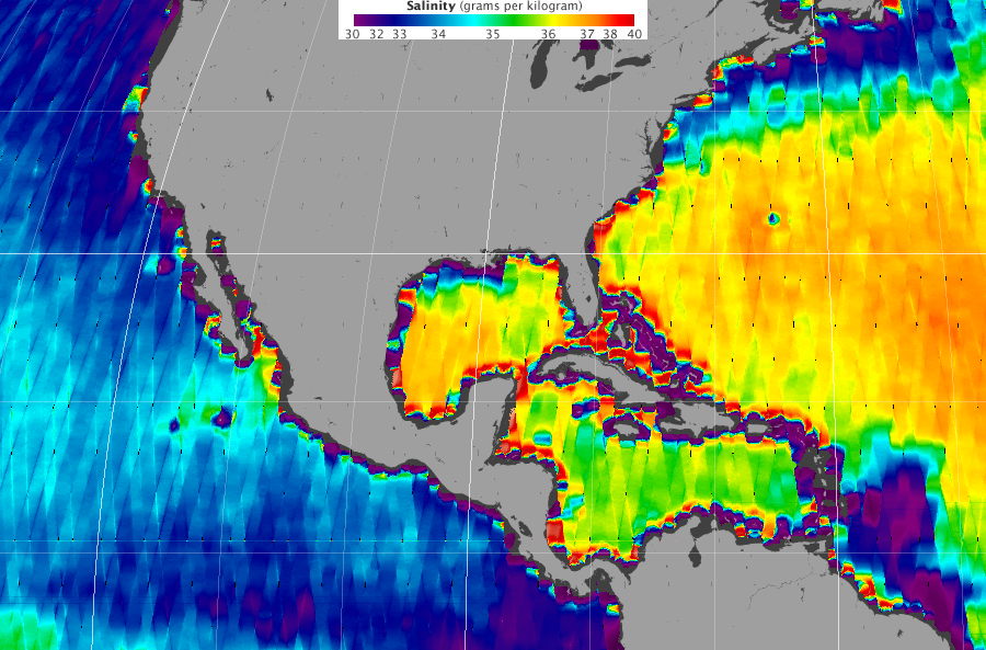
In the ocean, the water averages 3.5% of dissolved salts, or 35 parts per thousand (ppt). In metric terms, that is 35 grams/kilogram or 35 milligrams/liter (mg/l). Over 90% of the salt dissolved in seawater consists of sodium (NA+) and chlorine (Cl-) ions, along with sulfate (SO4), magnesium (Mg2), potassium (K*) and other molecules.
The Atlantic Ocean is slightly saltier than the Pacific Ocean. In the tropics, there is higher evaporation in the Atlantic followed by precipitation of freshwater as rain into the Pacific. The small streams on the west side of the Eastern Shore contribute only minor amounts of freshwater to dilute the dissolved salt content in the Atlantic Ocean next to Virginia.22
the Atlantic Ocean salinity varies due to evaporation and freshwater input from rivers
Source: National Aeronautics and Space Administration Earth Observatory, A Measure of Salt
Recreational hobbies can develop into a full-scale business, such as Peg's Salt. Its products, once made in a home kitchen, are now manufactured in Waynesboro. The salts are sold at food specialty stores, and are stocked on the "Local Goodness" shelves at Food Lion grocery stores in Hampton Roads. None of the salt components in the different mixture come from a Virginia source. For example, Imported Pink Himalayan and Pacific kosher sea salts are mixed with 20 common spices to produce Peg's Pink Salt.23
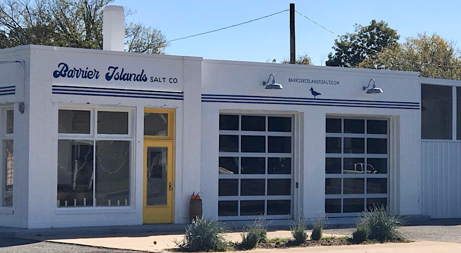
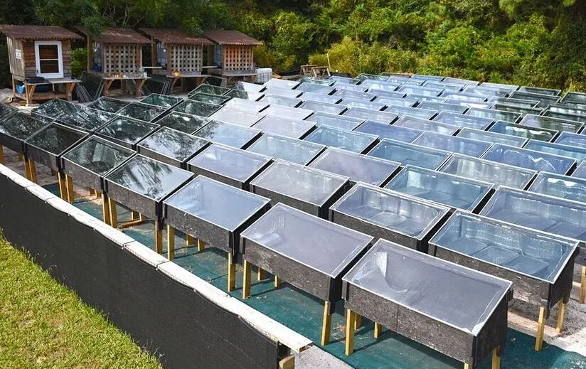
Virginia's first commercial saltworks on the Eastern Shore since the 1700s, Barrier Islands Salt Company, started operations in 2018. Their retail outlet is in a former 1936 gas station in Cheriton, on the Eastern Shore in Northampton County. One of the founders of the company had experience in marketing McCormick's gourmet Mediterranean Sea Salt. She noted that "we've got the same water right here" as the source for most brands of imported sea salt products, and started the business with her husband after four years of research.
Their salt production starts with taking a boat to the Atlantic Ocean near Cobb's Island, to collect salt water away from the sediments at the shoreline. The water quality is high, since The Nature Conservancy has protected that part of the Eastern Shore from development.
Heating in a kettle evaporates the water, leaving behind crystals that are processed into Pure Flake Finishing Salt, Pure Kosher Sea Salt, and other specialty versions of salt - including one mixed with Chatham Vineyards rosé wine. Boiling 100 gallons of seawater results in 25 pounds of salt.24
commercial salt-making returned to the Eastern Shore in 2018
Source: GoogleMaps
Salt is also produced on the Outer Banks of North Carolina, using the same approach as Sir Thomas Dale in 1614. Ocean water is pumped into evaporators made from metal pans, scrap wood, and old windows at Hatteras Saltworks. The windows trap the heat via the greenhouse effect, an advantage over the 1614 technology. Temperatures in the solar ovens can reach as high as 190 degrees. The high temperature kills any bacteria in the raw sea water, and after a week leaves a residue of artisanal sea salt. The product advertised as containing as much as 87 trace minerals, is sold in four-ounce packages for $10 each.25
In West Virginia, the J. Q. Dickinson Salt-Works also relies upon solar energy to evaporate brine. It is extracted from a well in the historic salt-manufacturing region in the Kanawha River valley. The name traces back to the Dickinson and Shrewsbury salt-making business that began at the end of the War of 1812, when the founders moved from Bedford County because producing salt would be more profitable than tobacco.
The salt is gradually concentrated through the heat from the sun; unlike traditional salt-making there in the 1800's, no coal or natural gas is used. The company emphasizes how slow it makes salt from brine:26
Of all the ways we could make salt from our brine we chose slowest. This may seem odd at a time when faster is often considered better. We are the tortoise of the salt making world. Have you heard of the Slow Food movement? We embrace it with gusto.
Hatteras Saltworks uses solar energy to evaporate brine and make salt from seawater
Source: Hatteras Saltworks
For major commercial operations today, including papermaking and food processing (including curing country hams), salt is imported through the Port of Virginia and the Port of Baltimore. Drivers on I-95 passing through the Fort McHenry Tunnel in Baltimore can see the massive piles of salt stockpiled as much as 10-stories high at the Rukert Terminal.
Homeowners with a water softener typically purchase 40-pound bags of salt for water purification. The sodium (Na+) ions in the water softener salt will replace calcium (Ca2+) ions in groundwater, reducing the buildup of "scale" in household pipes and cooking pots. Savvy gardeners use outdoor spigots to collect water for their plants, bypassing the extra salt that is added in the water conditioner. Otherwise, salinity will be gradually increased in soil of the houseplant pots by repeated watering.
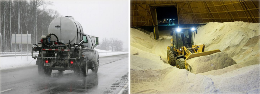
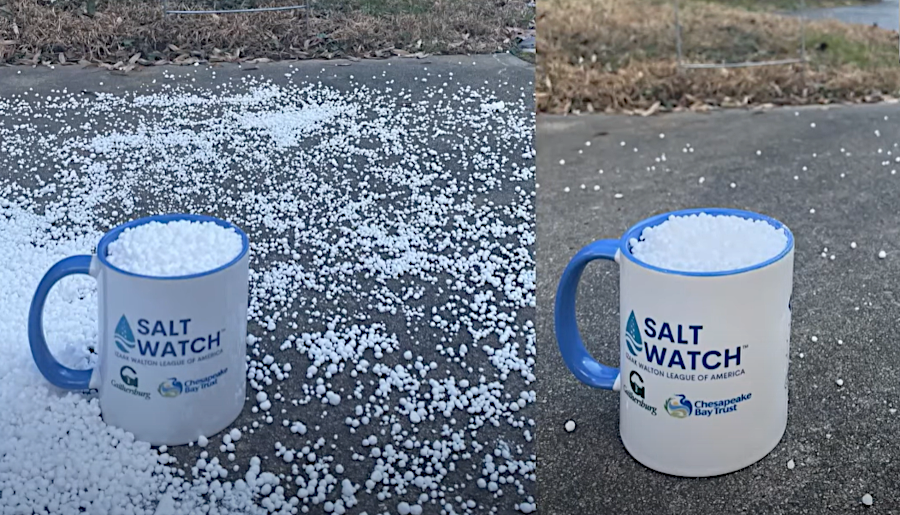
The Virginia Department of Transportation (VDOT) stockpiles 700,000 tons of salt, sand and treated abrasives each year for treatment of icy roads in the winter. The mixture of salt and melted snow/ice (brine) freezes at a lower temperature than water, so spreading salt reduces the slick ice on bridges and roadways when temperatures are not far below freezing.
the Virginia Department of Transportation (VDOT) uses salt, brine, and sand to facilitate safe travel in winter
Source: Virginia Department of Environmental Quality (DEQ), Salt Management Strategy (SaMS) for
Northern Virginia (January 17, 2018)
Over 40% of salt used in the United States is spread on roads for deicing. The source of road salt used in Virginia varies over the years, depending upon market conditions. Salt from Mexico's Baja Peninsula Mexico and from the Bahamas is produced by solar evaporation, while miners in the Atacama Desert of northern Chile excavate that source using heavy equipment.
Some salt is imported from as far away as India, while the domestic Cayuga Rock Salt Mine in Lansing, New York is also a supplier. Salt is mixed with beet juice to create a brine which can be sprayed on roads.27
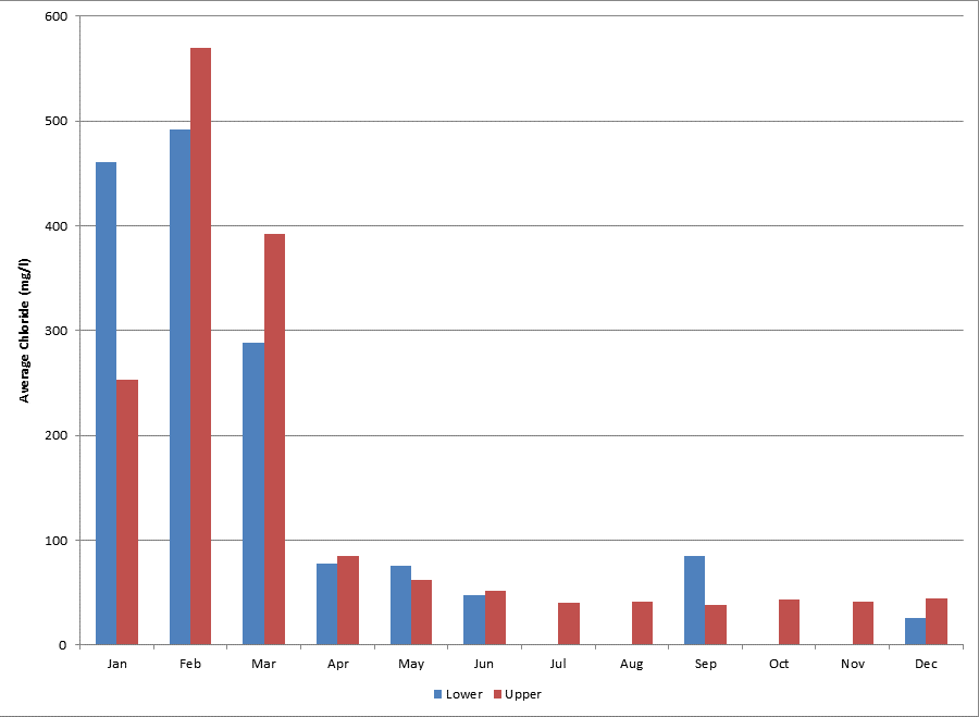
The Virginia Department of Environmental Quality and other stakeholders developed a Salt Management Strategy to reduce the runoff of salt used to reduce ice on roads in the winter. The 2017 Accotink Creek Total Daily Maximum Load (TMDL) included a limit on chloride. Testing samples had exceeded the acute maximum chloride concentration criterion of 860 mg/l (for a one-hour average not to be exceeded more than once every three years) and the 230 mg/l chronic criterion (a four-day average not to be exceeded more than once every three years). Such concentrations disrupt the natural osmotic regulation of aquatic organisms.
In North America, the average chloride concentration is 8mg/l (8ppt) in freshwater streams. Spikes of excessive chloride occur as snow/ice melts, washing the deicing products that were spread on roads into nearby streams.28
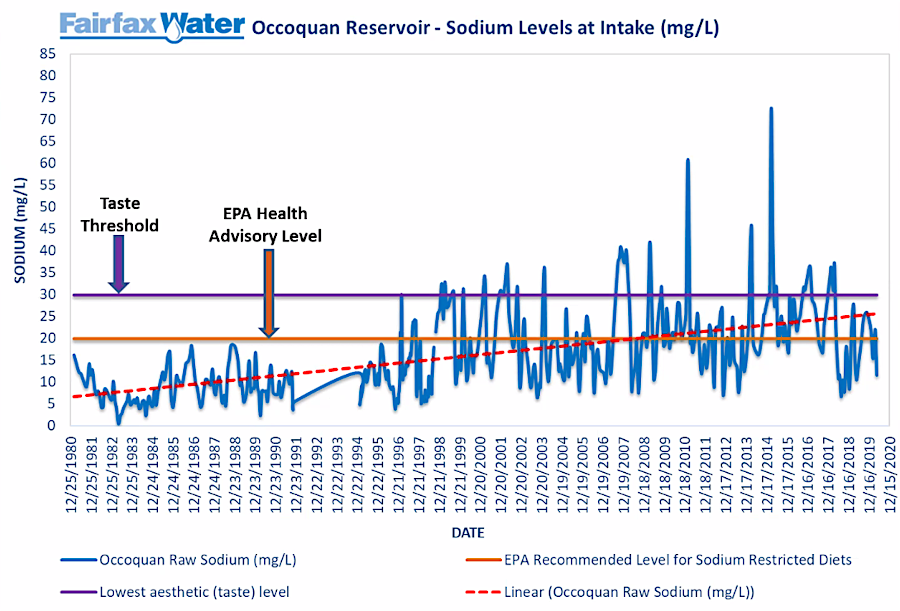
Except in the dry summer, most sodium washes off the land into the Occoquan Reservoir. In the winter when icy roads are predicted, the Virginia Dpartment of Transportation puts salt on roadways to reduce the temperature at which ice forms and thus increase highway safety.
Other major sources include residual sodium from discharge of cooling systems at data centers and office buildings, residue from sodium hydroxide used to clean computer chip components at the Micron manufacturing facility in Manassas, and especially salt in human waste that is flushed for treatment at the Upper Occoquan Servivce Authority (UOSA) plant:29
Sodium mass loading to the reservoir is primarily from watershed runoff during wet weather and reclaimed water during dry weather. Across all timescales evaluated, sodium concentration in the reclaimed water is higher than in outflow from the two watersheds. Sodium in reclaimed water originates from chemicals added during wastewater treatment, industrial and commercial discharges, human excretion and down-drain disposal of drinking water and sodium-rich household products.
Wastewater treatment and drinking water facilities do not remove salt, since that requires expensive reverse osmosis membrane processes. As a result, the drinking water now produced by Fairfax Water at its Griffith plant in Lorton often exceeds the recommended 20gg/l sodium levels for those on sodium restricted diets such as people with high blood pressure. Adding the capacity to use reverse osmosis at the facility to reduce the salt would cost about $1 billion for initial infrastructure, plus higher operating costs.
The General Manager at Fairfax Water has stated:30
As more and more impervious surface is laid down for roads and parking lots, more and more of this salt is going down. There's been an exponential increase in the use of salt... All this salt on the road is going to end up in the water. It never goes away.
The naturally slow geologic and hydrologic processes that cycle salt between geologic deposits and the surface have been altered by mining and distributing sodium chloride (NaCl) and other types of salt. Currently, human-caused salinization has impacted 2.5 million acres across the planet. Salt use is so common that runoff is contaminating freshwater supplies used for drinking water and irrigation to grow food.31
salinity of the drinking water produced from the Occoquan Reservoir often exceeds recommended levels for those on sodium restricted diets
Source: Green Risks blog, Staff Recommends No Overlay District for the Occoquan (December 1, 2021)