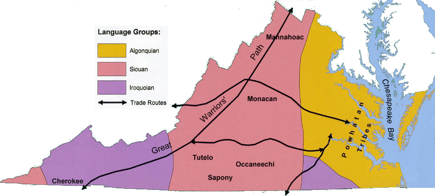
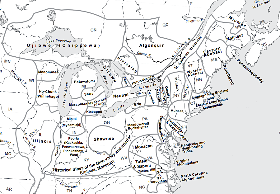
location of different language groups in Virginia, 400 years ago at the time of European contact
Source: Virginia Geographic Alliance, An Atlas of Virginia
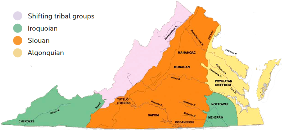
location of different language groups in Virginia, 400 years ago at the time of European contact
Source: Virginia Geographic Alliance, An Atlas of Virginia
Though our knowledge of the lifestyle of the first Virginians is primarily based on archeology, it is a safe bet that the Native Americans did not live in a constant state of peace and perpetual harmony sharing food, fuel, and shelter.
When humans first settled Virginia, the primary considerations of where to live were the availability of food and access to shelter from the bitter winds whipping off the ice sheet to the north. In the course of perhaps 20,000 years of settlement, family groups expanded and formed macro-bands of allied, related families. Different macro-bands of hunter-gatherers must have experienced numerous disputes over which groups would harvest animals and plant food from distinct areas. Later, macro-bands consolidated into tribes, with groups of unrelated people sharing the same leadership and asserting control over different territories.
Through competition and cooperation, different tribes established separate identities. One obvious social or religious difference demonstrated by archeological evidence: the mound building culture of the Southwest/Shenandoah Valley/western Piedmont did not extend across the Fall Line into Tidewater. Archeologists studying the shape of points/tools and styles of pottery can distinguish other boundaries, after identifying the patterns associated with excavated artifacts with distinct characteristics.
The number of people living in Virginia at the time of European contact is unclear. Across North America, the Native American population grew from the first arrivals south of the continental ice sheets over 20,000 years ago. There appears to have been a drop in overall population starting around 1150 CE (Common Era), followed by a recovery until 1500 CE. In the Mid-Atlantic region, however, there is less evidence for a population decline.
In what is now Virginia, there may have been 25,000 people in 1607. Around 15,000 of those were members of the 30+ tribes in the paramount chiefdom of Powhatan.1
By the time Columbus reached what Europeans labelled the New World in 1492, Native Americans in Virginia had split into three main linguistic groups.
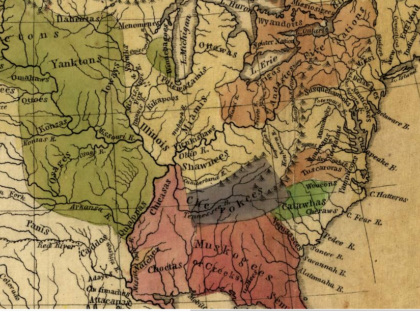
different tribes controlled different areas at the time of European contact
Source: Library of Congress, Map of the Indian tribes of North America, about 1600 A.D. along the Atlantic, & about 1800 A.D. westwardly (American Antiquarian Society, 1836)
The Algonquian-speaking tribes were in Tidewater. All of the tribes controlled by Powhatan spoke some form of Algonquian language, but so did other tribes who were beyond his control. The Dogue (known also as the Taux or Moyumpse) who lived at the mouth of the Occoquan River owed no allegiance to Powhatan. The Dogue/Moyumpse were associated with the tayac (leader) of the Piscataways, another Algonquian-speaking tribe who lived across the Potomac River in what is now Maryland.
In the first 50 years of colonization, the English interacted primarily with the Algonquian-speaking tribes. The colonists discovered that the Powhatans measured time by five seasons, based largely on food availability:2

John Smith mapped far more Native American towns on the north bank of the Rappahannock River (blue line), suggesting the river served as a border defining the limits of Powhatan's control when the English arrived in 1607
(NOTE: north is to the right, not towards the "top" of the map)
Source: Library of Congress, Map of Virginia/ discovered and discribed by Captain John Smith 1606
The Siouan-speaking tribes were located west of the Fall Line. The Manahoacs and Monacans in the James and Rappahannock river valleys plus the Tutelo/Totero near modern-day Roanoke, spoke Siouan languages.
The Iroquoian-speaking tribes included the Nottoway and Meherrin near the Fall Line in southeastern Virginia, as did the Tuscarora living further south on the Coastal Plain of Carolina. The Cherokee in southwestern Virginia also spoke and Iroquoian language. The fragmented pattern of different tribes could understand each other well enough to trade, but the variations in language groups (Algonquian, Siouan, and Iroquoian) provide a clue regarding territorial control and cultural allegiances at the time of European contact.
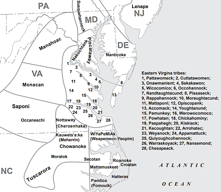
Source: Virginia Foundation for the Humanities and Public Policy, The Virginia Indian Heritage Trail (p.14)
The short time for human evolution in North America (just 15,000-20,000 years) was not enough to establish physically-distinct species, as occurred in Africa/Asia/Europe as humans migrated out of Africa over the last 2 million years. Still, the separate languages are an excellent clue that Virginia was not a homogenous community when the strangers from England sailed in from the east.
Changes in styles of stone tools and pottery illuminate the different cultures that developed in Virginia since Native Americans first arrived at the end of the last ice age. In contrast to the Olmec, Maya, and others living in Central America, the prehistoric inhabitants of Virginia did not develop writing, and the transmission of oral histories was disrupted after the European colonists arrived. Archeological research has revealed changing life patterns over time, but the best-documented Native Americans in Virginia are the tribes led by Powhatan that interacted with the English after 1607.

reconstruction of Native American dwelling at Henricus Historical Park
The English were not the first Europeans to trade with the Indians in Virginia. Long before the English explored north from their colonial beginnings at Roanoke, the Native Americans had already acquired metal and glass objects from Spanish and other ships.
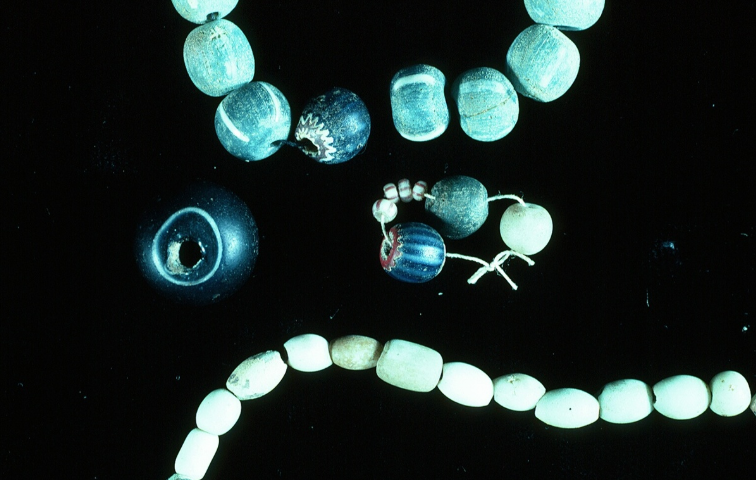
Native Americans in (modern) Montgomery County acquired glass beads in the Contact Period, as well as traditional shell beads from traders living on the coastline
Source: Virginia Humanities, Virginia Indian Archive, Glass Beads
The contact period lasted perhaps a century, from the earliest explorations in the 1520's along the Virginia coastline until after Jamestown was settled. We can date archeological excavations through such objects, while reports of others remain hard to explain.
For example, Governor George Yeardley reported that in 1621 the Patawomeck had a "China boxe" made of braided palmetto leaves, "lined in the inside with blue Taffata after the China or East India fashion." It excited Yeardley to think there might be a short passage through Virginia to China. Most likely, the prestige item came from a Spaniard in Florida and had been traded multiple times between different Native American leaders before arriving on the banks of the Potomac River.3
Source: Fairfax Public Schools, Trading with the Powhatan - Artifacts from Werowocomoco
Some villages were probably affected by European diseases even before they acquired European artifacts. In addition to measles, mumps influenza, and smallpox, one major introduced killer could have been the bacterium Salmonella enterica. It causes food poisoning, and may have been what wiped out the Aztecs in Mexico between 1545 and 1550.
Hernando de Soto's expedition between 1539 to 1543 dramatically disrupted Native American polities. Leaders who claimed authority based on their ability to protect groups of people were revealed as powerless against the Spanish invaders. Leaders who claimed authority based on their control of prestige goods lost power, as exotic materials from the Spanish were dispersed to new people. Towns which once asserted control over other communities lost their ability to demand tribute; tribal alignments were rearranged. The Native American nations "discovered" by English colonists in the 1600's may have formed in just the previous century, in reaction to the disruption by the Spanish.
The most significant impact of early contact was disease. Perhaps 90% of the Native American population may have died in the first century after contact. By one scientific calculation, there were 60 million people in the New World when Columbus arrived, mostly in Central and South America. By 1600, that number had been reduced to 5-6 million.
Over 200,000 square miles of agricultural land were abandoned. Vegetation regrowth pulled 7-10 parts per million of CO2 out of the atmosphere, helping (together with reduced sunspot activity and increased volcanic activity) to trigger a phase of the Little Ice Age. That global cooling occurred before the Industrial Revolution began to increase CO2 enough to lead to global warming.4
After three ships sailed upstream and unloaded colonists in 1607, Powhatan sought to control the English primarily through diplomacy. He did not try to expel the colonists by force. Powhatan's strategy of using diplomacy and trade sanctions ultimately failed. His younger brother Opechancanough then tried force, with two uprisings in 1622 and 1644.
Source: JYF Museums, Paramount Chief Powhatan | People of the Past
The military response by Opechancanough was equally unsuccessful in re-establishing Native American dominance. After each uprising, the English responded with violence and expanded their control over territory, expelling the Native Americans from their towns and hunting grounds.
As the Europeans then settled Tidewater and the Piedmont, the various tribes in Virginia struggled to maintain their land and cultural integrity. However, within 50 years of Jamestown, the English population reached 14,000 (including 500 blacks imported from the Caribbean islands or Africa).
The immigrants displaced the Native American societies in Tidewater through land seizures and military action, while disease apparently reduced substantially the number of Native American further inland. The breeds of domesticated dogs, developed by Native Americans over the last 10,000 years, were killed off. Based on modern DNA analysis:5

there is a colonial dog in this stereotypical American version of the "first" Thanksgiving (in Massachusetts)
Source: Library of Congress, The first Thanksgiving 1621 (Jean Leon Gerome Ferris, 1932)
After Opechancanough's second attack in 1644, the Powhatans were restricted to the territory between the York and the Rappahannock rivers. This was just the start of the westward march of the English and the retreat of the Native Americans. In some cases, official negotiations led to clarification of "property rights" through various treaties - though the two cultures viewed the negotiations through very different perspectives.
In 1686, a French traveler noted that the Native Americans still maintained much of their original lifestyle (and the traveler showed his cultural biases as well):6
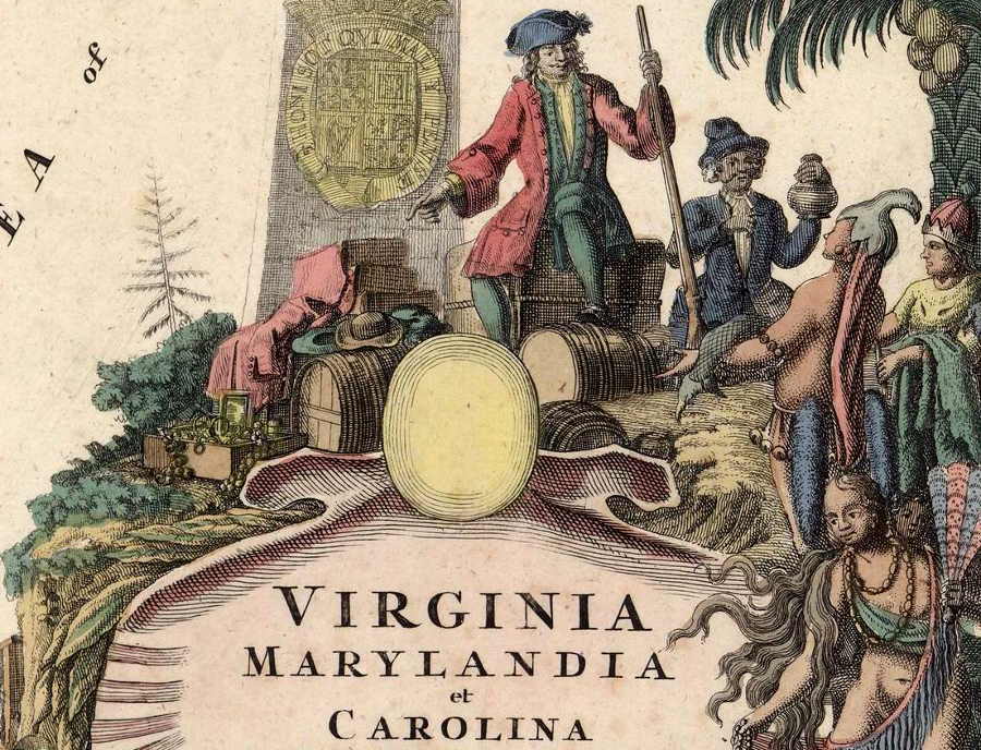
the English traded cloth, guns, liquor, and other manufactured products for food and deerskins
Source: Archives of Maryland, Virginia, Marylandia et Carolina: in America septentrionali Brittannorum industria excultae (by Johann Baptist Homann, 1714)
The English settled in Tidewater Virginia along the rivers, where tobacco could be loaded on wharves and shipped to buyers in Europe. Lands further inland, on the watershed divides of the Middle Peninsula and Northern Neck, were left unoccupied by colonists who chose to develop plantations next to the river shorelines.
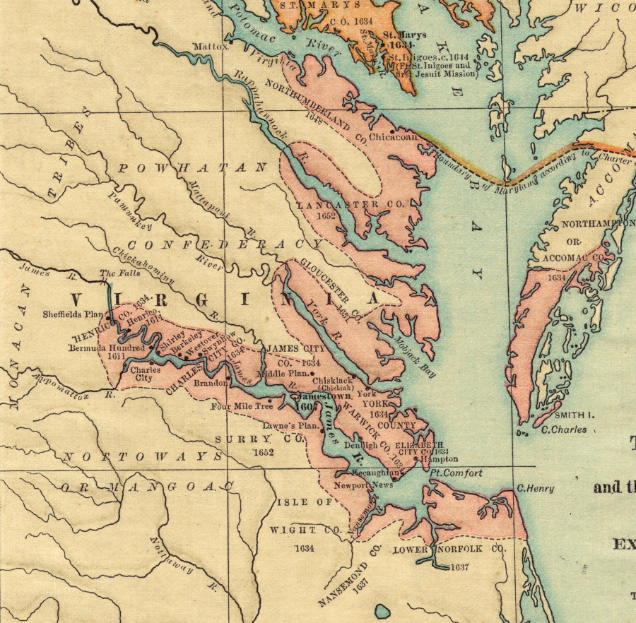
Virginia colonists chose to occupy lands along the shorelines of rivers in the 1600's, rather than move inland
Source: Boston Public Library, Norman B. Leventhal Map Center, The colonies in 1660, Virginia, Maryland, and the Dutch and Swedish settlements on the Delaware showing extent and dates of settlement (by Albert Cook Myers, 1905)
The conflicts between English settlers and Native Americans continued long after the Powhatan paramount chiefdom was disrupted after the 1644 uprising. In 1704, local English settlers usurped land of the Nanzatico, a group of Native Americans that included remnants of earlier tribes in the area.
After complaints to colonial officials produced no results, the Nanzatico killed one Englishman that they viewed as a trespasser, plus his family. In response, the colonial militia captured all of the Nanzatico. After a trial, the colony hung 7 Nanzatico men, sold all the others over the age of 12 into slavery in the West Indies, and forced the children to work as servants for colonial officials.7
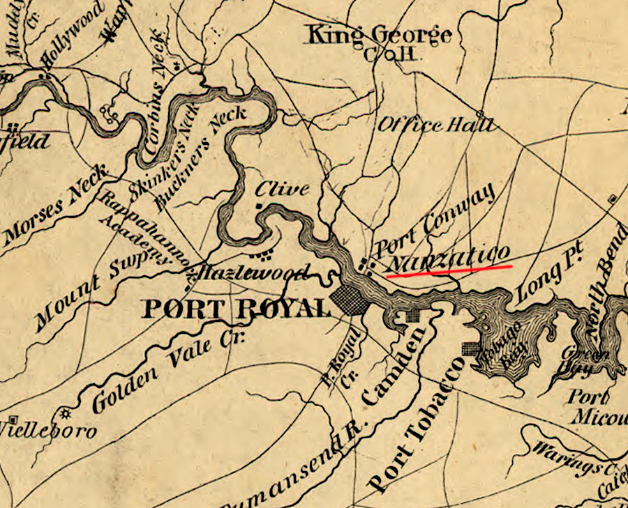
Portobago Bay, on the Rappahannock River downstream of Fredericksburg - former home of the Nanzatico community
Source: Library of Congress, Central Virginia (1862)
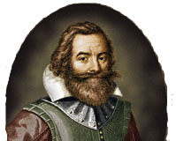
John Smith was the first English colonist to study Native American culture in depth
Source: National Park Service
Ewhen English colonists arrived in 1607, there were many different Native American societies in North America
Source: Smithsonian Institution, Handbook of
North American Indians (Figure 1, Figure 8, 2022)
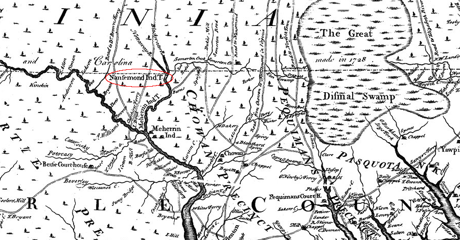
the 1728 survey of the Virginia-Carolina border resulted in a map documenting the presence of a Nansemond town near the confluence of the Blackwater and Nottoway rivers
Source: East Carolina University, New and Correct Map of the Province of North Carolina by Edward Moseley (1733)