 Pitch and Tar Swamp at Jamestown |
 reconstructed palisade at James Fort |
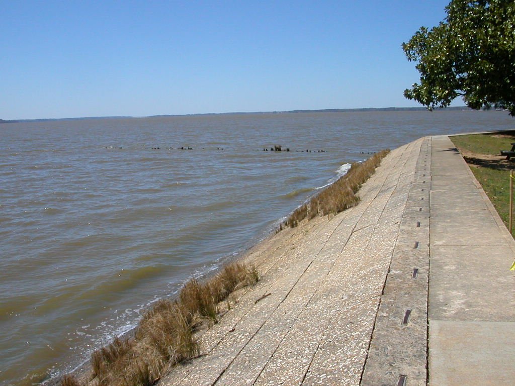 modern seawall at Jamestown |
 monument for 350th anniversary in 1957 |
(click on images for larger versions)
Pitch and Tar Swamp at Jamestown |
reconstructed palisade at James Fort |
modern seawall at Jamestown |
monument for 350th anniversary in 1957 |
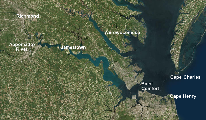
International rivalries with Spain and France shaped the location of Jamestown and the settlement of Virginia. The shape of the channel in the James River was also a factor.
The English were not the first people to arrive in Virginia, just as Columbus was not the first person to realize the earth was round. Asian hunter-gatherers got here first, about 15,000 years earlier. The Spanish explored the Chesapeake Bay before the English. In 1570, the Spanish even sent Catholic missionaries to convert the natives in Virginia and to expand the power of Spain north from Cuba.
The oldest continuously inhabited, European-established city in the Western Hemisphere is Santo Domingo. Christopher Columbus founded the town in 1496 on the southern side of on the island of Hispaniola in the Caribbean. Today Santo Domingo is the capital of the Dominican Republic.
In 1565 the Spanish established the first permanent European settlement in North America, St. Augustine in Florida. That settlement never developed beyond its role as a fort (presidio). Its primary role was to prevent pirates or other nations from establishing a base for capturing Spanish ships carrying gold and silver home from the New World. St. Augustine also protected Catholic missionaries - but the Spanish never tried to "plant" a large number of permanent settlers there.
Jamestown was intended to become the core of a long-term settlement effort, creating new wealth for the London investors and recreating English society in North America. The colonists arrived at Jamestown after a 4-month journey from London.
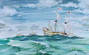
The three ships, the Susan Constant, Godspeed, and Discovery, left on December 16, 1606 from the docks at Blackwall on the Thames River, stopped at the Canary Islands for water, reached Martinique in the West Indies on March 23, sailed north from the Caribbean on April 10, reached Cape Henry on April 26 - and then spent over two weeks exploring places along the James River before settling at Jamestown on May 14, 1607.1
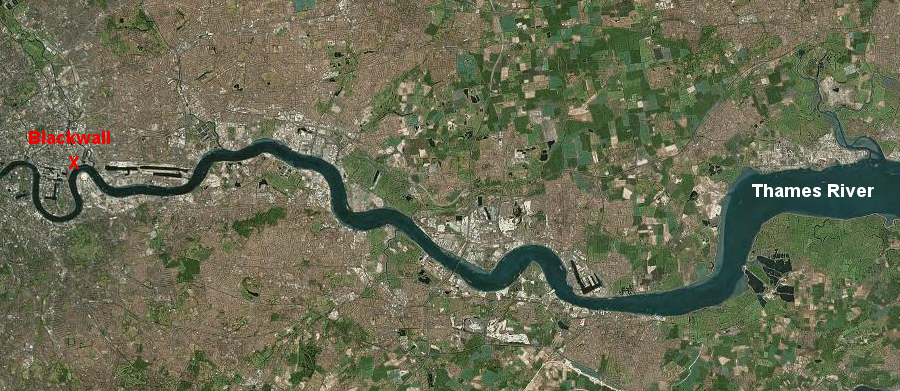
the first colonists to reach Jamestown in 1607 started their trip by sailing eastward from the docks at Blackwall in London to reach the English Channel
Source: ESRI, ArcGIS Online
One basic geography question is "Why did the English settle Virginia - and why did they start at Jamestown?" Factors to consider include:
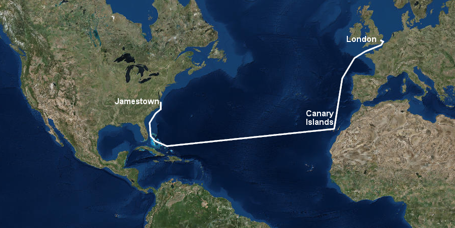
on the first trip to Jamestown, three English ships sailed south to the Canary Islands, then west to Martinique and other islands in the Caribbean, and finally north to the Chesapeake Bay
Source: ESRI, ArcGIS Online
The English spent over two weeks exploring the James River before choosing the site of their first settlement. Jamestown was placed on a peninsula with just a narrow link to the mainland, located 50 miles upstream from the mouth of the Chesapeake Bay. The original 1606 instructions to the colony, written by investors in London before anyone understood the local geography, prioritized safety over convenience for travel between England-Virginia.
The focus on safety was based on the French experience at Fort Caroline over 50 years earlier. The French settled in 1564 near the coastline in what today is Jacksonville, Florida. Within a year, the Spanish in nearby St. Augustine destroyed the fort and killed the French colonists attempting to flee. Jamestown was located far north of the Spanish base at St. Augustine and, in recognition of that threat, placed further inland:2
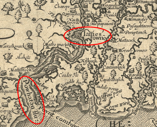
Jamestown was located on the "Powhatan" river, according to John Smith's map
Source: Library of Congress, Virginia / discovered and discribed by Captayn John Smith, 1606
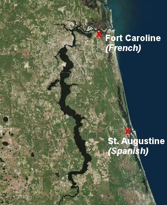
Fort Caroline was built in 1564, only seven miles from the coastline
Source: ESRI, ArcGIS Online
The English colonists who arrived in 1607 picked that site far upstream from the coast to avoid the Spanish. To a lesser extent, the English also feared the French and the Dutch. The constant international conflicts between European nations were a key factor in determining the location and the defenses of the new English colony halfway across the world.
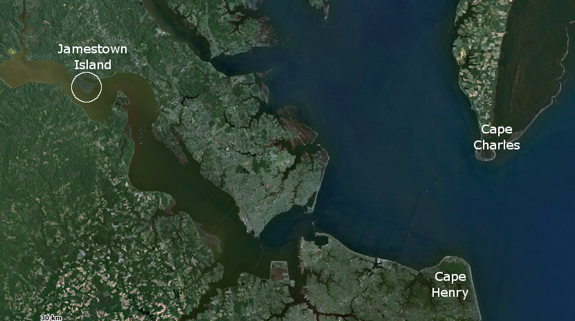
location of Jamestown, in relation to mouth of the Chesapeake Bay
Map Source: US Fish and Wildlife Service Wetlands Mapper
The Susan Constant, Godspeed, and Discovery sailed past the later sites of Norfolk, Suffolk, Hampton, and Newport News. Those locations were clearly convenient places to settle and offered plenty of fresh water from inland streams and wells. Point Comfort would have been far more convenient. As economic historian Philip Alexander Bruce later noted:3
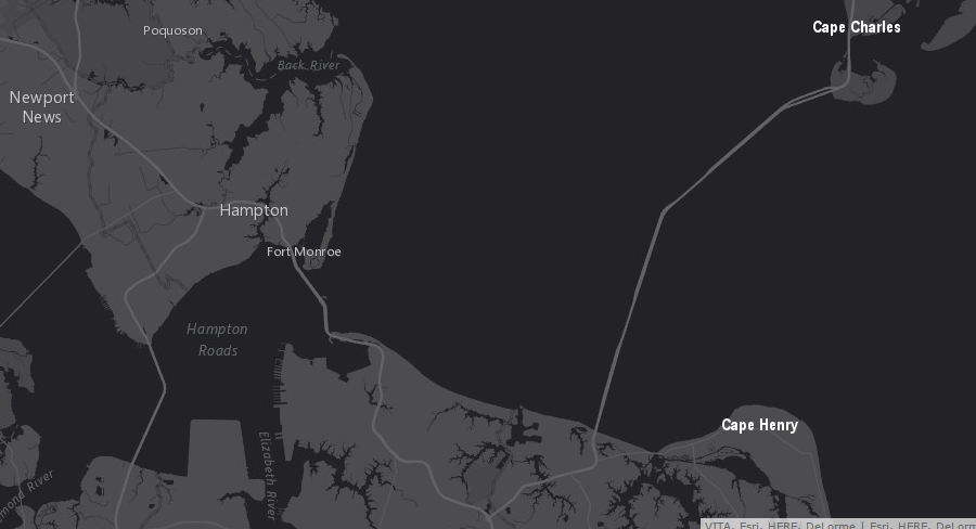
the site of Hampton was closer to England - and would have avoided the delay in sailing/rowing upstream to Jamestown
Source: ESRI, ArcGIS Online
However, all the future ports in Hampton Roads (and of course the Eastern Shore) were too exposed to attack by one or more enemy ships. The fears were realistic; at various times, pirates, Dutch, British, and Yankee ships showed that settlements in Hampton Roads were vulnerable to enemy raids.
In 1607 the English sailed "so far up as a bark of fifty tuns will float" and chose to settle on a peninsula that was almost an island. A slender neck of land on the northwest corner allowed access to the mainland, but could be defended easily against the Native Americans.
Width of the peninsula, or at least descriptions of it, changed over time. In 1676 the peninsula was calculated to be 50 feet wide. In 1688, estimates were 60-90 feet, but in 1694 the "slender neck" had grow to be nearly 200 feet wide. By 1748 erosion had washed away the link, but a human-built causeway allowed regular access to Jamestown.
during the Civil War, Union cartographers showed Jamestown as an island
Source: US War Department, Atlas to accompany the official records of the Union and Confederate armies, Southeastern Virginia and Fort Monroe Showing the Approaches to Richmond and Petersburg (1862)
Jamestown was an island at high tide during the American Revolution. By 1844 the isthmus had washed away completely, and a bridge over "Back River" connected the mainland to Jamestown Island.4
Jamestown was built on an peninsula that was connected to the mainland at the northwest corner, but storms have washed away/expanded that peninsula (a causeway provides road access now)
Source: ESRI, ArcGIS Online
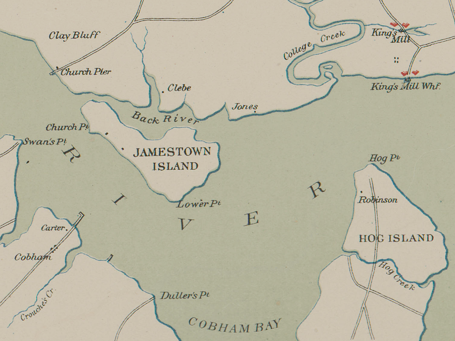
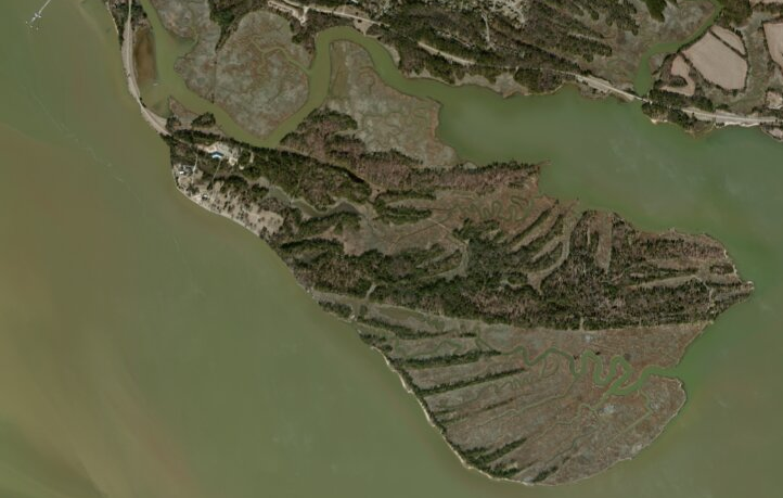
In 1607 there were no permanent Native American villages on the peninsula. The Pasapaheghs hunted and fished there, but lived upstream closer to the Chickahominy River. Captain Gabriel Archer advocated for Archer's Hope because that site offered better onshore conditions, but the river channel was not deep enough there. Today, the Kingsmill Resort has covered Archer's Hope with houses and golf courses.
Edward Maria Wingfield chose the specific location, perhaps with the support of Captain Christopher Newport. Archer's Hope had good soil, as evidenced by the large trees and vines growing there. There was an abundance of birds, including wild turkeys. As described later by George Percy:5
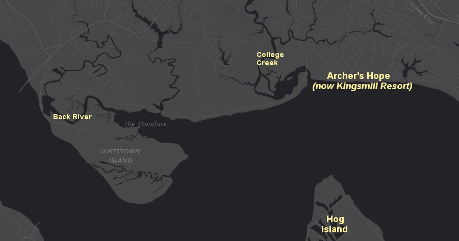
Gabriel Archer proposed locating Jamestown on land just east of what is known today as College Creek; Kingsmill Resort occupies the site now
Source: ESRI, ArcGIS Online
A day later Edward Maria Wingfield was elected President of the Council. Wingfield probably asserted authority as the only investor in the Virginia Company of London to travel to Virginia, and as the recruiter of 40% of the colonists who arrived in 1607. Wingfield believed that his rejection of Gabriel Archer's preferred location for the town was a key reason the Council removed Wingfield from his office as President and imprisoned him for four months, starting in September 1607.
Another factor would have been the imminent collapse of the colony. By September 10, 1607, 46 of the 104 colonists were dead due to disease and Native American attacks, and food supplies were low. The Virginia Company had relied upon the experience of Spanish colonies and the Roanoke settlements in the 1580's, and had planned to acquire food from the "naturals" in exchange for copper, glass beads, and other trade items.
By September 1607, it was becoming clear that Wahunsenacawh/Powhatan was a skilled diplomat as well as the leader of powerful military forces. He limited access to food, and the Council finally decided that new leadership was needed in Jamestown to counter Wahunsenacawh/Powhatan and perpetuate the colony. Wingfield was deposed on Sptember 10, 1607 and imprisoned. He eventually left the colony in April 1609 on Captain Christopher Newport's ship, after it brought more supplies.
Gabriel Archer had been part of the leadership that removed Wingfield. He stayed in Virginia as the recorder of the colony, but died in 1609-10 during the Starving Time. In 2015, archeologists excavated his skeleton from its burial site in the 1608 church. He was buried in a place of honor, though he may have secretly been a Catholic.6
Archer's preferred location for the colony would not have provided the same level of convenience or security as the site finally chosen. The James River channel was deep enough at the north end of the island for ocean-going ships to dock at the riverbank, eliminating any need to ferry goods from ship to shore on smaller boats. The fort built in 1607 was built slightly downstream of where the ships docked and about 100 yards from the shoreline.
The colonists may have grumbled about carrying everything between the ships and the fort, but the military advantages of the fort's location were obvious to people of that time. It was built at a site where Spanish/French/Dutch warships would have to sail further away from the riverbank; enemies would not be able to sail close to shore and bombard the English at point-blank range.
Most ships that arrived at Jamestown during the first three years, outside of local trips by the colony's Discovery, came with the First Supply and Second Supply in 1608 and the Third Supply in 1609. Carrying substantial amounts of cargo from ship to fort was a rare event.7
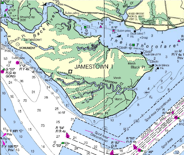
modern navigation chart showing river channel at Jamestown Island
Source: National Oceanic and Atmospheric Administration, Office of Coast Survey, Chart 12248
Most importantly, however, the island was far enough inland that any Spanish/French/Dutch ships would be spotted before they could reach Jamestown. As arriving enemy ships tacked back and forth to sail up the narrow river, the English would have time to prepare for defense and use gunfire effectively from the shoreline to attack the enemy ships ("beat them with your muskets") as they tacked back and forth in the narrow portion of the river.
There were clear alternatives to Jamestown. The Elizabeth River offered an excellent harbor (it is currently home to the US Atlantic Fleet at Naval Station Norfolk), but that site was too close to the Atlantic Ocean and at risk of enemy attack with minimal warning.
The English colonists could have settled further upstream than Jamestown. Their ships in 1607 were shallow draft. They would float in just a few feet of water, and the James River was easily navigated upstream to the Fall Line. The ships used by the English to sail across the Atlantic Ocean appear ridiculously small to modern viewers. Visitors to the Jamestown Settlement re-creation discover that the Discovery was the size of a modern school bus, and 21 people lived together in that small space for four months while crossing the Atlantic Ocean from London to Virginia.8
the ocean-going ships sailing to Jamestown in 1607 were tiny and crowded, so the colonists must have welcomed the opportunity to shift to a settlement on land at Jamestown
Map Source: National Park Service, What Happened to the Three Ships?
After the colonists chose to occupy Jamestown Island, Christopher Newport sailed up the James River and discovered the falls at the current location of Richmond. There he placed another cross, as the English had done at Cape Henry on April 29.
The Fall Line was as far as ships could go, but there was no obvious reason for the colonists to settle that far upstream. Transatlantic shipping would be the lifeline for the new colony to receive supplies and reinforcements; Richmond would not be founded until over a century later.
Wherever they chose to settle, the English in 1607 were far better prepared for a long-term occupation than Father Segura and the Spanish missionaries when they landed nearby in 1570. The Jamestown settlement depended upon resupply from England so it was located as close to the Atlantic Ocean as the initial colonial leaders thought was safe. Ships could sail further upstream from Jamestown Island but that site balanced military security with the logistics of getting back and forth to England.
Just as Goldilocks in "The Story of the Three Bears" preferred porridge that was not too hot and not too cold, Jamestown Island was not too close to the ocean and not too far from the ocean. It was a just-right compromise location.
Some members of the Virginia Company may have anticipated using Jamestown as the base for seizing Spanish ships and generating quick profits, but settling so far upstream limited the potential for Jamestown to become a refuge or launching pad for pirates. As was demonstrated in 1619, when the Treasure and White Lion brought cargo stolen from a ship sailing to Mexico and initiated the slave trade to Virginia, Hampton was a better location for a pirate base.
Edward Maria Wingfield chose the specific location of Jamestown based on instructions from the Virginia Company in London
Map Source: ESRI, GIS Online
Jamestown was an international shipping point from the beginning in 1607, but the delivery of supplies from England was not always synchronized with colonial needs. The Virginia Company thought the colonists could trade with the Native Americans to meet basic needs, and the company lacked the capital to send multiple expeditions each year across the ocean just to ensure the colonists had enough food.
The initial years at Jamestown were rough. With 20-20 hindsight, we know that the English needed more farmers willing to labor in growing food, and fewer gentlemen interested in adventure and treasure hunting without having to get their hands dirty in Virginia soil. Also, the island lacked fresh water springs, one reason the Pasapahegh had chosen to live elsewhere.
In April, the runoff from upstream is powerful enough to push fresh water on the surface of the James River from the Fall Line all the way downstream to Jamestown Island. In the summer, and especially during the severe drought that affected the area during the early 1600's, the flow of fresh water slacks off and the boundary line in the James River between fresh/brackish water moves upstream past the island. The first colonists may have been sickened by drinking brackish water and suffered chronic salt poisoning until John Smith ordered a well to be dug in 1608.9
The Virginia Company was more prepared in 1607 to fund regular resupply missions to Jamestown than Sir Walter Ralegh could finance for his Roanoke colonies in the 1580's; there were multiple shareholders in the joint stock company. However, it remained undercapitalized and unprofitable until being dissolved in 1624.
Trade with the Algonquian-speaking tribes provided an intermittent but unreliable source of corn and deer meat. Colonists started to die from disease during the first summer. Right after the First Supply ships arrived in January 1608, Jamestown was destroyed by fire. It was rebuilt, but conflicts within the colony's leadership and with the local Native Americans prevented acquisition of a reliable food supply.
New leadership was sent with additional supplies and colonists in the 1609 Third Supply. Most of the eight ships in that convoy arrived in August, 1609, but the 300 new settlers arrived after the planting season, and the colonists in Virginia did not have adequate supplies to feed the additional mouths.
The Sea Venture did not manage to complete the journey across the Atlantic Ocean. That ship, with the new governor Sir Thomas Gates, was wrecked at Bermuda.
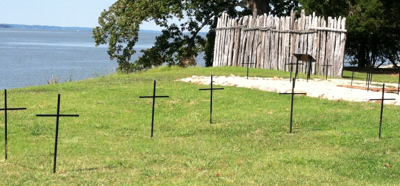
gravesites of settlers who died in first years at Jamestown, buried inside the walls of the fort to disguise the deaths from local Algonquians
The Third Supply ships that did arrive did not carry enough food to feed those additional colonists through the winter until new crops would ripen in 1610, and that was of greater significance than the absence of Sir Thomas Gates. The winter of 1609-10 ended up being the "Starving Time," when the majority of the colonists at Jamestown died. Contemporary records report that one person even killed and ate his wife, after "powdering" the meat with salty-tasting gunpowder. Cannibalism is also documented by the bones of a 14-year old girl, excavated in 2012. Analysis at the Smithsonian Institution showed that her body was carved up by someone wielding a knife with their right hand.10
The 1606 instructions directed that the first English town be located where ships could arrive easily, but at a site that could be defended against attack. The Virginia Company in London knew that at the beginning, Jamestown would not be a self-sufficient community. It would be an isolated seaport at the end of the line for international trade, an outpost that required regular replenishment from Europe in its early years.
Resupply trips from Europe required 12-18 weeks, until the Virginia Company in London hired Samuel Argall. In 1609 he identified a route along the 30th parallel that required only nine weeks at sea and reduced the risk of landing on Spanish-controlled islands in the Caribbean.
The shorter route turned out to be key to the survival of Jamestown. Lord De La Warr used it when traveling to the colony in 1610, and arrived just in time to intercept the ships that were abandoning Jamestown completely after the "starving time" winter of 1609-1610. Had Lord De La Warr followed the traditional route used since Columbus in 1492, he would have found just an empty fort.11
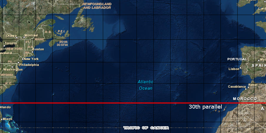
Samuel Argall determined that turning west at the 30th parallel, rather than sailing south to catch the westerly winds at the latitude of the Caribbean, would reduce the London-Jamestown travel time by up to 50%
Source: ESRI, GIS Online
Had Sir Thomas Gates arrived with the rest of the Third Supply in 1609, Lord De La Warr may have found the colony already gone from Jamestown. The Virginia Company in London concluded within a year that the location chosen by Edward Maria Wingfield in 1607 that was not defensible against an attach by Spanish, French, or Dutch ships that might maneuver upstream.
The instructions given to Gates in 1609 included directions to maintain Jamestown as a port of entry, but to shift most of the colonists to other locations that were more healthy - and more isolated, so attacking European forces would end up starving before the fortified English settlements would have to surrender:12
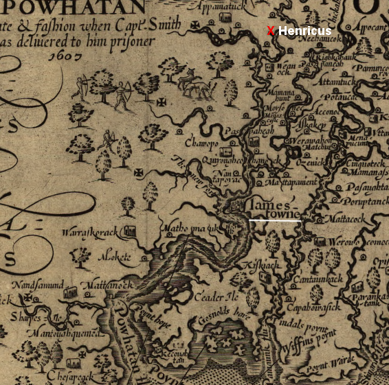
in 1611, Sir Thomas Dale located the second official Virginia Company settlement, Henricus, on a peninsula upstream from Jamestown
Source: Library of Congress, Virginia / discovered and discribed by Captayn John Smith, 1606
In 1611, Sir Thomas Dale started the new settlement at Henricus. It was more-defensible than Jamestown, located on a high bluff, but not isolated in the backcountry. Dale ignored the 1609 instructions to find an isolated location far from the water. He chose a peninsula along the river that could be easily fortified with a palisade, recognizing that the Native Americans posed a greater threat than any European country.
The danger was demonstrated clearly in 1622, when Henricus was destroyed in the uprising led by Powhatan's successor Opechancanough.
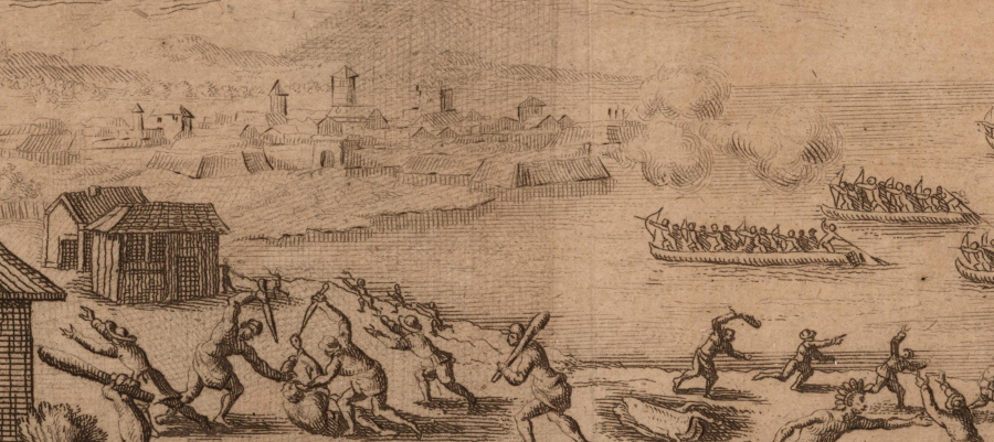
Jamestown was not attacked by Native Americans paddling across the James River during the first uprising led by Opechancanough in 1622, but European artists still included such an assault in their engravings
Source: Brown University, John Carter Brown Library, Massacre at Jamestown, Virginia, 1622
Today, the closest equivalent to Jamestown is Antarctica. Scientific facilities there are cut off from the rest of the world for several months a year. When humans colonize the moon and planets, or the seafloor, those new colonists will face a resupply a challenge not unlike what the English faced with Jamestown.
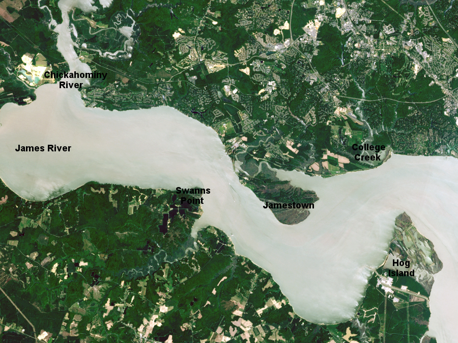
Jamestown is located upstream of Hog Island and downstream of the Chickahominy River
Source: National Aeronautics and Space Administration (NASA), Earth Observatory, Four Centuries at Jamestown, Virginia
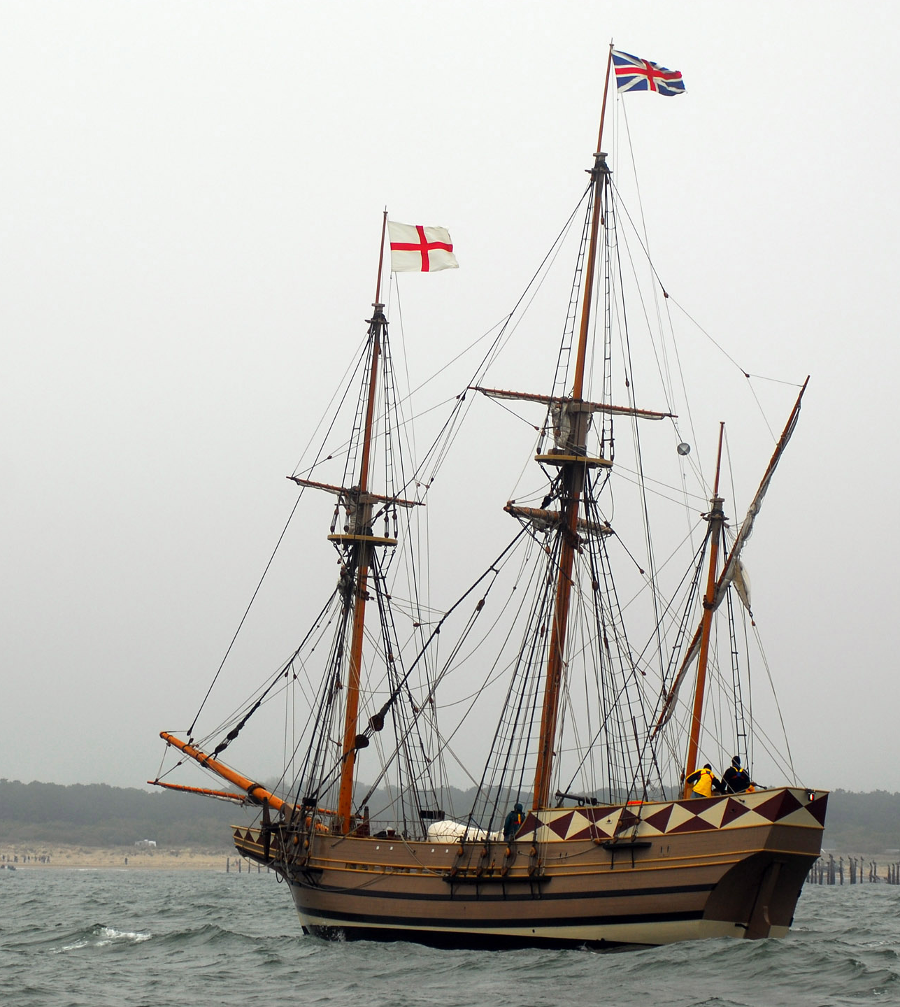
Jamestown was an international seaport, starting with the Susan Constant, Discovery, and Godspeed
Source: US Navy (070426-N-4515N-261)