Origin of Carolina Bays, Lake Drummond and Great Dismal Swamp
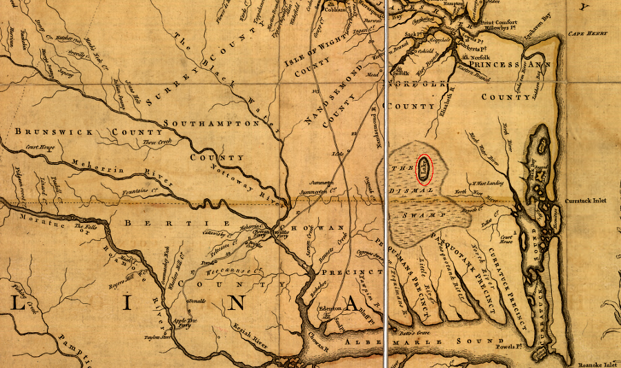
the 1755 Fry-Jefferson map of Virginia shows Lake Drummond, in the middle of the Dismal Swamp
Source: Library of Congress, A map of the most inhabited part of Virginia containing the whole province of Maryland with part of Pensilvania, New Jersey and North Carolina (by Joshua Fry and Peter Jefferson, 1755)
Lake Drummond is one of just two natural lakes in Virginia. It is not clear why either lake formed or persisted until today, when all other lakes in Virginia have been drained by erosion.
The other natural lake, Mountain Lake in Giles County, disappears at times. Mountain Lake may have formed on Salt Pond Mountain by eroding a basin into an unusual structure in the Clinch Sandstone formation. Cracks in the sandstone have formed a depression allowing water to seep underground, etching a lake basin in the bedrock. Intermittently, the cracks are opened (allowing Mountain Lake to drain and be replaced by a meadow) or blocked (causing the lake to reform).
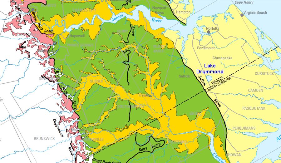
The creation of Lake Drummond is even more curious. Geologically, Lake Drummond is an unusually large (3,108 acre) open body of water on the Coastal Plain, east of the Suffolk Scarp. The scarp marks the location of the Atlantic Ocean shoreline and barrier islands roughly 125,000 years ago, comparable to Daytona Beach in Florida today. Temperatures were higher, the ice melted off the southern half of Greenland, and sea level was higher.1
Dismal Swamp drains to the north, east, and south, but the Suffolk Scarp blocks drainage to the west
Source: City of Chesapeake, Water Management at Great Dismal Swamp (by Frederic C. Wurster, July 27, 2017)
The scarp is used today as a dividing line to separate the Outer Coastal Plain (including Lake Drummond) vs. the Middle Coastal Plain west of the scarp. "Outer" is equivalent to "closer to the Atlantic Ocean." On the eastern side is the Hickory Scarp, marking another shoreline as sea levels dropped.
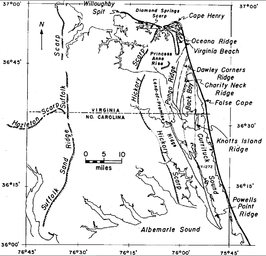
Lake Drummond is located between two scarps
Source: Virginia Division of Mineral Resources Bulletin 82, Post-Miocene Stratigraphy and Morphology, Southeastern Virginia (Figure 5)
The Suffolk Scarp is as much as 65' high, though the swamp starts on the eastern face at about 25' in elevation. It separates terraces of essentially flat sediments to the east and west.
west of Lake Drummond and the Suffolk Scarp, land elevations are higher
Source: US Geological Survey (USGS), Hydrologic Conditions and Simulation of Groundwater and Surface Water in the Great Dismal Swamp of Virginia and North Carolina (Figure 2)
To the east, the Norfolk Formation was deposited on top of the clay-rich Yorktown Formation, and the sandy sediments provide the groundwater recharge area for the Great Dismal Swamp National Wildlife Refuge.
Lake Drummond is located east of the Suffolk Scarp on the Coastal Plain, 18' above sea level
Source: US Geological Survey (USGS), A Surficial Hydrogeologic Framework for the Mid-Atlantic Coastal Plain (Plate 1)
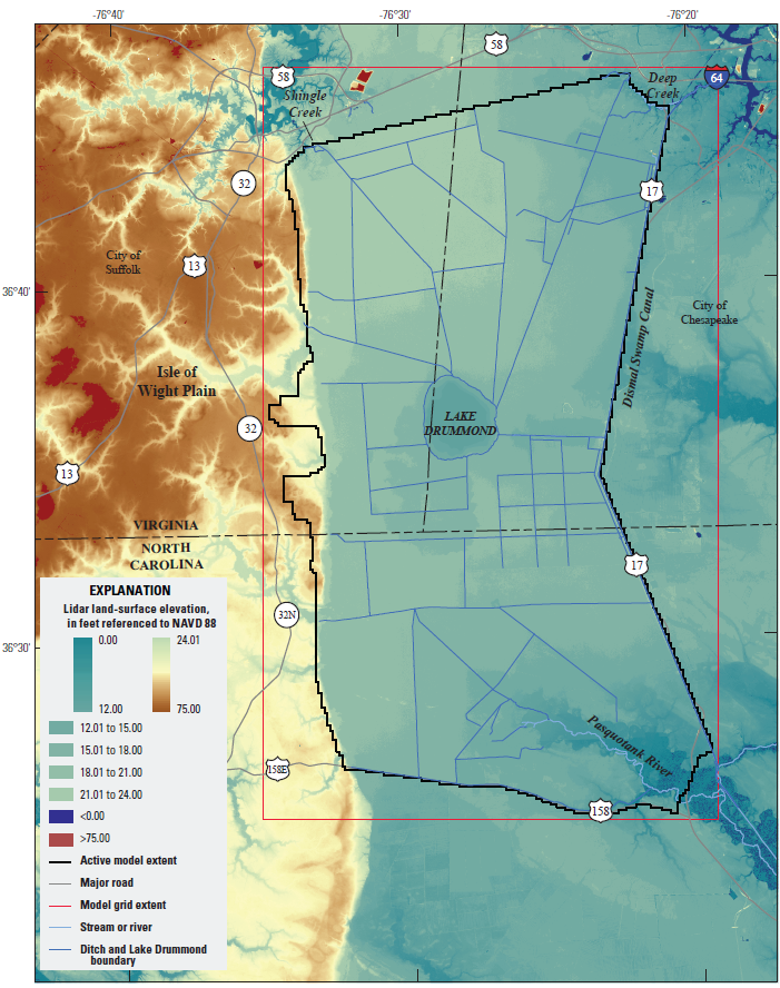
At normal water levels, the lake is 6-7 feet deep and the surface is 18 feet above sea level. There is little topographic relief in the area, with the tops of hummocks only about three feet above water level. Elevation drops at one foot per mile near the lake. The highest portion of the swamp, over 25 feet in elevation, is on the western side of the swamp near the Suffolk Scarp. The swamp tilts down to the east, and the lowest part near the Fentress Rise is about 10 feet in elevation. Drainage out of the swamp reaches sea level at Deep Creek and the Pasquotank River.2
There's no obvious reason for one big lake to exist in the middle of the Great Dismal Swamp, which extended all the way to Back Bay/Albemarle Sound in the colonial era. There is no network of streams draining a watershed upstream and emptying into the lake. Lake Drummond is in the middle of the remnants of the swamp, in no obvious swale.
Ditches - including some dug during the time when Virginia was a colony, such as "Washington Ditch" initiated in the 1760's - are supplied naturally with water that drains by gravity out of the lake. When lake level drops to 15.75 feet, the U.S. Army Corps of Engineers stops releasing water from Lake Drummond to supply the Dismal Swamp Canal.
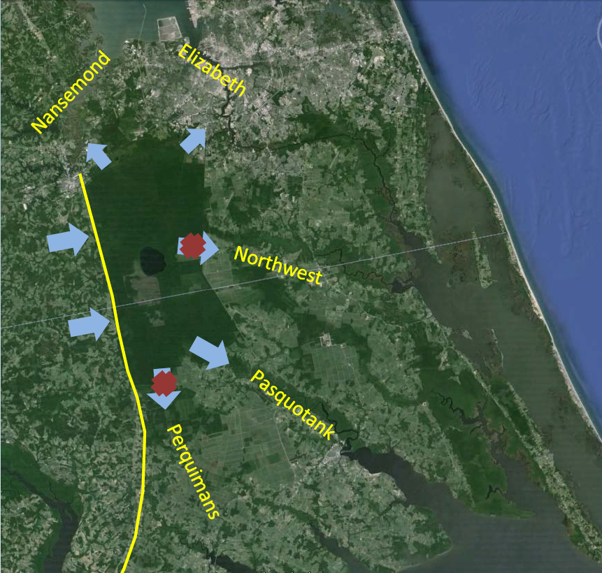
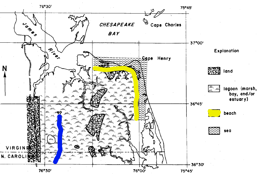
Until 9,000 years ago, the area was drained by a dendritic pattern of streams. The peat accumulated first in the stream valleys, so the ancient drainage patterns are revealed by the places with the deepest peat today. The northern part of what is now the swamp drained into the Northwest River. The southern part drained into the Pasquotank River.
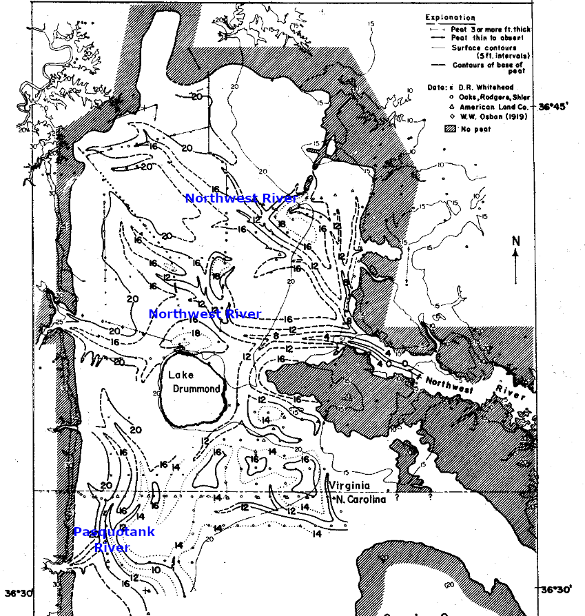
depth of peat shows drainage channels before formation of the Great Dismal Swamp and Lake Drummond
Source: Virginia Division of Mineral Resources Bulletin 82, Post-Miocene Stratigraphy and Morphology, Southeastern Virginia (Figure 33)
Plants grew and died, and began to replace themselves faster than they decayed. As organic material accumulated, their debris blocked streams. Slower-moving streams allowed even more material to accumulate, ultimately building a layer of "peat" as much as 12' thick in places. One research project concluded that peat accumulated at the rate of one foot per century. Natural fires would remove the top layer of organic material, then vegetation would regrow and the cycle would start again. A 1930 fire may have burned through six feet of accumulated peat in the northeastern corner of the swamp.
Perhaps 50% of the swamp had developed between 9,000-6,000 years ago. Rate of formation slowed during a warm period, but the swamp reached its full extent by 3,500 years ago. As summarized by the US Fish and Wildlife Service:3
- The Great Dismal Swamp is less than 9,000 years old; it was formed on a hillside instead of a basin and without the benefit of rivers flowing into or beside it.
The origin of the swamp dates back to the end of the last Ice Age. Spruce-pine forests covered the area when the first Native Americans arrived. Sea level was 400' lower and the coastline was 40 miles to the east. As the climate warmed, sea levels rose and beech, hemlock, and birch became common. Warmer temperatures led to a forest of hardwood species, including oaks and hickories. The last tree species to dominate the area were cypress, cedar, and gum, species willing to tolerate high water levels.
Marshes developed along the coastline, behind the barrier islands. Plants grew in inland marshes, west of the beach, and organic material was formed by photosynthesis faster than it decayed. Some of the first peat was deposited when the water was brackish:4
- Evidence indicates that the Dismal Swamp first began to develop along streams 11,000 to 12,000 years ago. A previous ice advance had left the area with characteristic boreal vegetation of jack pines and spruces. Over a period of 3,000 to 4,000 years the boreal vegetation was replaced by northern hardwood species that, in turn, was replaced by oaks, hickories, and other endemic southeastern species.
- The swamp gradually expanded westward along watercourses and peat began to accumulate. By 3,500 years ago, peat had blanketed the present-day Dismal Swamp, the water regime was saturated, and the oak-hickory forest was replaced by a cypress-gum swamp.
Where water levels stayed high for a longer hydroperiod, a "gum swamp" forest developed. Dominant species were black gum, red maple, and bald cypress. In areas with a shorter hydroperiod, a "light swamp" evolved with Atlantic White Cedar as the dominant species. Where the cedar burned, it was replaced by a dense a shrub-dominated community. Explorers had to fight through a tangle of sweet bay and vines of laurel-leaved brier. In what is now Dismal Swamp State Park in North Carolina, hardwoods have invaded the pocosins and replaced cedar forests.
On the periphery of the swamp, sweet gum, oaks, and hickories are particularly common. Loblobby and Virginia pine are the pioneer species that establish the initial forest after a fire.5
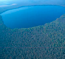
Lake Drummond
Source: US Fish and Wildlife Service
Geologically, the swamp and lake formed on top of coarse sand that is very permeable, but with layers of clay and silt that block water flow and infiltration into the sedimentary formations that underly the swamp. The "terrace" east of the Suffolk Swamp was formed as shoreline, barrier islands, and bottom of the Atlantic Ocean. The scarp marks the location of an ancient line of dunes and barrier islands.
the Suffolk Scarp is an old beach, with marine sediments deposited to the east underneath today's Dismal Swamp
Source: Virginia Division of Mineral Resources Bulletin 82, Post-Miocene Stratigraphy and Morphology, Southeastern Virginia (Figure 23)
The Miocene-age sediments consist of layers deposited when sea level rose, barrier islands formed, and southeastern Virginia was underwater. At times the water was the Atlantic Ocean; at other times, lagoons at the edge of the shoreline. Most sediments were deposited when the water was brackish, rather than fresh, and accumulated long before any peat was formed in the current swamp.
Below the organic layer of peat which has accumulated at the surface is the Sandbridge Formation, with upper layer of silty clay and a lower layer of sand. It is the most recent deposit of marine sediments. Local geology reveals:6
- a complex series of marine, barrier, and lagoonal sediments, indicating as many as five transgressions, all possibly occurring during the Sangamon interglacial.
Sussex Scarp is east of Suffolk Scarp. Even older scarps and sediments were washed away or reworked by more recent changes in sea level. Current topography reveals cycles of sea level dropping, after which another line of dunes and barrier islands formed to the east. What today is Hickory Scarp blocked water from flowing in deep channels to the ocean.
when Hickory Scarp formed, sea level was 20' higher than today and peat deposits to the west accumulated in the Great Dismal Swamp
Source: Virginia Division of Mineral Resources Bulletin 82, Post-Miocene Stratigraphy and Morphology, Southeastern Virginia (Figure 25)
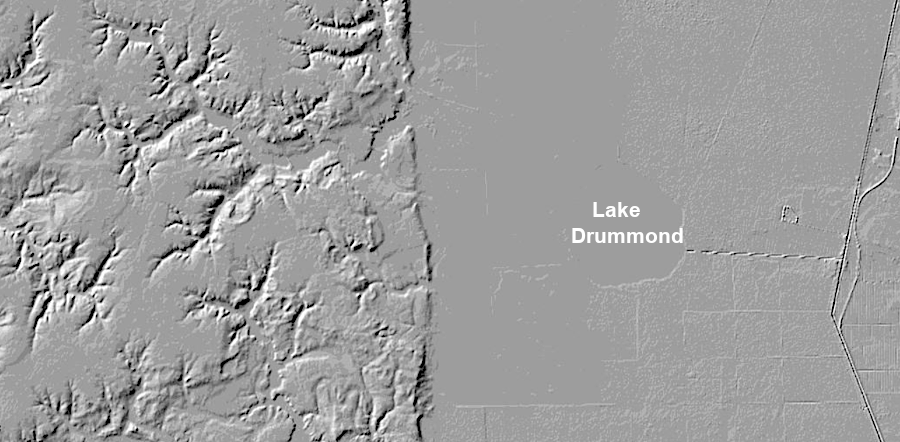
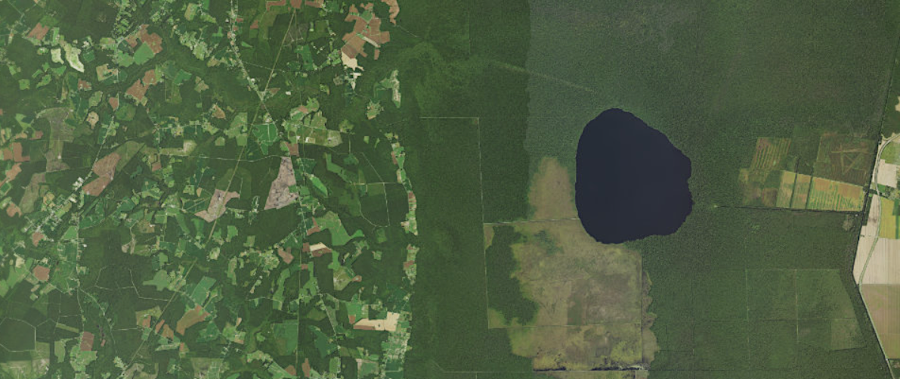
Lake Drummond is located east of the Suffolk Scarp
Source: US Geological Survey (USGS), The National Map
Sea level later rose to 24 feet above the present, re-flooding the area with salty water. What today is the Dismal Swamp was a shallow lagoon with at least one oyster reef. At that time, the London Bridge Formation was deposited. It lies below the more-recent Sandbridge Formation. The London Bridge Formation is mostly clay silt deposited when the ancestral Roanoke, James and Susquehannna rivers reached sea level. The river currents slowed, and sediments they had carried from as far away as the Blue Ridge settled to the bottom of lagoons.
Below the London Bridge Formation, meaning it is an even older deposit, is a series of layers of sand and silt called the Norfolk Formation. The Norfolk Formation is exposed on the surface today west of the swamp at the Suffolk Scarp:7
- This is the groundwater recharge area for the aquifer... Groundwater input from the Norfolk Formation accounts for the majority of water that upwells in the swamp.
sea level was 24' higher than today and an oyster reef existed (blue line) when the London Bridge Formation was deposited in lagoons
Source: Virginia Division of Mineral Resources Bulletin 82, Post-Miocene Stratigraphy and Morphology, Southeastern Virginia (Figure 28)
Okefenokee Swamp, the largest swamp in North America, also formed after the Ice Age as barrier islands created lagoons which accumulated peat. Karst formation in the limestone bedrock there may also have created low spots, a process that did not shape development of the Great Dismal Swamp in Virginia. There is no equivalent to Lake Drummond in the Georgia swamp.
Lake Okeechobee in Florida, like Lake Drummond, formed after the Ice Age as sea level rose. Lake Okeechobee was originally part of a depressed trough in limestone, where fresh water "leaked" from the underlying aquifer and reached the surface. Marshes created peat deposits on top of the southern end of the trough, blocking the flow from the aquifer and creating the Everglades. Lake Okeechobee is a remnant of the trough, and the modern version is diked and managed by the US Army Corps of Engineers.8
One possible way Lake Drummond was formed: a natural fire could have burned a "hole" in the peat of the Great Dismal Swamp. In 2011, during a severe drought, one of the largest wildfires in the modern history of Virginia burned over 6,000 acres of the swamp. The "Great Conflagration" of 1923-26 was probably even more significant.9
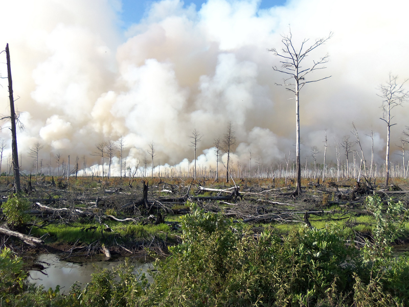
Dismal Swamp on fire, 2011
Source: US Fish and Wildlife Service (Mike Petruncio/North Carolina Forest Service)
Lake Drummond is relatively recent. Perhaps 6,000 years ago, when the peat layer was thinner, a lightning strike may have triggered a fire that burned hot enough to reach all the way down to the confining clay layer, the "aquiclude" that keeps the water in the swamp from draining into the sand underneath. Such a fire could have carved out a bowl within the peat, creating a hole that developed into Lake Drummond.10

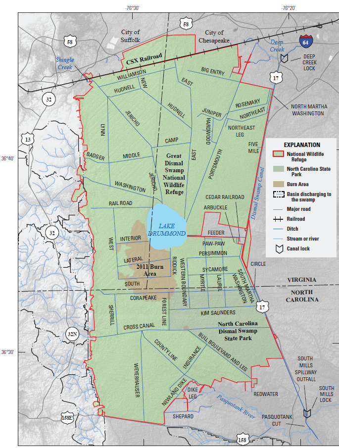
ditches drain Lake Drummond, especially Feeder Ditch connecting the lake to the Dismal Swamp Canal at Arbuckle Landing
Source: US Geological Survey (USGS), Lake Drummond 7.5x7.x topographic map (2011)
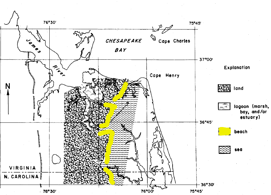
Another possibility: Lake Drummond resembles may other elliptical "bays" or small lakes on the Coastal Plain of the Eastern United States, from Florida to New Jersey, with a southeast-northwest orientation. They appear to have formed naturally in the Pleistocene as the climate changed, comparable to the formation of modern lakes on the Arctic Coastal Plain. Lake Drummond may have started as a Carolina bay, then been deepened by a wildfire that cut through the peat on the bottom.
The elliptical pattern of Carolina bays was caused, most likely, by winds blowing from the southwest. Water blown by steady winds during the last 50,000 years ago formed sand ridges around the edge of the lakes. The Carolina bays are thermokarst features, created when the climate was different by cold winds blowing water and sediments across the Coastal Plain during the Ice Age. As rainfall increased in the last 20,000 years, lakes and wetlands formed within the interior of some bays. Ridges as well as lake bottoms have been vegetated.11
An extraterrestrial cause for the creation of Lake Drummond and other Carolina bays has been disproven. The bays were not formed by a shower of meteorites, or by an icy comet/meteor ("bolide") that broke up in the atmosphere and peppered the Coastal Plain. Lake Drummond was not formed by a dying comet.
On average, 500 meteorites reach the Earth's surface after surviving the trip through the atmosphere. Most are small fragments that do not form an impact crater, and the craters that do form are circular rather than elliptical like Carolina bays.
One of the strongest pieces of evidence that the bays are not impact craters is:12
- The stratigraphy below each bay is intact. It would be shattered if the bay were an impact crater.
Meteorite fragments are rare in the area, which would be expected if the lake was a meteor crater. Nowhere else on earth is there evidence of a cascade of meteorites which would create craters capable of surviving natural erosion for 6,000 years. The theory of extraterrestrial formation, now disproven, included a speculation that comet exploded above the surface of the earth and shock waves carved out the initial depressions, perhaps during the Younger Dryas period of global cooling 12,800 years ago.
The "created by impact" theory assumed that fragmentation of an extra-terrestrial comet in the atmosphere created the regular pattern of the ellipses and their large number (roughly 500,000). Because of their icy composition, comets leave no trail of "meteorites" to record their impact or disintegration in the lower atmosphere. Iron-rich meteorite fragments were absent because, according to the theory, the Carolina bays were excavated by fragments of ice.
However, impacts powerful enough to create craters would also disrupt the sediments underneath the bottom of the crater. Winds, on the other hand, have the capacity to disturb surface sediments and create the rims of Carolina bays without affecting the soft sedimentary layers underneath crater bottoms.13
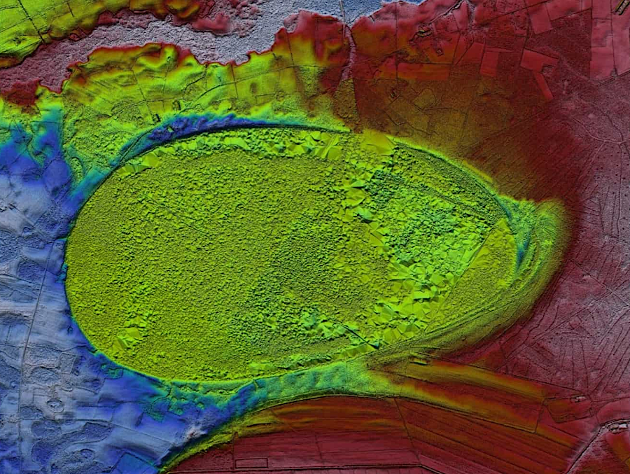
Carolina Bays are ellipical thermokarst features formed by wind, not circular impact craters
Source: Wikipedia, Woods Bay State Park
Though Lake Drummond is surrounded by a wildlife refuge and far from modern development, the water is still listed as "impaired." Two pollutants placed it on the 2020 305(b)/303(d) Water Quality Assessment Integrated Report (the "Dirty Waters List") issued by the Virginia Department of Environmental Quality (DEQ). Excessive levels of mercury, probably deposited from raindrops passing through polluted air, were found in fish tissue samples.
The lake was "Not Supporting" for aquatic life due to high pH levels noted in 100% of observations. Those levels were thought be natural:14
- Aquatic Life Use is impaired for pH values. Pooled pH violation rate is 100% (97 violates/ 97 obs) and is thought to be the result of naturally occurring organic acids.
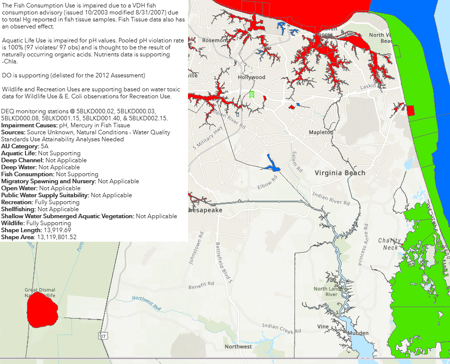
water quality in Lake Drummond is impaired due to naturally high pH levels caused by decay of organic debris
Source: Virginia Department of Environmental Quality (DEQ), Environmental Data Mapper (2024)
Links
- Digital Atlas Project
- Geology Of The Upland Gravels Near Midlothian, Virginia, by Bruce K. Goodwin and Gerald H. Johnson, prepared for the Eleventh Annual Field Conference of the Atlantic Coastal Plain Geological Association (October 17 and 18, 1970)
- Great Dismal Swamp Megasite
- National Aeronautics and Space Administration (NASA)
- Science On a Sphere
- US Fish and Wildlife Service
- US Geological Survey
- The Virginian-Pilot
Lake Drummond is completely within Virginia, but the Great Dismal Swamp is in both Virginia and North Carolina
Source: North Carolina Collection at the University of North Carolina at Chapel Hill, A Compleat map of North-Carolina from an actual survey (1770 map by John Collet)
References
1. "Extreme Ice," NOVA, Public Broadcasting System (PBS), March 24, 2009, https://www.pbs.org/wgbh/nova/video/extreme-ice/; Joseph A. DiPietro, Geology and Landscape Evolution: General Principles Applied to the United States, Elsevier, 2018, p.208, https://books.google.com/books?id=myk0DwAAQBAJ (last checked January 23, 2019)
2. "Great Dismal Swamp National Wildlife Refuge and Nansemond National Wildlife Refuge Final Comprehensive Conservation Plan," US Fish and Wildlife Service, July 2006, p.36, p.44, http://library.fws.gov/CCPs/GDS/greatdismalswamp06.pdf; Jack R. Eggleston, Jeremy D. Decker, Jason S. Finkelstein, Frederic C. Wurster, Paul E. Misut, Luke P. Sturtevant, Gary K. Speiran, "Hydrologic Conditions and Simulation of Groundwater and Surface Water in the Great Dismal Swamp of Virginia and North Carolina," US Geological Survey, Scientific Investigations Report 2018 5056, 2018, p.4, https://pubs.usgs.gov/sir/2018/5056/sir20185056.pdf (last checked January 23, 2019)
3. "Great Dismal Swamp National Wildlife Refuge and Nansemond National Wildlife Refuge Final Comprehensive Conservation Plan," p.41, p.44; R.L. Phipps, D.L Ireley, C.P. Baker, "Tree Rings As Indicators Of Hydrologic Change In The Great Dismal Swamp, Virginia And North Carolina," U.S. Geological Survey Water-Resources Investigations 78-136, 1979, p.2, p.24, https://pubs.usgs.gov/wri/1978/0136/report.pdf; Donald R. Whitehead, "Developmental and Environmental History of the Dismal Swamp," Ecological Monographs, Vol. 42, No. 3 (Summer, 1972), pp.301-302, https://www.jstor.org/stable/1942212; Robert Q. Oaks Jr., Nicholas K. Coch, "Post-Miocene Stratigraphy and Morphology, Southeastern Virginia," Virginia Division of Mineral Resources Bulletin 82, 1973, p.104, https://www.dmme.virginia.gov/commercedocs/BUL_82.pdf (last checked January 21, 2019)
4. "Great Dismal Swamp National Wildlife Refuge and Nansemond National Wildlife Refuge Final Comprehensive Conservation Plan," p.60; Donald R. Whitehead, "Developmental and Environmental History of the Dismal Swamp," Ecological Monographs, Vol. 42, No. 3 (Summer, 1972), p.301, p.305, https://www.jstor.org/stable/1942212 (last checked January 21, 2019)
5. Donald R. Whitehead, "Developmental and Environmental History of the Dismal Swamp," Ecological Monographs, Vol. 42, No. 3 (Summer, 1972), p.304, https://www.jstor.org/stable/1942212; "Dismal Swamp State Park General Management Plan," North Carolina Department of Natural and Cultural Resources, May 2017, p.2, https://files.nc.gov/ncparks/481/DISW%20GMP%20FINAL%2006282017.pdf (last checked January 21, 2019)
6. Donald R. Whitehead, "Developmental and Environmental History of the Dismal Swamp," Ecological Monographs, Vol. 42, No. 3 (Summer, 1972), p.303, https://www.jstor.org/stable/1942212 (last checked January 21, 2019)
7. "Great Dismal Swamp National Wildlife Refuge and Nansemond National Wildlife Refuge Final Comprehensive Conservation Plan," pp.37-38; Robert Q. Oaks Jr., Nicholas K. Coch, "Post-Miocene Stratigraphy and Morphology, Southeastern Virginia," Virginia Division of Mineral Resources Bulletin 82, 1973, p.83, https://www.dmme.virginia.gov/commercedocs/BUL_82.pdf (last checked January 21, 2019)
8. Whit Gibbons, "Natural History of the Okefenokee Swamp," New Georgia Encyclopedia, July 26, 2017 https://www.georgiaencyclopedia.org/articles/geography-environment/natural-history-okefenokee-swamp;
Fred K. Parrish, Edward J. Rykiel, Jr., "Okefenokee Swamp Origin: Review and Reconsideration," Journal of the Elisha Mitchell Scientific Society, Volume 95, Number 1 (Spring 1979), https://www.jstor.org/stable/24333260; "The Geological and Ecological History of the Okefenokee Swamp (Part One)," Georgia Before People, November 19, 2010, https://markgelbart.wordpress.com/2010/11/19/the-geological-and-ecological-history-of-the-okenfenokee-swamp-part-one/; "Lake Okeechobee Geology," AccessGenealogy, September 21, 2016, https://www.accessgenealogy.com/florida/lake-okeechobee-geology.htm (last checked January 23, 2019)
9. "The Great Dismal Swamp a year after the fire," Chicago Tribune, August 4, 2012,
http://www.chicagotribune.com/news/dp-nws-great-dismal-swamp-20120804,0,6818233,full.story; "Great Dismal Swamp wildfire still burning after more than 2 months," The Washington Post, October 6, 2011, http://www.washingtonpost.com/national/health-science/2011/10/05/gIQALlJYRL_story.html (last checked September 9, 2012)
10. Donald R. Whitehead, "Developmental and Environmental History of the Dismal Swamp," Ecological Monographs, Vol. 42, No. 3 (Summer, 1972), pp.313-314, https://www.jstor.org/stable/1942212 (last checked January 21, 2019)
11. Robert E. Carvera, George A. Brook, "Late pleistocene paleowind directions, Atlantic Coastal Plain, U.S.A," Palaeogeography, Palaeoclimatology, Palaeoecology, Volume 74, Issues 3-4 (30 November 1989), http://dx.doi.org/10.1016/0031-0182(89)90061-8; Christopher R. Moore, Mark Brooks, David Mallinson, Peter Robertson Parham, Andrew Ivester, James K. Feathers, "The Quaternary evolution of Herndon Bay, a Carolina Bay on the Coastal Plain of North Carolina (USA): implications for paleoclimate and oriented lake genesis," Southeastern Geology Volume 51, Number 4 (March 2016), https://www.researchgate.net/publication/297716466_The_Quaternary_evolution_of_Herndon_Bay_a_Carolina_Bay_on_the_Coastal_Plain_of_North_Carolina_USA_implications_for_paleoclimate_and_oriented_lake_genesis/citations;' Mark Lundine,
Arthur Trembanis, "Investigating the origin and dynamics of Carolina Bays," Marine Geology, Volume 480, February 2025, https://doi.org/10.1016/j.margeo.2024.107449 (last checked March 22, 2026)
12. "Researchers have taught a drone to recognize and hunt down meteorites autonomously," Phys.org, July 9, 2021, https://phys.org/news/2021-07-taught-drone-meteorites-autonomously.html; "Caolina Bay Structure," Crater Explorer, https://craterexplorer.ca/carolina-bays-structure/; "The Enigmatic Carolina bays," Cintos, https://cintos.org/CarolinaBays/index.html (last checked December 30, 2023)
13. James H. Wittke, James C. Weaver, Ted E. Bunch, James P. Kennett, Douglas J. Kennett, Andrew M. T. Moore, Gordon C. Hillman, Kenneth B. Tankersley, Albert C. Goodyear, Christopher R. Moore, I. Randolph Daniel, Jr., Jack H. Ray, Neal H. Lopinot, David Ferraro, Isabel Israde-Alcantara, James L. Bischoff, Paul S. DeCarli, Robert E. Hermes, Johan B. Kloosterman, Zsolt Revay, George A. Howard, David R. Kimbel, Gunther Kletetschka, Ladislav Nabelek, Carl P. Lipo, Sachiko Sakai, Allen West, and Richard B. Firestone, "Evidence for deposition of 10 million tonnes of impact spherules across four continents 12,800 y ago," Proceedings of the National Academy of Sciences (PNAS), published ahead of print May 20, 2013, http://dx.doi.org/10.1073/pnas.1301760110; J. Ronald Eyton, Judith I. Parkhurst, "A Re-Evaluation Of The Extraterrestrial Origin Of The Carolina Bays," April 1975, http://abob.libs.uga.edu/bobk/cbayint.html; Michael Davias, "Correlating the Orientation of Carolina bays to a Cosmic Impact," http://cintos.org/SaginawManifold/introduction/index.html; Christopher Swezey, "Carolina Bays of the U.S. Atlantic Coastal Plain Are Relict Thermokarst Lakes That Formed Episodically During the Last Glaciation," 67th Annual Southeastern GSA Section Meeting, 2018, https://www.doi.org/10.1130/abs/2018SE-310370 (last checked December 30, 2023)
14. "2020 Reservoirs (Any Use): Lake Drummond," Environmental Data Mapper, Virginia Department of Environmental Quality, https://apps.deq.virginia.gov/EDM/ (last checked August 18, 2021)
the Great Dismal Swamp today is about 50% of its original size
Source: US Geological Survey (USGS), Hydrologic Conditions and Simulation of Groundwater and Surface Water in the Great Dismal Swamp of Virginia and North Carolina (Figure 10)
Rivers and Watersheds
Virginia Places