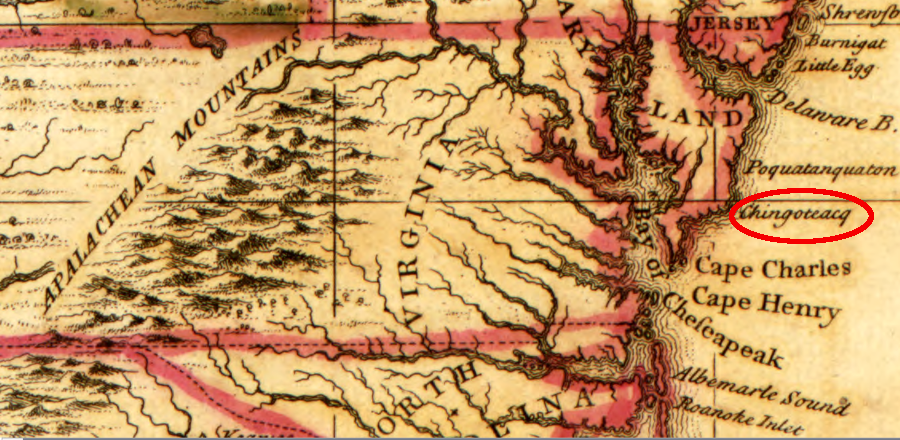
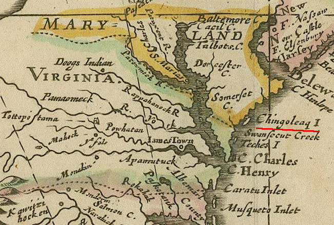
Henry Popple failed to portray the Eastern Shore correctly in 1743, but did identify Chincoteague
Source: Library of Congress, A map of the British Empire in America with the French and Spanish settlements adjacent thereto (by Henry Popple, 1743)
Henry Popple failed to portray the Eastern Shore correctly in 1743, but did identify Chincoteague
Source: Library of Congress, A map of the British Empire in America with the French and Spanish settlements adjacent thereto (by Henry Popple, 1743)
An 1821 hurricane may have generated a storm surge, or perhaps even a tsunami after wave action generated an underwater landslide, that devastated Assateague and Chincoteague islands.
Residents reported that as the storm approached the coast from the southeast, the sea receded and exposed miles of ocean bottom. Soon afterward, a deep roar could be heard moments before a "monstrous wall of inky waters rushed with the speed of lightning toward the island." The wall of water struck Assateague first, decimating trees and anything else in its path, and then struck Chincoteague, carrying away men and ponies "like insects."
One man with his grandson clinging to his neck was reportedly swept far up on to the mainland six miles to the west. Another was found the next morning hanging in a pine tree by his waistband, twenty feet from the ground.1
The low-lying island is at high risk of flooding, particularly as land subsides and sea level rises. A nor'easter in 2022 triggered town officials to declare a state of emergency and call for a voluntary evacuation of the entire island. The Virginia Department of Transportation (VDOT) prepared to close the road on the causeway leading into town. The Chincoteague Emergency Management Department warned residents/visitors to fuel up vehicles, because gas pumps would not work if the island lost electricity.2
a Category 3 hurricane would flood most of Chincoteague Island under three feet of water
Source: First Street Foundation, FloodIQ
Today, Chincoteague economically benefits from its proximity to Wallops Island. Antares launches of resupply missions to the International Space Station bring tourists in the off-season. The general manager for Ropewalk Restaurant in Chincoteague reported in 2018:3
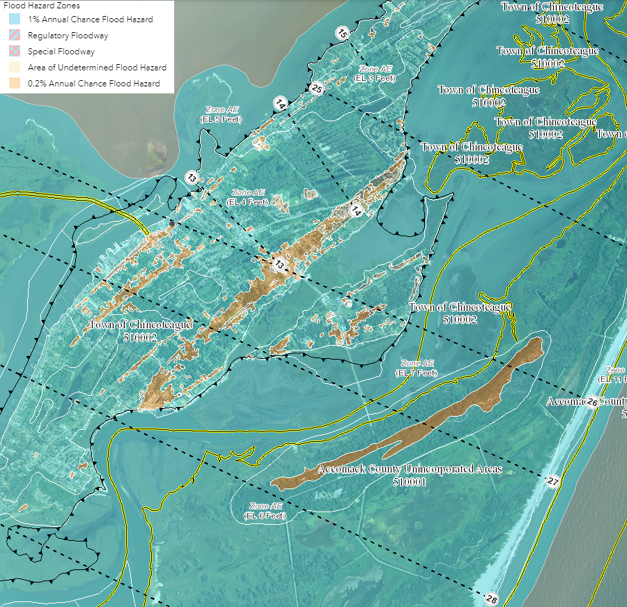
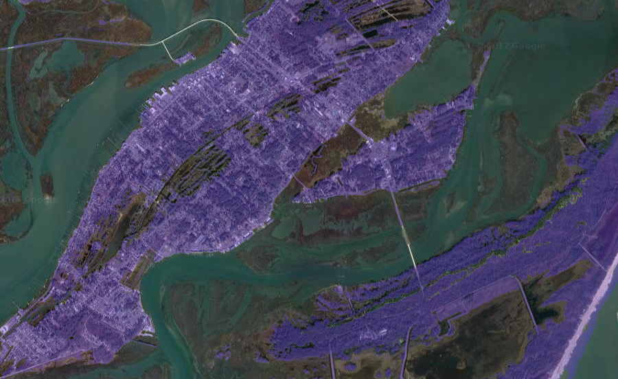
flooding risk at Chincoteague
Source: Federal Emergency Management Agency (FEMA), National Flood Hazard Layer (NFHL) Viewer
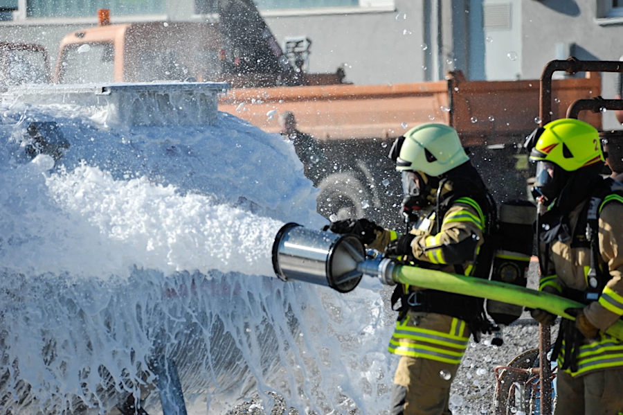
Chincoteague gets its drinking water from wells on the mainland at the Wallops Flight Facility of the National Aeronautics and Space Administration (NASA). The groundwater was contaminated with per- and polyfluoroalkyl substances (PFAS) from foam used in fire training activities in the late 1970's to 1988, and from Aqueous Film Forming Foam used in fighting a 1998 airplane crash. Perfluoroalkyl and polyfluoroalkyl substances are made artificially, and are so stable in the natural environment that they are known as "forever chemicals."
The Environmental Protection Agency (EPA) had issued nonbinding regulations of 70 parts per trillion combined for PFOS and PFOA exposure. Chincoteague's drinking water, coming primarily from shallow wells, exceeded the recommended thresholds. In 2023, the Environmental Protection Agency proposed a 4 parts per trillion threshold for perfluorooctanoic acid (PFOA) and perfluorooctanesulfonic acid (PFOS).
In 2017, the Wallops Flight Facility installed a groundwater treatment system using granular activated carbon (GAC) and supplemented the town supply from the facility's water system. Chincoteague completed a new deep well in 2021 and a new filtration system, and began using the town wells again as its source of drinking water. The $2.5 million water treatment system now detects less than one part per trillion of PFOA and PFOS, below the 4 parts per trillion threshold finally established by the Environmental Protection Agency.
Relocating the town's seven wells on the mainland was an option. Drilling new wells would be expensive, but an even greater cost could be constructing new transmission lines to connect them to the town. Town officials were pleased with the response from the National Aeronautics and Space Administration:4
PFAS from fire fighting foam contaminated drinking water wells at Wallops Flight Facility, forcing Chicoteague to drill a new deep well
Source: Defense Visual Information Distribution Bureau, Urlas Civilianl Firefighter II Training
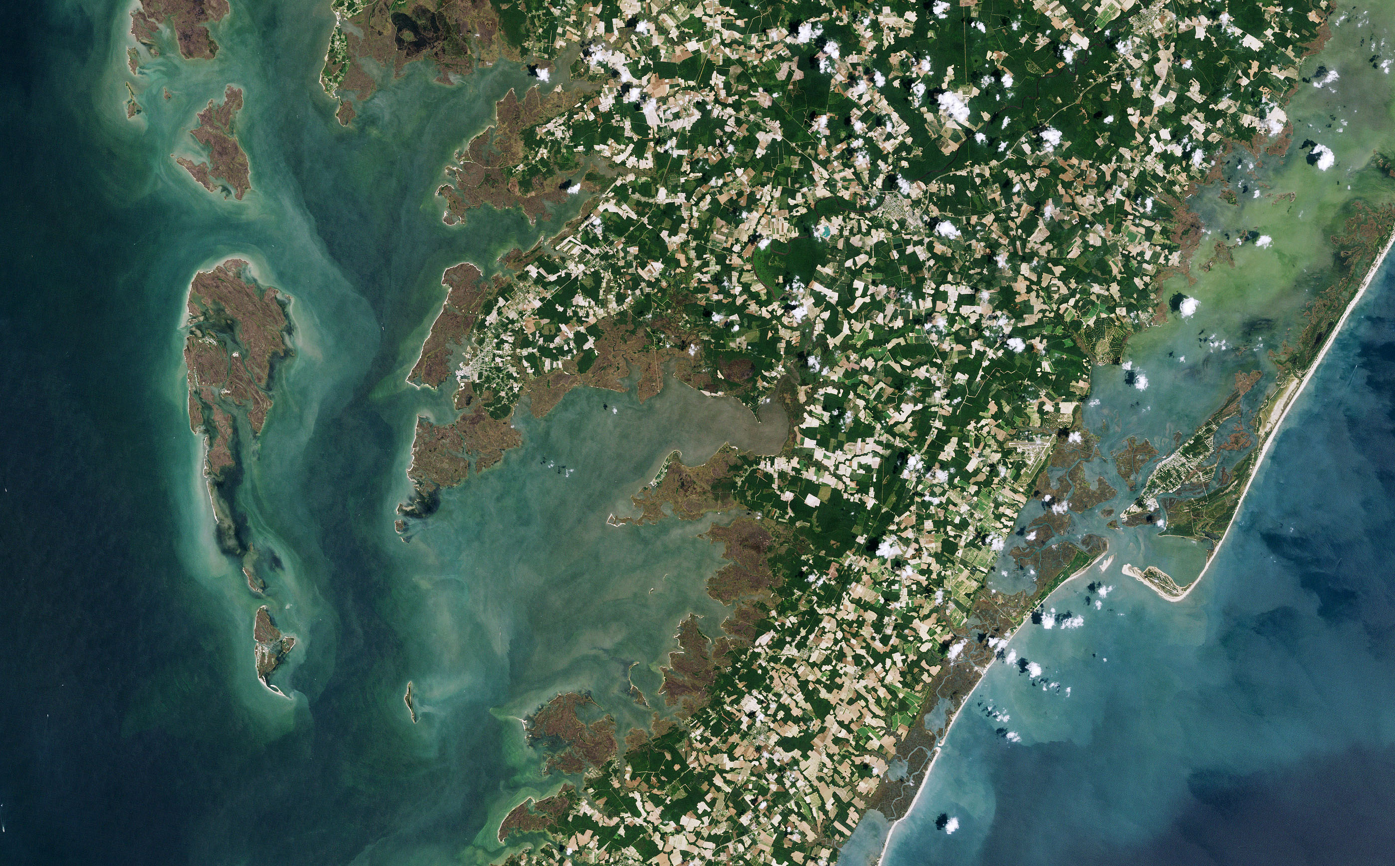
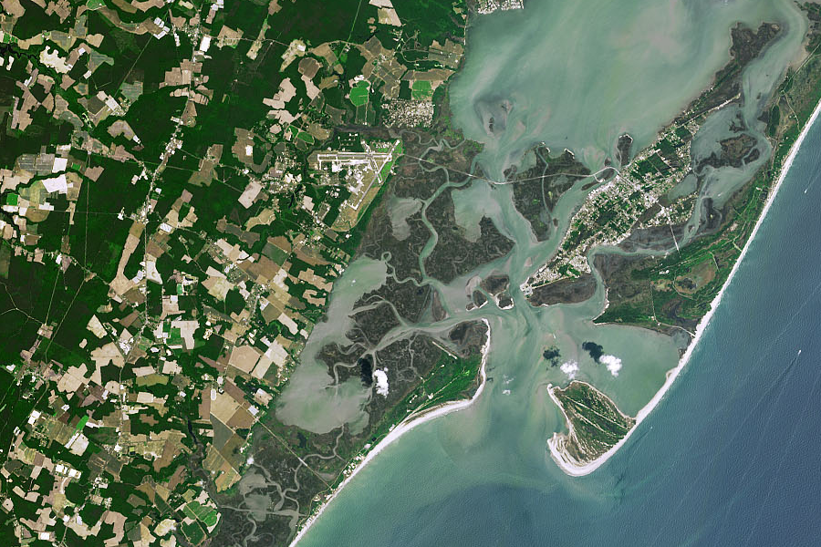
Chincoteague benefits from its proximity to Assateague Island. For the last 2,000 years, longshore currents have carried sand south and extended the tip of Assateague Island. Today, it:5
Most Americans who know of Chincoteague associate it with the annual roundup of wild horses on Assateague Island. In 1947, Marguerite Henry published her novel "Misty of Chincoteague," based on the actual Beebe family adopting "Misty" after the annual Pony Swim. A 1961 film publicized the story further, and the July roundup is now a major tourist event.
During the 1962 Ash Wednesday storm that flooded Chincoteague Island, the Beebe family put Misty and her foal Stormy into the kitchen of their ranch house. In 2023, the Museum of Chincoteague Island purchased the remaining 10 acres of the Beebe Ranch to preserve the house and land where Misty spent most of her adult life.
That same year, the General Assembly designated the Chincoteague Pony as the official pony of the Commonwealth.6
The repetitive flooding of Assateague Island caused the Federal government to close the Toms Cove Visitor Center and plan to demolish it at the start of 2026. National Park Service personnel moved to the Bateman Center, managed by the US Fish and Wildlife Service That facility was located much further inland.
Public access to the Chincoteague National Wildlife Refuge and the Virginia unit of the Assateague Island National Seashore was fundamental to the economy of Chincoteague. The pony penning drew visitors for just a week in July. Birding at the refuge and swimming at the oceanfront beach drew visitors for the rest of the year. Visitors filled hotels and rental houses, and supported far more food trucks/restaurants than were needed by just the population of the town.7
southern end of Assateague Island on June 20, 1985
Source: NASA Earth Observatory, Assateague on the Move
southern end of Assateague Island on June 2, 2019
Source: NASA Earth Observatory, Assateague on the Move
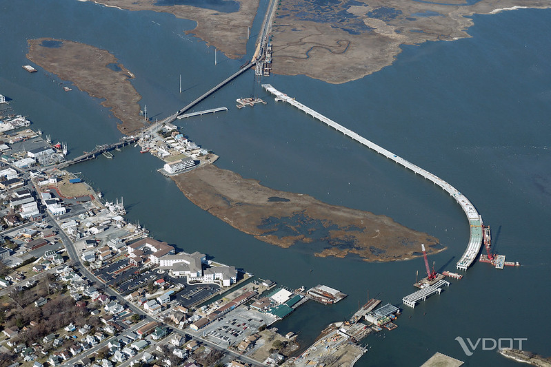
building the new bridge to Chincoteague in 2009
Source: Virginia Department of Transportation, Chincoteague Bridge
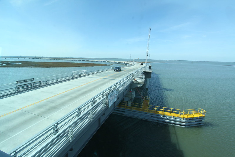
the new drawbridge to Chincoteague, replacing the 1939 swing bridge, opened in 2010
Source: US Army Corps of Engineers, U.S. Army Corps of Engineers Norfolk District
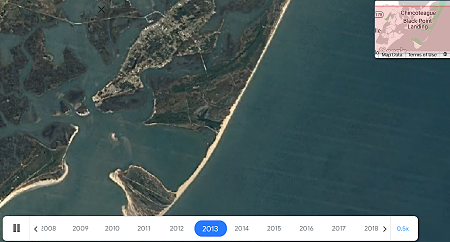
Toms Cove, morphing over time (click on link)
Source: Google Earth Engine
Chincoteague Island in 1673
Source: John Carter Brown Library, A New Map of the English Plantations in America (Blathwayt Atlas, 1673)
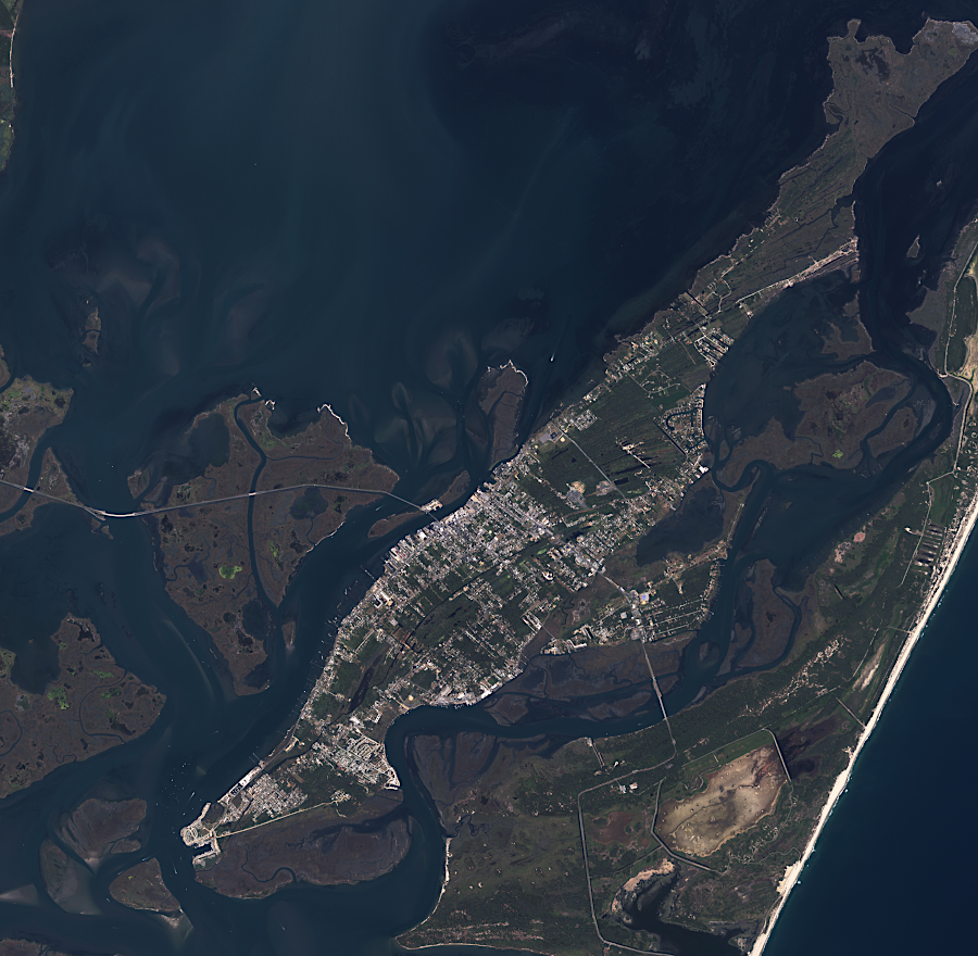
Chincoteague Island, 2001
Source: NASA Earth Observatory, Assateague and Chincoteague Islands, Virginia
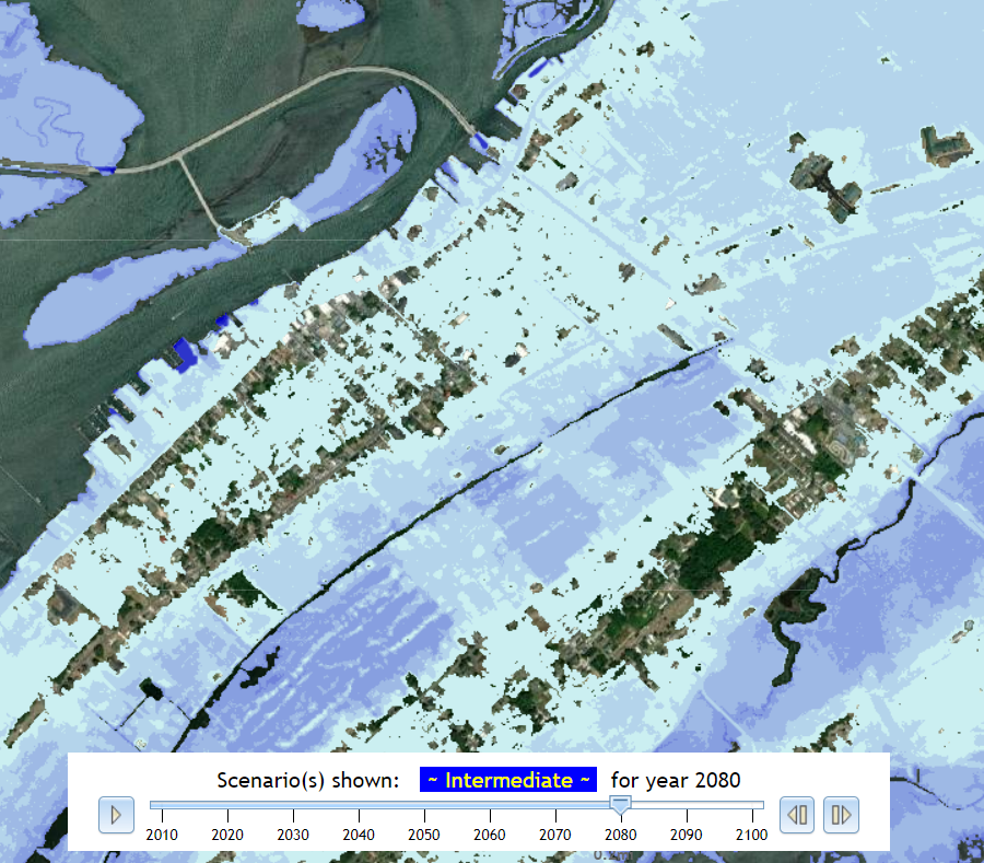
by 2080, sea level rise could make Chincoteague Island uninhabitable
Source: Commonwealth Center for Recurrent Flooding Resiliency, Sea Level Rise Projection