When the English arrived in Chesapeake Bay, the Native Americans they met referred to the Eastern Shore as Accawmacke - the "across the water place" or "land beyond the water."1
The Native Americans living on the Eastern Shore were associated with Powhatan's paramount confederacy. The peninsula was isolated by the Chesapeake Bay from most of his territory in Tidewater, but paddling a canoe across the bay was a common experience.
The spelling of Accawmacke, soon converted by the English into Accomack, has varied over the years. The General Assembly finally resolved in 1940 that the county name would be spelled with a "k" as Accomack County, but the town that serves as the county seat is still spelled Accomac without the "k." There is just one other place in the United States called Accomac, and no other place spelled with the "k" in the name.2
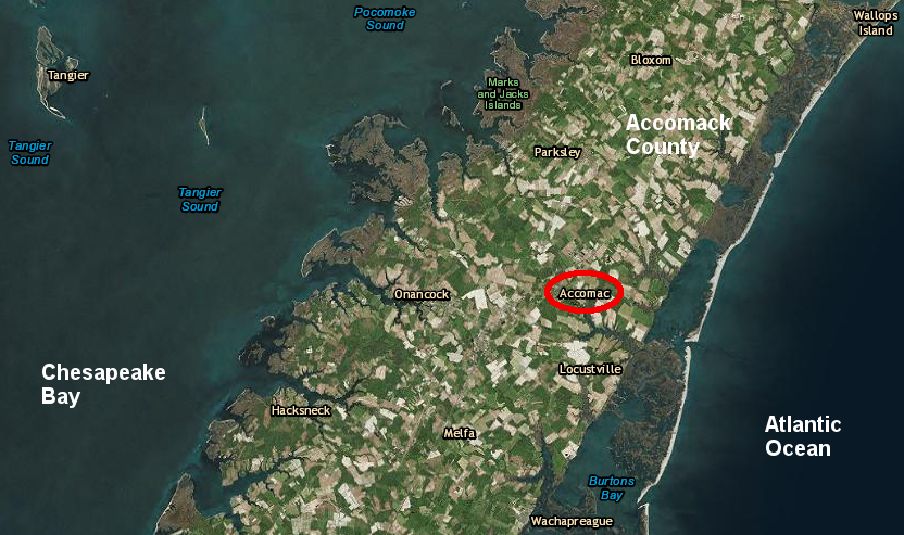
the Town of Accomack county has no "k" at the end of its name
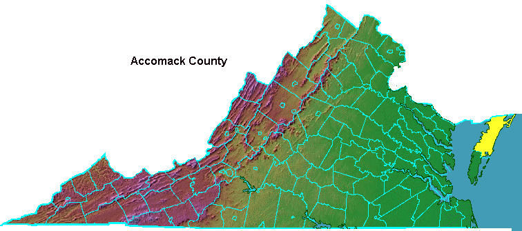
Source: ESRI, ArcGIS Online
English settlement of "Ye Plantation at Accawmacke" came early. The natives on the Eastern Shore were friendly, and access to the area by boat was relatively easy. The Chesapeake was a highway, rather than a barrier, in the 1600's.
In 1634, Accomack was created as one of the first 8 local jurisdictions (initially called shires rather than counties) in the colony of Virginia, when the General Assembly began decentralizing government services from Jamestown. The original Accomack County covered the entire Eastern Shore. Today's Accomack County is just half of its original size.
In 1643, the county name was changed to Northampton County, perhaps because the leading citizen on the Eastern Shore (Obedience Robins) sought to honor his home territory in England and perhaps as part of an effort to select English rather than "heathen" aboriginal names. Robins was a supporter of Oliver Cromwell and the Parliamentarians who controlled England, and a powerful member of the gentry on the Eastern Shore - but in 1643, Jamestown was still dominated by a Royalist governor. A third alternative is that the county name could have been changed to honor the Earl of Northampton, a supporter of Charles I as the English Civil War heated up.3
By 1663, both Obedience Robins and Cromwell were dead, King Charles II had been restored to the English throne, and the Royalists were back in charge in Jamestown. The General Assembly divided the Eastern Shore into two counties, and the northern half of the peninsula next to Maryland was given the original name of Accomack County.
Obedience Robins' rival, the Royalist Edmund Scarborough (or Scarburgh), ensured that the southern boundary of Accomack County was drawn more than halfway down the peninsula towards Cape Charles. That boundary left 50% of the Eastern Shore population in Northampton County, but significantly more than half the acreage was placed in Scarborough's Accomack County.
Scarborough, the Surveyor General of the Virginia colony, worked with Maryland officials to define the northern boundary of Accomack County further north than Lord Calvert's 1632 charter proposed. Through his forceful personality and his willingness to ignore legal limits as defined in the charters, he managed to get the Virginia-Maryland boundary line drawn so Virginia's portion of the Eastern Shore was enlarged.
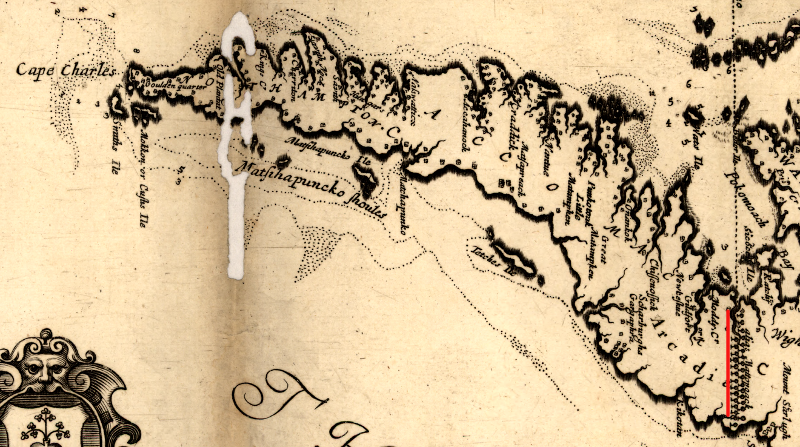
Accomack County, 1670 (red line highlights double line of trees, marking Maryland boundary established by Scarborough)
Source: Library of Congress, Virginia and Maryland as it is planted and inhabited this present year 1670
Scarborough's influence in Jamestown did not last. By 1670, Governor William Berkeley wanted to arrest Edmund Scarborough for threatening the Native Americans and Quakers on the peninsula, even threatening people who lived clearly across the line in Maryland. Scarborough's reported murder of several Native American chiefs was one of many Anglo/Algonquian incidents that ultimately culminated in Bacon's Rebellion, a civil war within the colony of Virginia in 1676.
Scarborough claimed to be immune from arrest by the royal governor, because he was an elected burgess for Accomack County. That protection from arrest prevented the King Charles II (or his governor in the colony of Virginia) from harassing the legislators when there were major disagreements. Without immunity, the king/governor could have arrested elected representatives to block them from voting in the House of Burgesses.
Governor Berkeley eliminated Scarborough's immunity by abolishing Accomack County in 1670. This ended Scarborough's position as a burgess, and thus his protection from arrest.
Scarborough died in 1671. That ended his conflict with Gov. Berkeley, and the next General Assembly re-created Accomack county.
In 1687, the General Assembly responded to complaints from Northampton County about the imbalance of acreage between Accomack/Northampton counties. The colonial legislature adjusted the boundaries so Northampton County was expanded to the north, creating the current line that runs between Occohannock Creek and the aptly-named Parting Creek.4

the boundary between Northampton and Accomack counties includes Parting Creek
Source: ESRI, ArcGIS Online
Today, Virginia's only spaceport is located at Wallops Island.
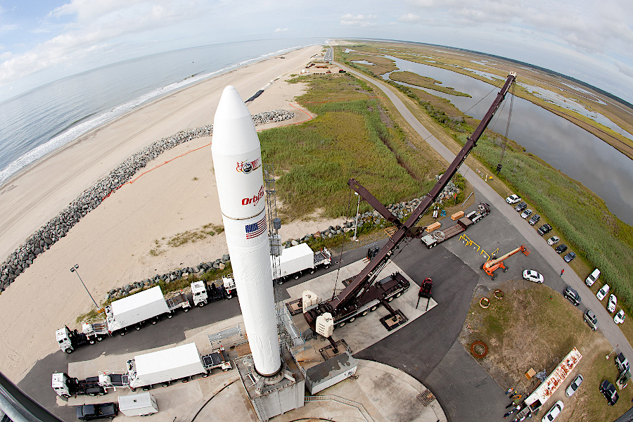
missions to the moon have been launched from Mid-Atlantic Regional Spaceport's pad 0B0
Source: US Army Corps of Engineers, 090613-A-CE999-001.JPG
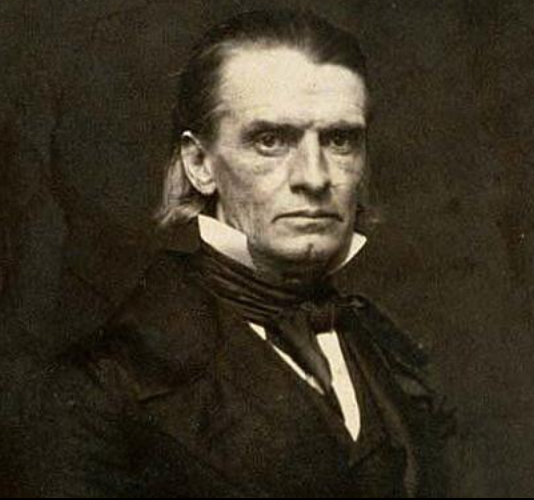
Henry Alexander Wise, born in Accomack County, was governor of Virginia between 1856-1860
Source: Smithsonian Institution, Henry Alexander Wise
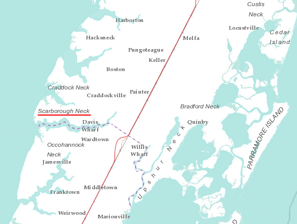
one of the many necks of land jutting into the Chesapeake Bay, just north of the Northampton County line, is named for Edmund Scarborough
Source: ESRI, ArcGIS Online
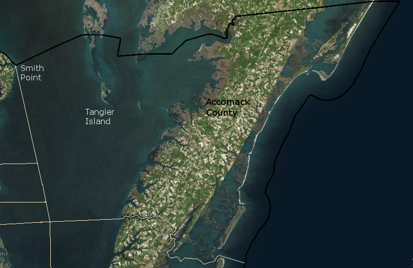
the boundaries of Accomack County extend to the eastern edge of the Chesapeake Bay at Smith Point, and include Tangier Island
Source: ESRI, ArcGIS Online with Virginia Administrative Units