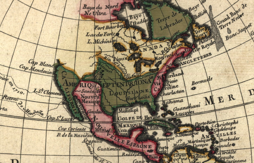
from the French perspective, English land claims were restricted to the Atlantic Ocean shoreline
Source: Library of Congress, Mappemonde a l'usage du roy (by Guillaume de L'Isle, 1720)
from the French perspective, English land claims were restricted to the Atlantic Ocean shoreline
Source: Library of Congress, Mappemonde a l'usage du roy (by Guillaume de L'Isle, 1720)
In 1716, Governor Alexander Spotswood led the Knights of the Golden Horseshoe across the Blue Ridge. It was a fun trip, with lots of drinking as Spotswood sought to steer the next stage of English settlement along the Rappahannock where he controlled vast tracts of land.
However, Spotswood's encouragement of westward settlement was also good public policy for the empire of Great Britain. He recognized that the French had established close relationships with the tribes along the upper Ohio River and along the Great Lakes, and also along the Gulf Coast and the mouth of the Mississippi River. It was logical to assume that the French would try to connect the two and expand their control of the lands west of the Blue Ridge.1
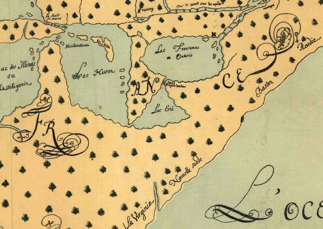
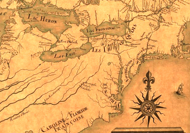
Louis Joliet map of North America, 1674 (note assumption of short distance between Lake Erie and Virginia colony)
Source: Library of Congress, Louis Joliet 1674 map - Nouvelle decouverte de plusieurs nations dans la Nouvelle France en l'ann e 1673 et 1674
Spotswood saw the "big picture" of settlement patterns both inside and outside the boundaries of the Virginia colony. He sought to make peace with tribes on the frontiers of the colony, and was arranging the Treaty of Albany in 1722 when his replacement arrived in Williamsburg.
By stimulating English settlement near the Blue Ridge, Spotswood was extending the international competition between European rivals deeper into the North American continent. It took 125 years for the Virginia colonists (including Germans and Scotch-Irish recruited from Pennsylvania) to actually move 125 miles inland from Jamestown to the Shenandoah Valley. Another 50 years passed before the conclusion of the French and Indian War in 1763 determined whether France or England would control the lands in the watersheds of the Ohio River and Mississippi River, and by the early 1800's displace most of the Native Americans living there.
Throughout that time, various landowners tried to attract French Protestants to settle on Virginia's northern, western, and southern frontiers. The gentry acquired claims to vast tracts of land based on their ability to recruit new settlers.
Until people moved into the backcountry and paid for land, the speculative land claims generated no income. When new settlers actually arrived and purchased the land, the wealth of the landowners finally increased.
Virginian leaders such as William Fitzhugh, Governor Spotswood, and William Byrd II managed to find a few opportunities to recruit French immigrants throughout the international competition, "planting" them on lands east of the Blue Ridge. Today, much of the early French heritage in Virginia is tied to the immigration of Huguenots, French Protestants attracted to Virginia by promises of economic opportunity and religious freedom.
at the start of the French and Indian War in 1755, British colonial leaders were still unclear about the location of the Ohio River
Source: Library of Congress, A map of the middle British colonies in North America (Lewis Evans, 1755)
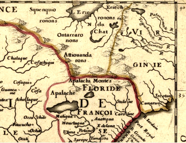
1650 map showing French understanding of distance between Lake Erie and Blue Ridge
Source: Library of Congress, Am rique septentrionale / par N. Sanson d'Abbeville, g og. du Roy
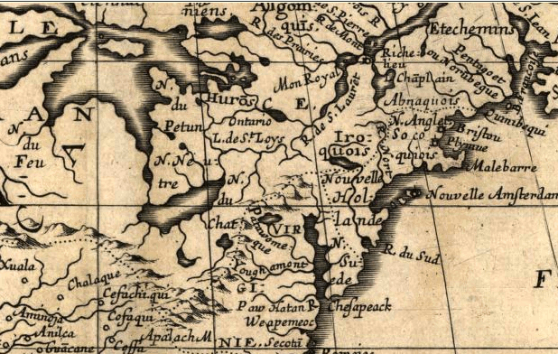
1657 map showing French claim to Ohio River Valley (and presumption of lakes at headwaters of Tidewater rivers in Virginia)
Source: Library of Congress, Am rique septentrionale / par N. Sanson d'Abbeville, g og. du Roy
1685 map showing Ohio River and Virginia
Source: Library of Congress, Am rique septentrion.lle [i.e. septentrionale]:
compos e, corig e, et augme t e, sur les iournaux, m moires, et observations les plus justes qui en n' etes.tes en l'ann e 1685 & 1686, par plusieurs particuli s
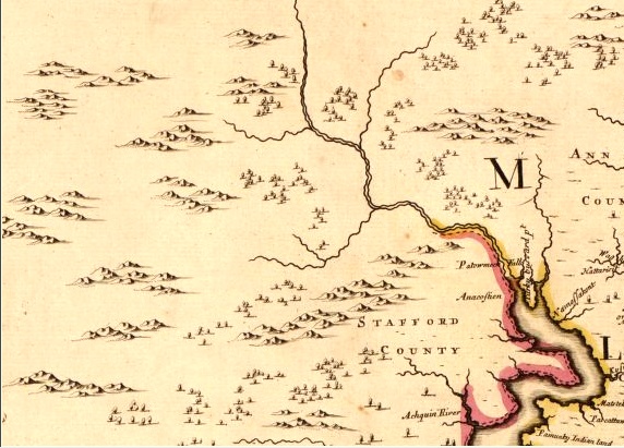
1670 map by Augustine Herrman, showing area south of Potomac River (north is to the right)
Source: Library of Congress, Virginia and Maryland as it is planted and inhabited this present year 1670
1740 map - without data from 1736 survey of Fairfax Grant - showing ignorance of land upstream of Patowmeck Falls (Great Falls)
Source: Library of Congress, John Senex 1740 map - A new map of Virginia, Mary-Land, and the improved parts of Pennsylvania & New Jersey