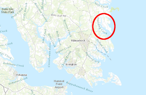
the Wiccocomico reservation was on the north bank of Dividing Creek in Northumberland County
Map Source: ESRI, ArcGIS Online
the Wiccocomico reservation was on the north bank of Dividing Creek in Northumberland County
Map Source: ESRI, ArcGIS Online
The 4,400-acre Wiccocomico reservation was set aside in 1655 and surveyed in 1656, when English colonization was beginning to advance up the Potomac River.
The English tried to settle on the majority of the land, and dedicate just a small tract of land for occupation by both the Wiccocomico and Sekakawon (Chickacone) tribes. The size of the reservation was based on the number of "bowmen" in the two tribes, with each of the 88 bowman entitled to 50 acres.
The two tribes were not allies. By 1659 the Sekakawon (Chickacone) tribe had abandoned the site - but by then, Governor Samuel Mathews had also obtained title to the old Wiccocomico lands on the Great Wicomico River.
Encroachment by settlers continued to chip away at the reservation. Within just 50 years, all Native American title to the lands had been extinguished, and the tribe was nearly exterminated as well. Only three members were recognized in 1705, and they were all renting land from the English on what was once their reservation.1