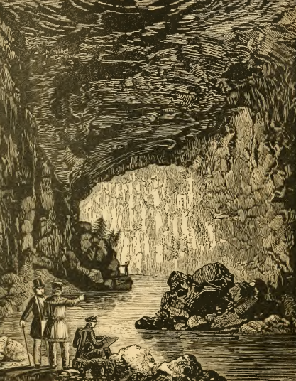
tourists entered Natural Tunnel, a large cave in Scott County, until a railroad built a track through it
Source: Historical collections of Virginia, The Natural Tunnel (p.465)
tourists entered Natural Tunnel, a large cave in Scott County, until a railroad built a track through it
Source: Historical collections of Virginia, The Natural Tunnel (p.465)
There are 4,000+ caves in Virginia. Explorers actively searched for caves after the Civil War, once they created commercial tourism opportunities. Topographic mapping by the US Geological Survey in the 1900's, and today with LIDAR, revealed where a cave search by spelunkersin karst topography may be successful. Construction work occasionally exposes the location of new caves as well.
All caves in Virginia were formed by groundwater slowly dissolving limestone and dolomite formations underground. In other places, acidic emissions from sulfur deposits is responsible for creating some caves.
Rainwater in Virginia seeps down through the soil, becoming slightly acidic as it passed through decaying organic matter such as leaves. That acidic water slowly has transformed the calcium carbonate - CaCO3, the predominant mineral in limestone and dolomite - to create voids. Bacteria in the soil, and in the interstices of deeper bedrock particles, release gases with hydrogen and increase the acidity of groundwater.
In dolomite, magnesium atoms are mixed in with calcium atoms to create another mineral with the chemical formula of CaMg(CO3)2
Chemical weathering of limestone/dolomite can create calcium bicarbonate. That mineral, with a chemical formula of Ca(HCO3)2, is more easily dissolved in water compared to calcium carbonate. Limestone composed of calcium carbonate and dolomite (with additional magnesium atoms) are hardy building stones. However, when acid water converts calcium carbonate into calcium bicarbonate, then limestone/dolomite can dissolve away.
Biological activity by sulfur-based microbial communities may also contribute, as at Cesspool Cave along Sweet Springs Creek in Allegheny County. Bacteria eating organic material buried underground with limestone will release hydrogen sulfide as a gas. It mixes with oxygen to form sulfuric acid. The acid dissolves carbonate minerals in the limestone, etching out a cavity.1
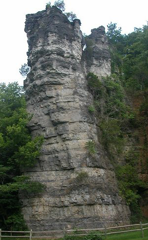
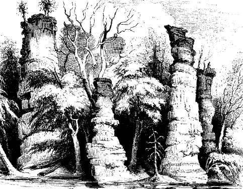
As the calcium carbonate weathered away, the rock became pockmarked with voids and created a "karst" landscape with springs, sinkholes, caves. In Virginia, exposed remnants of once-undrground cave systems are visible at Natural Bridge, Natural Tunnel, and Natural Chimneys. Acid rain may also be speeding up the creation of caves by increasing the acidity of rainwater.
The chemical weathering process is invisible when it occurs underground, but clearly visible in cemeteries aboveground. On old marble gravestones, once-clear letters have eroded away. The calcium in the marble (which is metamorphosed limestone) has dissolved in just a few decades, until the carved letters on many gravestones are no longer legible.
Some minerals, such as silicon dioxide or quartz (SO2), are very hard to dissolve. The beach at Virginia Beach is formed predominantly from quartz sand grains, rather than calcium carbonate grains. Quartz is not very reactive; silicon dioxide is about the last mineral to dissolve, as rocks are washed down from the Appalachians. The quartz resists its inevitable fate of dissolving into the ocean. Granite headstones, with a high percentage of quartz and little or no limestone, retain their lettering longer than marble headstones.
The granite and metamorphosed lava in the Blue Ridge, and the sandstone ridges of Massanutten Mountain, are not riddled with caves like the limestone valleys in Virginia. In a few locations, rocks have fallen or eroded to create overhangs, crevices, and even a few spots that could be used as a shelter and perhaps labelled a cave. Pete's Cave on North Mountain near Iron Gate, a popular hiking destination, is just a jumble of fallen rocks that created a sheltered space.
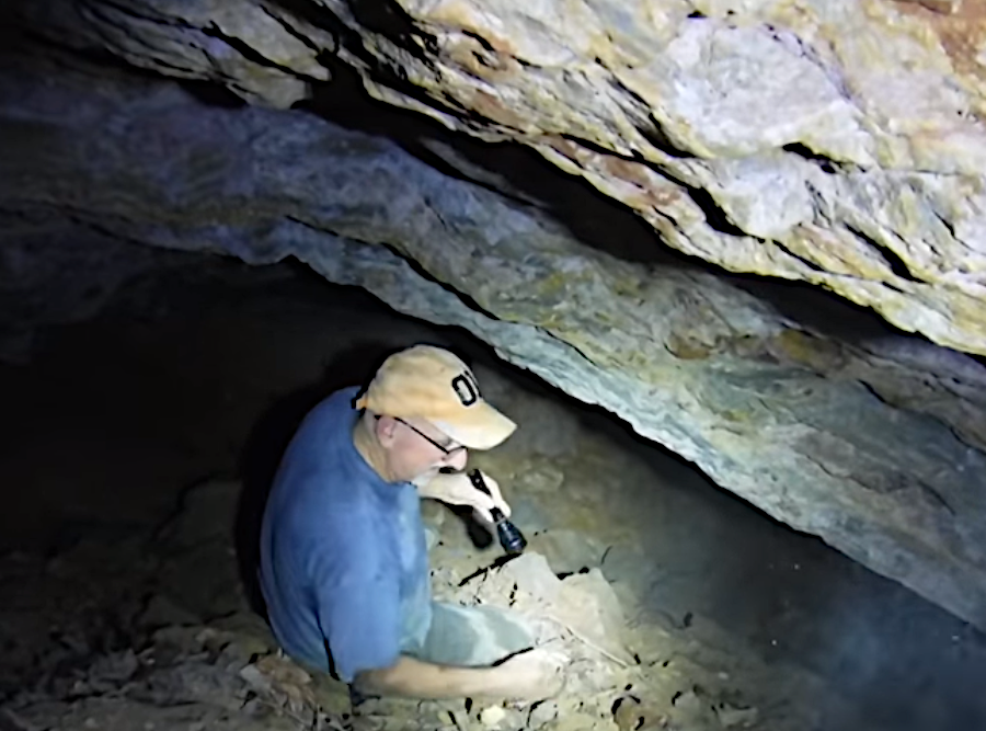
Sand Cave is often advertised as being in Virginia, but is located just across the border in Kentucky. There are over 30 caves in Cumberland Gap National Park, but Sand Cave is actually a rock shelter. It formed in sandstone that cracked in freeze-thaw cycles and wind eroded. The floor of the the largest rock shelter in Kentucky (over an acre in size) is covered in multi-colored sand.2
The metamorphic bedrock of the Piedmont and the sediments of the Coastal Plain also lack caves. No caves have formed in the sediments of the Triassic basins. There are only a few places in those regions where limestone or calcium-rich marl outcrops on the surface and caves might form naturally.
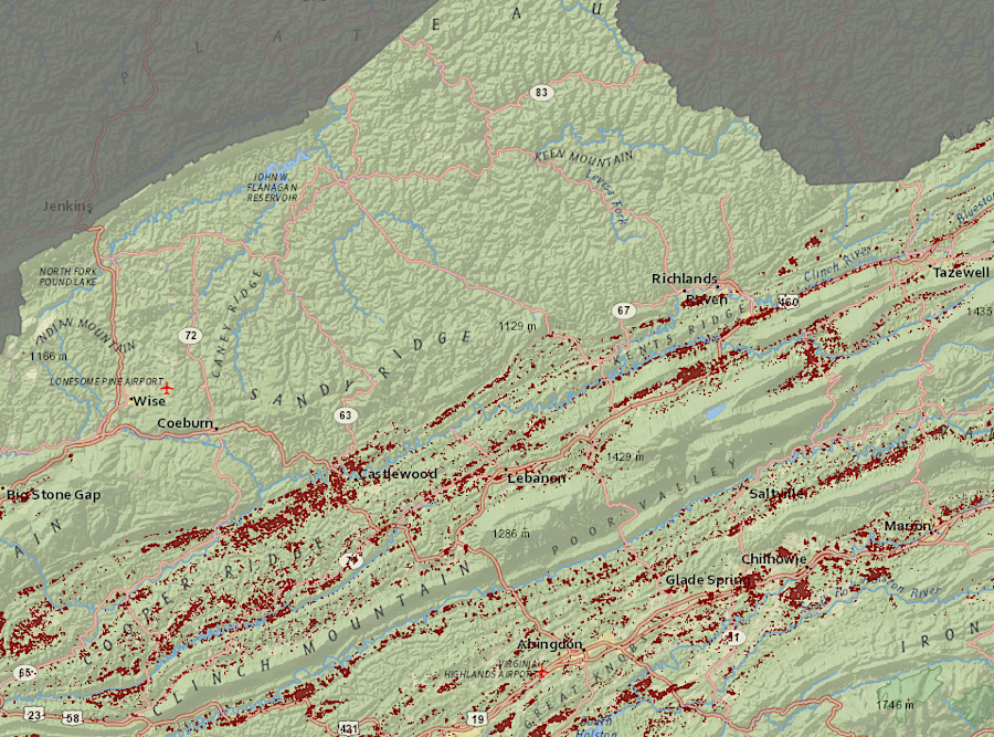
Where calcium carbonate (limestone) is the bedrock, caves will be more common. A map of cave locations in Virginia shows that nearly all the caves are west of the Blue Ridge, in the limestone of the Shenandoah Valley and in the equivalent valleys south of Augusta County. There may be cave-related museum exhibits in the Blue Ridge, Piedmont, or Coastal Plain physiographic provinces, but all the natural caves open to visitors are in the Valley and Ridge physiographic province.
Several caves are located in Loudoun County, east of the Blue Ridge. The caverns formed in the Leesburg member of the Balls Bluff siltstone, and that member includes a limestone conglomerate known locally as "Calico marble." The Leesburg member was deposited in the Culpeper Basin during the Triassic Period. The lakes in which the conglomerate accumulated after big storms must have been visited by dinosaurs, but no dinosaur fossils have been found in that limestone.
Over 1,200 feet of passage have been explored in Rust Cave #1 in Loudoun County. Sinkholes are common at Temple Hall Farm, and a "window" into an underground chamber is exposed on the east side of Route 15 just north of the entrance into the Raspberry Falls subdivision.3
The Loudoun County caves are named for the Rust family, whose brothers explored the caves after the Civil War in hopes of finding a "show cave" comparable to what was developed at Luray. At the time, the caves were called Big Cave and Eddie's Cave, after Eddie Rust. The mansion house Carlheim in Loudoun County was also built on top of a cavern.4
Commercial caves attract tourists interested in seeing a unique environment with odd formations (speleothems). In caves with heavy visitation, stalactites, stalagmites, helictites, and other formations have been damaged. Many were broken as people initially explored caves, before paths were developed. Some formations were cracked off and taken home as souvenirs.
Before electric lights were installed in commercial caves, smoke from candles left soot on cave roofs. Creation of paths and installation of cables for electric lights transformed some cave passages. After lights were installed, algae grew on damp formations and altered their natural appearance. Efforts to remove algae with chemicals and abrasives created even more damage.
There are still thieves who consider cave formations to be items worth stealing. At the end of 2020, two men broke into Endless Caverns and stole formations which could be sold for over $1,000. They were arrested, but stalactites and stalagmites can not be glued back into place.5
Caves and cave formations can be dated using a variety of techniques. The Jenolan caves in Australia are the oldest caves on Earth, located in 430 million year old offshore reef that ended up as a limestone formation. Based on potassium-argon dating of clay sediments within them, the caves formed as much as 340 million years ago. The extraordinary stability of the continental crust that forms Australia has allowed the Jenolan caves to survive.
Carlsbad Caverns in New Mexico formed 4 million years ago, Lechuguilla Cave formed 6 million years ago, and other caves in the Guadalupe Mountains date back to over 11 million years ago.
Caves formed after the limestone sediments were originally deposited, Virginia caves west of the Blue Ridge are younger than the 570-350 million year old limestone formations in which the caves are found. The Taconic, Neo-Acadian, and Alleghenian orogenies destroyed whatever caves originally were created in those formations more than 200 million years ago. As the bedrock was squeezed and thrust westward by the accretion of terranes and finally the collision with Africa, any voids in the limestone formations that pre-dated the original Appalachian Mountains were squeezed shut.
Using the rate at which uranium decays, the age of speleothems can be determined. "Altamura Man," a Neanderthal skeleton entombed in calcite within a cave in southern Italy, is at least 130,000 years old. The calcite shell is still growing and the bones have not fully fossilized in the wet cave environment.
A stalagmite from Grand Caverns is 66,500 years old, so the cavity (cave) in which it formed must be older. Dating the mud watermark from a flood within Grand Caverns suggest the cave is at least 670,000 years ago.
Dates of caves can be estimated using the magnetic orientation of particles in cave sediments and the calendar of magnetic reversals over time. One passage in Buckeye Creek Cave, in West Virginia just west of Alleghany County, is at least 788,000 years old.6
New caves have been manufactured in recent times as well. There is one artificial cave in York County, which Cornwallis supposedly used before surrendering on October 9, 1781. Cornwallis' Cave is not a natural feature. That hole in the hillside was excavated as a shelter from French and American bombardment during the Revolutionary War battle.
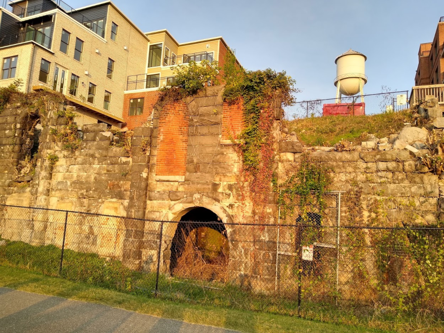
Artificial caves were constructed to age lager beer in Richmond. D.G. Yuengling Jr. opened James River Steam Brewery at Rocketts Landing in 1868. The cool conditions facilitated fermentation and storage of 6,000 barrels in the days before refrigeration. The brewery closed in 1879 and its building burned in 1891, but the caves have survived. Today they are visible from the Capital Cities bike trail, along the James River at the Richmond/Henrico County border.7
Later, other artificial caves have been built to store wine. The "cellars" ensure steady temperature conditions during the aging process.
There are at least 45,000 caves within the United States, so Virginia has somewhat less that 10% of the national total.8
The longest cave system in the world is Mammoth Cave in Kentucky, with 426 miles of mapped cave. The largest individual underground space is in China. The Miao Room, in Ziyun Getu He Chuandong National Park, is a 10.6 million cubic foot hole in the ground.
The Veryovkina cave in the region of Abkhazia, in the country of Georgia, is the deepest cave in the world. Cavers require four days to go down to the bottom at 7,257 feet. They require an equal amount of time to return, in a 100% humid environment where the temperature is 40-45°F. Explorers did not determine the lowest depth until 2017.
The tallest stalagmite in the world, over 260 feet tall, is located in Son Doong Cave in Vietnam. That is also the largest cave in the world, measured in volume.
The longest cave system in Virginia is the Omega System in Wise County, with over 29 miles of underground passages within Powell Mountain. It is possible to walk in the main stream passage for six miles. The Omega cave system is the deepest in the United States east of the Mississippi River, at over 1,250 feet beneath the surface.
There are more than 80 cave systems in Virginia with at least one mile of passage. Eight caves in Virginia are at least 500 feet deep:9

karst topography is common near Radford
Source: ESRI, ArcGIS online
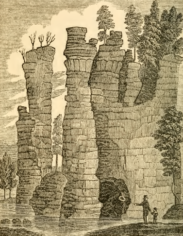
limestone layers are exposed by water-driven erosion at the Natural Chimneys, known as the "Cyclopean Towers" in the 1800's
Source: Henry Howe, Historical collections of Virginia (p.180)
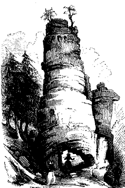
The Chimneys (including the Great Tower) were a tourist attraction even prior to the Civil War
Source: Harper's New Monthly Magazine, Virginia Illustrated (February 1855)
hikers climbing up the Crabtree Falls trail in Nelson County will see a crevice in the Blue Ridge created by fallen boulders
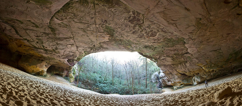
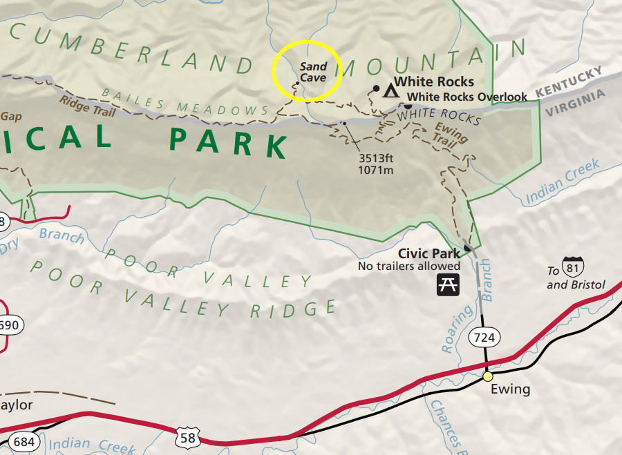
Sand Cave, eroded into sandstone, is accessed by a trail from Ewing but is located in Kentucky
Source: Jeff Moore, 20131110_064Pr VA Cumberland Gap National Historic Park, Sand Cave; National Park Service, Cumberland Gap Historical Park
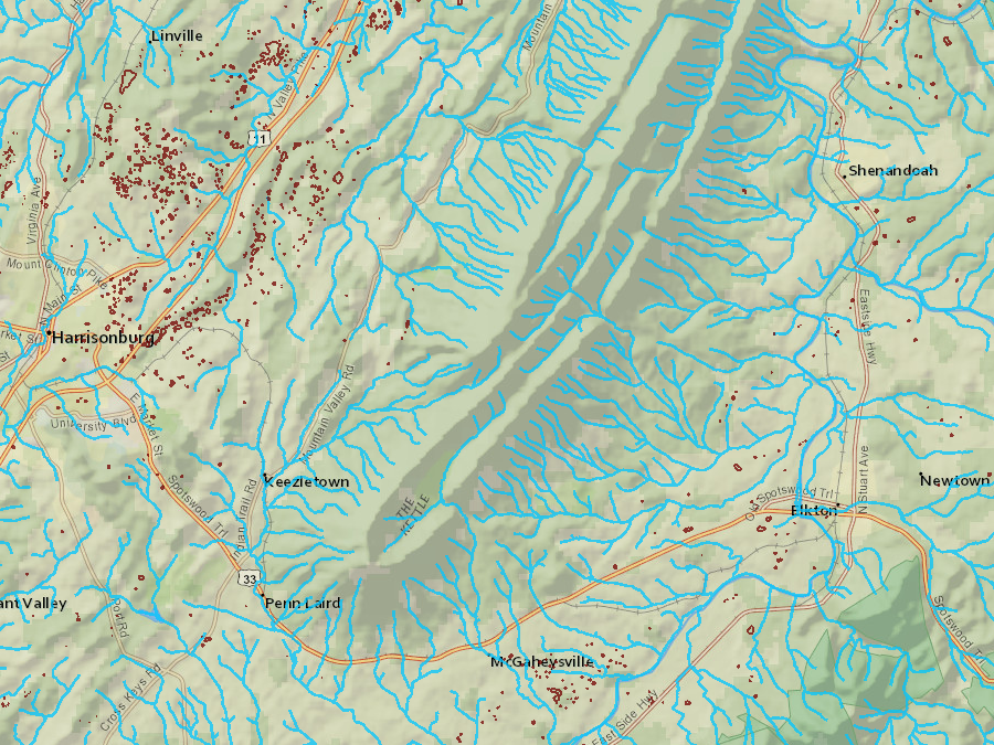
sinkholes and karst landscape features (brown lines) are common in the valleys with linestone bedrock, but not on Massanutten Mountain
Source: Virginia Department of Conservation and Recreation, Virginia Natural Heritage Data Explorer
the only site on the Virginia Cave and Karst Trail east of the Blue Ridge is the simulated cave exhibit at the Virginia Living Museum in Newport News
Source: Virginia Department of Conservation and Recreation (DCR), The Virginia Cave and Karst Trail
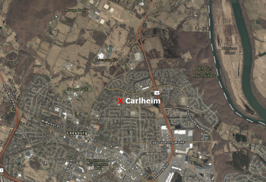
in 2020, the Carlheim mansion site was occupied by the Aurora School
Source: ESRI, ArcGIS Online

a Neanderthal skeleton in Italy ("Altamura Man") is entombed in calcite formations at least 130,000 years old
Source: PLOS One, In situ observations on the dentition and oral cavity of the Neanderthal skeleton from Altamura (Italy)
gold miners created mines ("artificial caves") in the gold-pyrite belt east of the Blue Ridge, stretching from Fairfax to Buckingham counties
Source: Gigmaster, Virginia Gold Mine!
the James River Steam Brewery beer caves are still visible at Rocketts Landing, now on the border of Richmond and Henrico County
Longest Caves in Virginia Rank Name County Length (in miles) 1 Omega System Wise County 29.430 miles 2 Sugar Run Cave System Giles County 22.500 miles 3 Chestnut Ridge Cave System Bath County 22.063 miles 4 Gap Cave System (Cudjo's) Lee County 19.884 miles 5 Butler-Sinking Creek System Bath County 18.060 miles 6 Perkins Cave Washington County 9.997 miles 7 Skydusky Hollow Cave System (Newberry - Bane - Buddy Penley Cave) Bland County 9.000 miles 8 Thompson Valley Cave System (Corkscrew Cave) Lee County 8.600 miles 9 Unthanks Cave Lee County 7.900 miles 10 Stompbottom Cave Tazewell County 7.730 miles
Deepest Caves in Virginia Rank Name County Depth (in feet) 1 Omega System Wise County 1263 feet 2 Chestnut Ridge Cave System Bath County 814 feet 3 Sugar Run Cave System Giles County 718 feet 4 Butler-Sinking Creek System Bath County 644 feet 5 Doe Mountain Cave Giles County 628 feet 6 Thompson Valley Cave System (Corkscrew Cave) Tazewell County 604 feet 7 Dulaneys Cave Giles County 601 feet 8 Bullpasture Mountainside Cave Highland County 519 feet 9 Gap Cave Lee County 491 feet 10 Seabolt-Spence Cave System Smyth County 463 feet
Some caves found in Virginia have been impacted by modern development. Nellie's Cave Road in Montgomery County was built on top of the entrance to Nellie's Cave. After the Civil War, when the cave-exploring grotto club was first established at what is now Virginia Tech, a formerly enslaved woman known as "Nellie" and her husband Gordon Mills owned 100 acres which included the cave.
Nellie sold food to the cavers and people who picnicked at the cave entrance. Spelunkers would lower themselves on ropes into a cavern which reportedly stretched all the way to Cambria. According to the descendants of the Mills family, there was underground ballroom large enough for a fleet of school buses.
The entrance was sealed up when the gravel road was paved. That was done, over objections by the Mills, to provide a highway for Woodland Hills residents.10
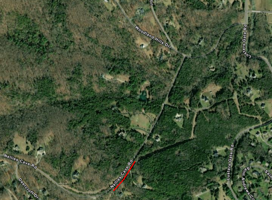
Nellie's Cave now lies beneath Nellie's Cave Road
Source: ESRI, ArcGIS Online
Road construction can intercept and reveal cave systems. Island Ford Cave in Alleghany County, reportedly "the most readily accessible non-commercial cave in Virginia," was discovered in the 1930's when US 60 was built:11

a US 60 roadcut during construction in the 1930's exposed Island Ford Cave
Source: US Geological Survey (USGS), Natural Bridge, VA 1?125,000 topograpgic quadrangle (1894)
Recreational use is managed by the West Virginia Cave Conservancy, to which the cave was donated when the landowner died. The organization has an open access policy at Island Ford Cave for not-for-profit visitation. he cave has isopods and crayfish adapted to the dark and several Pleistocene age bone sites, but is not famed for its speleothems. Technical skills required to explore the 1,400 feet of passage are minimal.12
People have been going into caves for various reasons. Ancestors of modern humans were making tools in Wonderwerk Cave in South Africa 1.8 million years ago, and used fire inside it 1 million years ago. People lived inside Kenya's Panga ya Saidi cave network for 78,000 years. In the United States the oldest evidence of humans going underground was found at Paisley Caves in Oregon. Coprolites (fossilized human excrement) there are over 14,000 years old.
A stenciled hand in Liang Metanduno cave in Indonesia may be the oldest cave art found to date. it was painted nearly 68,000 years ago. At the time, humans would have been using torches and building fires inside caves for light. Flickering flames may have made the art on the walls appear to move.13
The desire to explore underground has not disappeared. Commercial caves are easy for tourists to explore. They have trails, handrails, and lights.
Wild caves are dangerous. In Virginia today, people going into wild caves are often introduced to the experience by friends who belong to caving clubs known as grottoes. Mentors and cave trip leaders emphasize safety; exploring underground in the dark in narrow passages is dangerous. Cavers will not know when a storm on the surface is producing heavy rainfall. Passages can fill quickly with water, trapping and even drowning cavers who did not pay close attention to weather predictions.
Caves are filled with pits into which people can fall. Breakdown and cave formations that are difficult to negotiate; tight squeeze passages are common. Sprains and broken bones are always a possibility. Extraction from a cave is difficult; those who are injured still have to exert energy to walk/crawl out. Caves in Virginia are normally cold with an average temperature of about 56°F. Cavers who maneuver through cold water can get hypothermia and stop thinking rationally about how to return to the surface.
Even commercial caves have risks. In Austria, visitors in an ice cave nearly 1,000' underground were injured by a lightning strike.14
sinkholes (brown lines) are not found in the Appalachian Plateau, but are common in the Valley and Ridge physiographic province
Source: Virginia Department of Conservation and Recreation, Virginia Natural Heritage Data Explorer
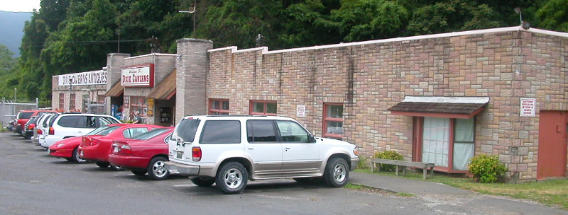
the entrance to Dixie Caverns is a functional structure with minimal esthetic appeal, and many stalactites in the commercial cave have been broken off
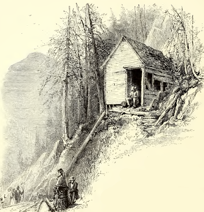
entrance to Weyers Cave (1872)
Source: Picturesque America (p.212)