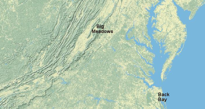
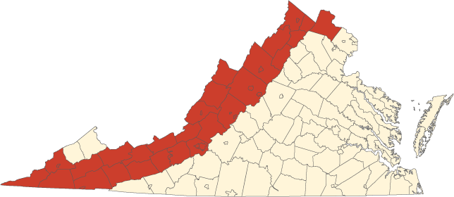
Big Meadows is over 4,000 feet higher in elevation than Back Bay, and over two degrees in latitude (>140 miles) further north
Source: ESRI, ArcGIS Online
1) Climate, Storms, and Floods
Big Meadows is over 4,000 feet higher in elevation than Back Bay, and over two degrees in latitude (>140 miles) further north
Source: ESRI, ArcGIS Online
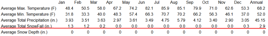
average annual snowfall in Virginia varies by elevation, latittude, and distance from the Atlantic Ocean
Source: Historical Climate Summaries for Virginia, Back Bay National Wildlife Refuge

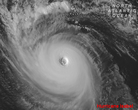
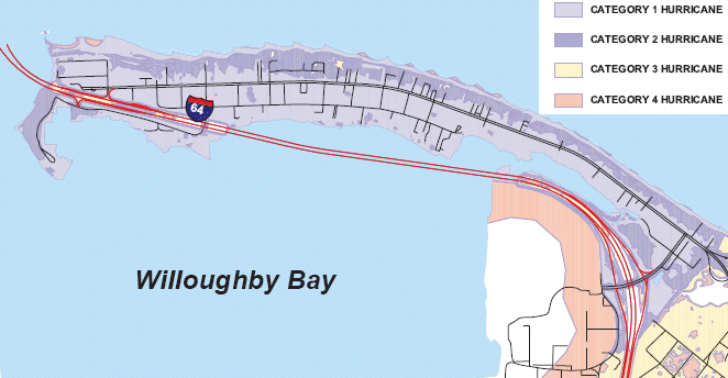 how would the predicted storm surge from a Category 2 hurricane affect Willoughby Spit and travel on I-64 through the Hampton Roads Bridge-Tunnel? Source: Hampton Roads Emergency Management Committee |
|
Ecosystems, Communities, and Species
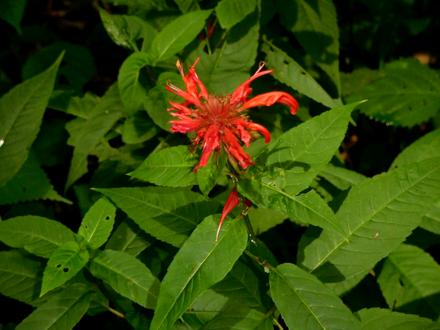
look in wetlands for cardinal flowers, which bloom in August/September and are a clear sign that Summer is ending
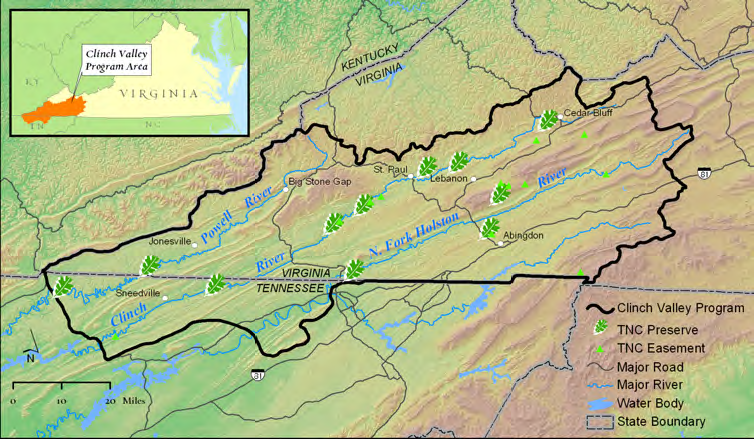
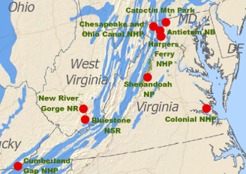
the Holston, Clinch, and Powell rivers are biological hotspots and land prices are relatively low, so The Nature Conservancy has made the area a priority for acquiring/expanding preserves
Source: The Nature Conservancy, Clinch Valley brochure
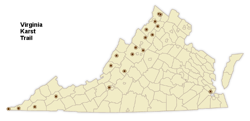
the Virginia Karst Trail highlights sinkholes, sinking streams, springs, and caves - all west of the Blue Ridge except for the Virginia Living Museum in Newport News, with its walk-through simulated cave exhibit including calcite formations and cave-dwelling animals
Source: Virginia Department of Conservation and Recreation, The Virginia Cave and Karst Trail
 karst is common in the Vally and Ridge physiographic province, but the Piedmont has significant karst acreage in only Loudoun County (how about the Appalachian Plateau?) Source: Virginia Department of Mines, Minerals and Energy, Sinkholes and Karst Terrain |
 karst (area colored blue) is rare in the national parks in Virginia, but Cumberland Gap has a public cave tour Source: National Park Service, Cave and Karst in the U.S. National Park Service |
Watch oysters filtering water:
Unfortunately, filtering by a fully-restored oyster population would not "save" the Chesapeake Bay. The only way to clean up the excessive population of algae in the Chesapeake Bay (which creates "dead zones" on the bottom where nothing can live, when the algae dies and decomposes) is to reduce the amount of nitrogen and phosphorous dumped into the bay from upstream sources. Oysters are tiny little wastewater treatment plants, but even a zillion oysters in the bay could not compensate for excessive upstream pollution.
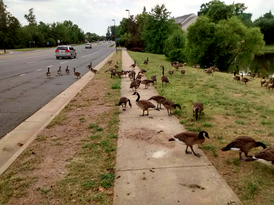
non-migratory geese (which do not migrate north in the Summer) have become pests in Fairfax County
Source: Fairfax County Police
Eeek! It's a Crisis! The Invasive Snakeheads Are Here and Threatening Life and Limb!
Or maybe not:
Snakeheads are here, but they are not devastating our creeks.
A plant out of place is a "weed" - but most of the plants in our gardens, both food plants and flowers, are not native.
Anglers recognize snakeheads as a good challenge to catch, and a delicious fish to eat.
So... is it "bad" that this non-native species has adapted to Virginia?
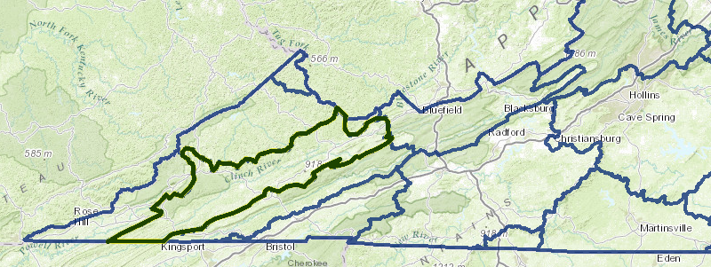
the southern Appalachians (including the Clinch River watershed and Great Smoky Mountains National Park further south) is a biological hot spot
Source: Virginia Department of Conservation and Recreation, Virginia Hydrologic Unit Explorer
Map Exercise
In the Atlas and Gazetteer, find Burke's Garden in Tazewell County (see sandstone ridges surrounding the valley). Note the name of the ridge on the southwest corner, west of Garden Mountain. Will the rainfall that flows down the ridges into Burke's Garden end up in the New River?
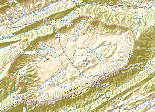
raindrops that reach the valley floor at Burke's Garden flow through the same gap used by Route 623 - and end up in which Virginia river?
Source: US Geological Survey (USGS), The National Map - Hydrography
Video
Watch "Conway Robinson" video:
The Con Rob from GMU-TV Courses on Vimeo
Site Visit
How did your site look in 1607, when the Enlish colonists arrived at settled at Jamestown? Think you had chestnut trees? Would the forest have been undisturbed, or would there have been scattered openings from Native Americans planting corn fields? (Corn was planted on fertile soil, typically on flood plains - "bottomland" - next to a creek rather than on slopes/uplands with less-fertile soil.) How large are the trunks of the trees today, compared to 400 years ago?
Mammoths and mastodons were extinct by 1607, but would you have seen elk in your neighborhood then? What predators would have kept the elk population in balance with the "carrying capacity" of the habitat to provide food? Are deer in your neighborhood now? If so, are there more deer than the habitat can support, and how do people cope with excessive grazing on near-the-house plants and gardens?
Where is the nearest natural, undisturbed area at (or close to) to your site? Who owns it - is it private land, or public? How is the site protected from inappropriate development or activity? Do the signs add any value, either explaining the natural resources or the rules of behavior... or are the signs just visual clutter and a target for vandalism? How would you revise the signs to make them more useful? Can you pick flowers there, or walk a dog (on a leash, perhaps)? Is there an admission fee? How is management of the location funded - through admission fees, local taxes, state agency budget, Federal agency budget - or a community group, perhaps a Home Owners Association (HOA) or a non-government organization (NGO)?
Web Exercises
- use the Virginia Department of Emergency Management Virginia Hurricane Storm Surge Tool and see what the storm surge from a "normal" Category 2 hurricane would do to Hampton Roads.
- Check out the areas of Norfolk that will flood, especially the Willoughby Spit area through which half the residents were supposed to evacuate on I-64 through the Hampton Roads Bridge-Tunnel.
- use the Critical Habitat Mapper of the US Fish and Wildlife Service (FWS). Is Burke's Garden in Tazewell County "critical habitat"?

search for Burke's Garden in the Critical Habitat Mapper