Follow up that oh-so-challenging exercise:
- explore What's Missing From the Map of Virginia?
- Locate Virginia on the Globe - and in the Galaxy
2) Find the corners of Virginia
When you read about finding the corners, you should have clicked on the links to:
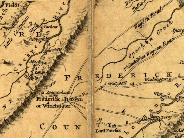
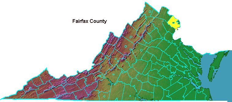
- find Fairfax county
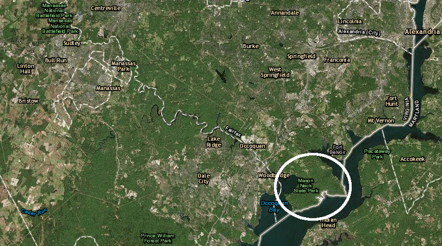
- see Mason Neck in ArcGIS Online and Google Maps
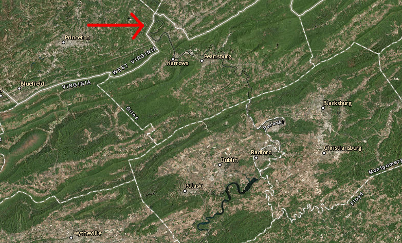
- find where the New River exits Virginia
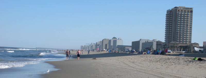
Virginia Beach
3) Use the DeLorme Virginia Atlas & Gazetteer
Why can't you find Potomac Mills or Kings Dominion in the Index?
4) Map "Scale"
Bottom line: maps of smaller areas such as neighborhoods are large-scale maps; maps of larger areas such as countries and continents are small-scale maps.
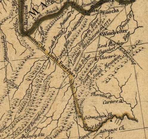
5) Which Way Do the Rivers Run?
Maps hung on the wall in elementary school classrooms may give the false impression that North is "up." Rivers flow downhill and north is "up" - so can rivers flow north?
Yeah, it's not a hard question. If north is downhill, then water will flow in that direction. In Egypt, the Nile River flows north. The Shenandoah River and the New River in Virginia are two more-local examples.
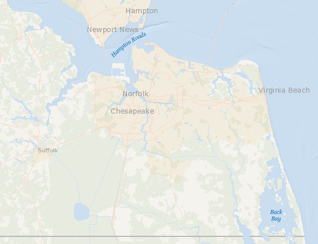
Why do we care? What gets flushed in the bathrooms at Mary Washington University in Staunton and James Madison University in Harrisonburg will flow north down the Shenandoah River to Harpers Ferry, then east down the Potomac River. Near the Loudoun/Fairfax county boundary, Fairfax Water sucks up raw water, processes it, and sends it through pipes to customers throughout Northern Virginia - including the Fairfax campus of George Mason University. If we are what we eat, then we oughta know what we are drinking as well.
the water in the South Fork of the Shenandoah River flows downhill, going north ("up the map" is "down the valley") to join the North Fork at Front Royal, then the Potomac River at Harpers Ferry
Source: US Geological Survey (USGS), Streamer
6) Learn how to Use the Geographic Names and Information System
Follow additional links to:
- U.S. Board on Geographic Names
- Query Form For The United States And Its Territories
- click on the link to "GNIS in Google Map" and then click on "Terrain" and "Topo" links
- find out how many places are named "Little River" and "furnace" in Virginia
|
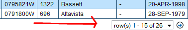
7) Find a Particular Place in Virginia - find the community of Hurt in Pittsylvania County (and if you see only 15 rows displayed initially when the GNIS has 26 places named Hurt... click on the arrow to see the rest) 8) Use GNIS to determine the elevation of a "populated place" |
 |
If you were already savvy about geography - great, that basic material was just an easy refresher. Now let's dig in and, for the next 14 weeks, study what makes Virginia a unique place.
9) Read What's At the Corners?
(The corners may or may not be consistent with the choices you made in the "Find the corners of Virginia" exercise.)
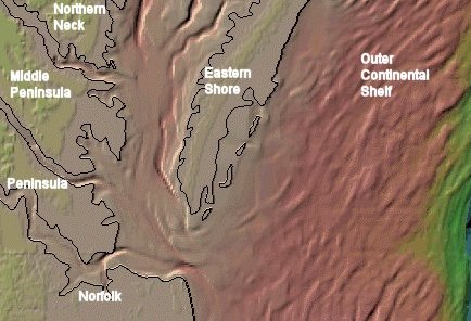 Chesapeake Bay bathymetry - showing edges of the land and depths of the water |
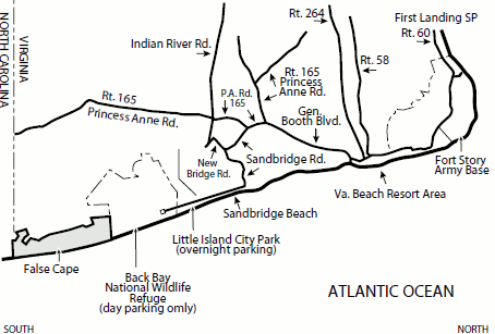 False Cape State Park (City of Virginia Beach) |
10) Get exposed to Accomack County, half of the Eastern Shore of Virginia
- the rough-and-tumble political process of modern times would be "old news" to Edmund Scarborough and Governor Berkeley
- compare Census Bureau statistics for the land area of Accomack County vs. Northampton County. WARNING: Don't confuse Northampton with Northumberland county; some of Virginia's jurisdictions have similar names. (There is a county named Richmond and a separate city also named Richmond.) Scroll all the way to the bottom of the statistics to see the "Land area in square miles, 2010" data and confirm if the 1687 boundary adjustment equalized the size of these two Eastern Shore counties.
NOTE: since 1940, Accomack has had a k at the end of its name officially. The town of Accomac has no k, but the Post Office will deliver mail even if the town's name is not spelled korrektly. Accomack is not the worst challenge in Virginia for bad spellers. Two Virginia places made a list of the Top 10 most misspelled cities in America - Culpeper and Fredericksburg. There is no populated place in Virginia named Culpepper, and no Fredericksburgh either.1
A portion of colonial Virginia (now in Pennsylvania) has the same confusion regarding the correct official spelling. Pittsburgh now has an h at the end, despite a ruling by the Board of Geographic Names that the German version of "burg" should be used instead of the Scottish variant "burgh" for American place names.
Pittsburgh officials managed to get their "h" added back officially in part because General John Forbes (who named Pittsburgh) was a Scot. He would have found the "burgh" spelling most familiar, and probably pronounced it "Pitts-burro." The Board of Geographic Names officially accepted Pittsburgh in 1911.2
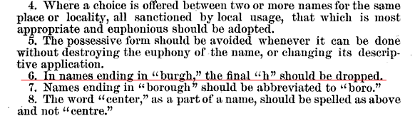
the Board of Geographic Names started by establishing principles for standardizing names and dropped the h from Pittsburgh
Source: First report of the United States Board on Geographic Names. 1890-1891 (p.8)
![]()
Land Area of Accomack County
Source: Census Burea Quickfacts
11) Assateague Island: (get to know the Eastern Shore in more detail)
Read:
- Assateague Island National Seashore map (The "seashore" managed by the National Park Service is all in Maryland, while the "wildlife refuge" managed by the US Fish and Wildlife Service is all in Virginia. The barrier island itself ignores those administrative boundaries, and is migrating south.)
- Challenge of Developing vs. Preserving Assateague Island
- The Assateague Island Coasts/Shorelines are moving, and barrier islands along the Eastern Shore may disappear if sea level begins to rise faster than the islands can migrate
- check out the shifting Historic Shorelines - Toms Cove, Virginia (would you buy shoreline property on the Eastern Shore? should your tax dollars be used for the Federal Emergency Management Agency to rebuild houses on the shoreline that get flooded?)
- history of Chincoteague National Wildlife Refuge (did the local residents abandon Assateague Village due to sea level rise? Did the government evict many landowners to create the wildlife refuge, as occurred when Shenandoah National Park was created?)
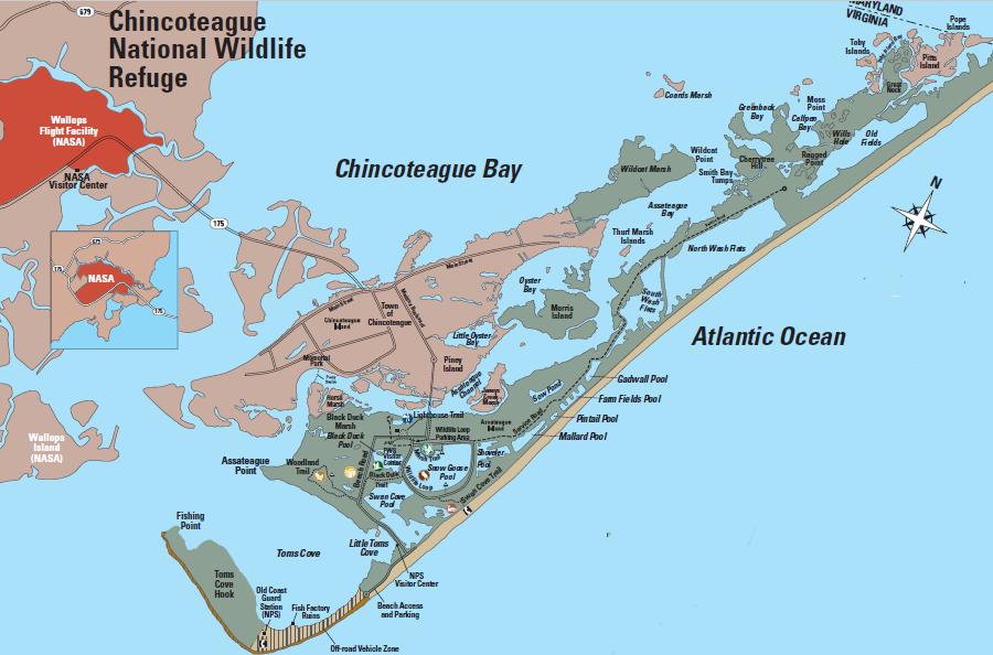
every US citizen owns property on the Eastern Shore of Virginia at Chincoteague National Wildlife Refuge
Source: US Fish and Wildlife Service, Chincoteague National Wildlife Refuge brochure
NOTE: there is much historical data here to explain how the lines were drawn, but remember - quizzes are open book. There's no need to memorize dates, but get a sense of what happened when, so you can understand how places (including Virginia's boundaries) have changed over time. |
 False Cape State Park, at the southeastern corner of Virginia, is located between Back Bay and the Atlantic Ocean Source: NOAA's National Geophysical Data Center, Bathymetry Data Viewer |
13) Grab one of your favorite beverages (OK, maybe more than one) and check out the evolution of the northern and eastern edges of the state:
- Virginia-Maryland Boundary
- Virginia-Maryland Boundary Upstream of Harpers Ferry
- Virginia-Maryland Boundary for Chesapeake Bay/Eastern Shore
- Modern Maryland-Virginia Boundary Disputes
- Slot Machines (and Casino Gambling?) on the Maryland-Virginia Waterfront
- Fairfax Grant
- Virginia-Pennsylvania Boundary
- Virginia-District of Columbia Boundary
- Virginia and the Outer Continental Shelf
- Virginia and Submerged Lands
- King's Grants/Crown Grants
NOTE: we will examine the North Carolina, Kentucky, and West Virginia boundaries later
|
14) Introduce Yourself on the Discussion Board Respond to my initial post, and tell other students what you find interesting about Virginia and what you want to learn. (Note: the Discussion Board on Blackboard is limited to just the students in this class. There is also a public VirginiaPlaces blog that will include news and recent activities involving the geography of Virginia. Whenever material from that blog will be used in the quizzes, then I will alert you.)
15) Video
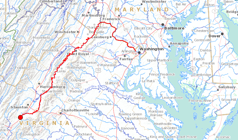
16) Map Exercise: Follow the James River Start by finding the mouth of the James River where it empties into the Chesapeake Bay between the cities of Norfolk/Hampton. Feel free to use the Index to find which pages in the Virginia Atlas & Gazetteer include those two cities. Flip through the pages and follow the James River upstream. You'll go west predominantly, because water in the James River flows east towards the Chesapeake Bay. Move upstream from Norfolk and Newport News, past Jamestown Island, then past the rapids in downtown Richmond. Captain Newport, John Smith, and other English explorers could not sail upstream beyond those rapids in 1607, but you can keep on going. Go past Lynchburg on the south bank, and then underneath Route 11 and Interstate 81 at the Town of Buchanan. Did you notice where you crossed the Blue Ridge and entered the Shenandoah Valley? Once you get a little bit past the Botetourt County line into Alleghany County, you're there. If you get to Iron Gate, you went upstream a bit too far. You're following the Jackson River, a tributary of the James River.
17) Web Exercise
18) Site Visit
Key Dates This Week
References
1. "Most Misspelled Cities In America," ePodunk, 2007, http://www.epodunk.com/top10/misspelled/index.html (last checked August 27, 2016)
2016 Syllabus and Class Schedule for Geography of Virginia (GGS 380) Virginia Places |
